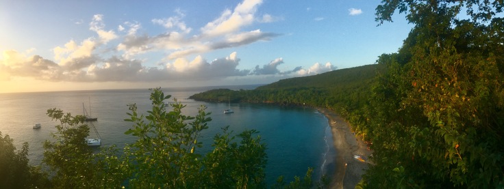
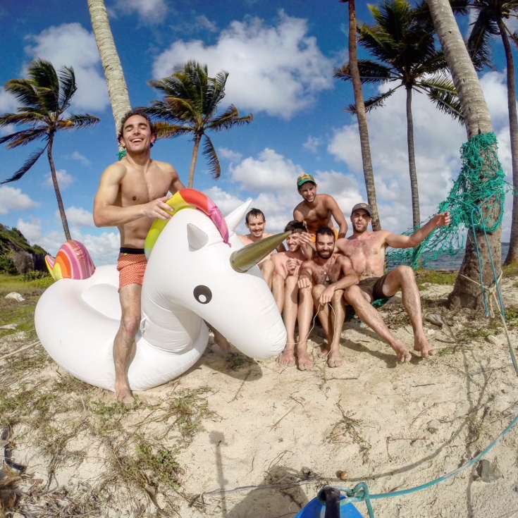
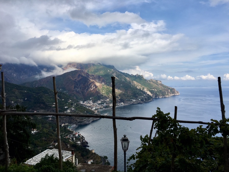
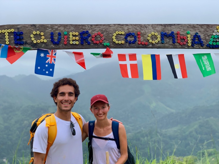
Among all countries we have done so far, Colombia is in our top three! It is not only about the landscapes and monuments, but also the people, the food – very important, and the experiences!
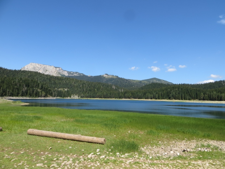
The diversity in Colombia is stunning, from the mountains to the Caribbean coast and stopping by the coffee area. Each area is very different from the others and usually food follows!
We were charmed by the Colombian people, welcoming and friendly. Also important, we felt safe everywhere we went – although we wouldn’t go by night in Bogota downtown and Medellin downtown.
Colombia is definitely a country of backpackers so far. Although Colombia becomes more and more popular as a holiday destination, the number of tourists on site was still really limited in comparison to other destinations in the Caribbean.
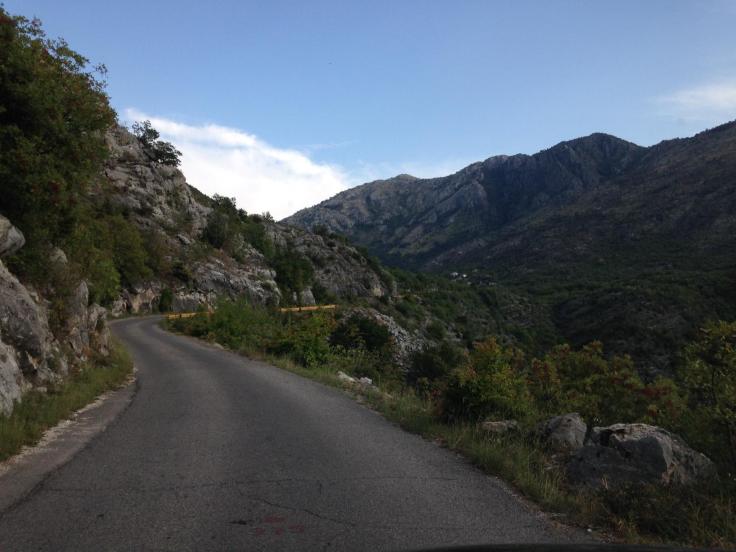
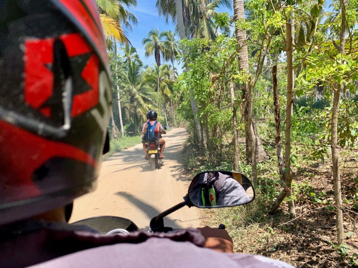
The country is super mountainous and you may need four hours to do 100 km sometimes. Therefore, we were of the opinion of opting for the bus and plane and not renting a car.
Our guidebook for Colombia was the Michelin. We were disappointed from the Lonely Planet on our last trips and we therefore opted for another editor. We were super happy about it! The itineraries suggested by the book to discover a city were taking us off the beaten path of all tourists, with precise descriptions, food recommendations were fair, etc. It’s overall a great guide book for this country!
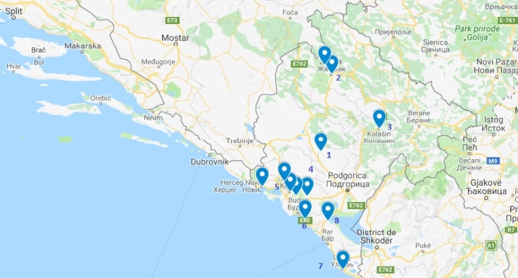
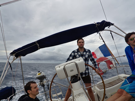
This is our two weeks story, crossing what we could in Colombiaby plane (3), bus (a lot) and foot (248.20 km) – a lot still needs to be done, but this will be for another time!
Here are all the places we travelled to!
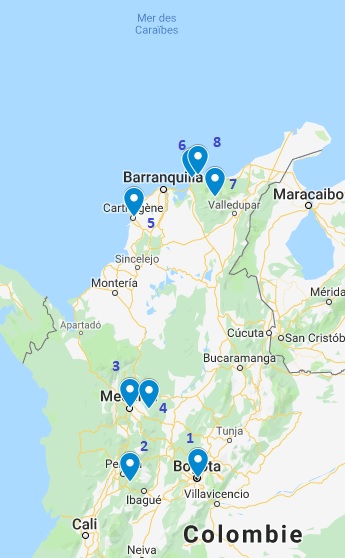
We landed on a Friday afternoon in Bogota (1) and spent the Saturday visiting La Candelaria. On Sunday morning, we had a flight to Pereira, from where we took a bus to Salento (2), where we stayed until Tuesday evening. On Wednesday, we arrived in Medellin (3) in the morning after one night in the bus from Pereira, where we stayed three days, including one day to go to Guatapé and Piedra del Peñol (4). On Saturday early morning, we left Pereira for Cartagena (5) by plane. We spent the day in Cartagena and reached out Santa Marta (6) in the evening. On Sunday morning, we left for the Lost City (7) in the Sierra Nevada Santa Marta, where we stayed four days. Thursday and Friday were dedicated to the Tayrona Park (8), Saturday on Cartagena, and Sunday to Bogota (Chapiñero ad Monserrate).
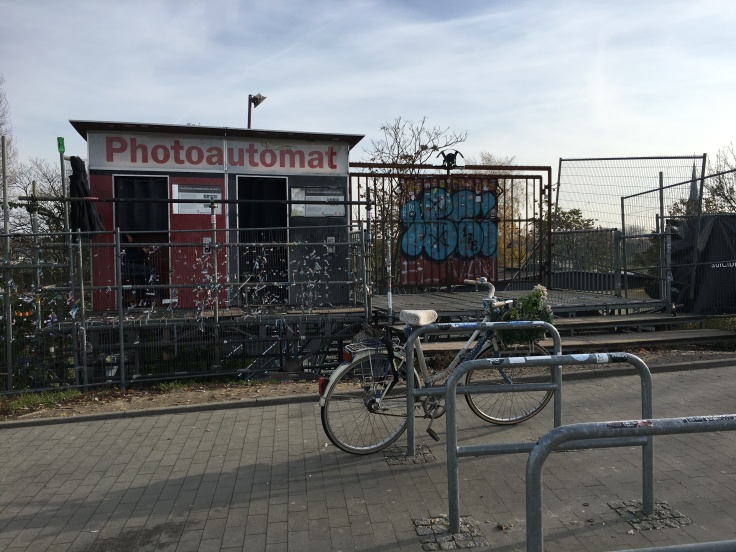
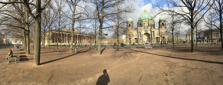
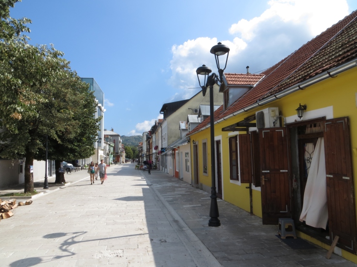
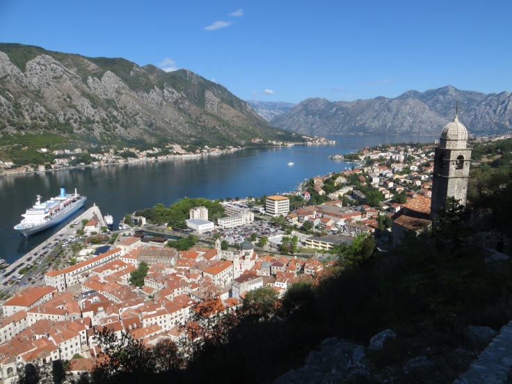
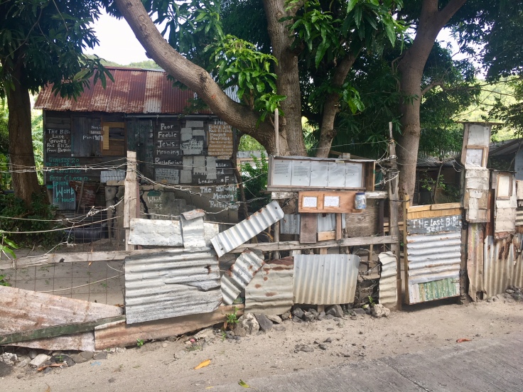
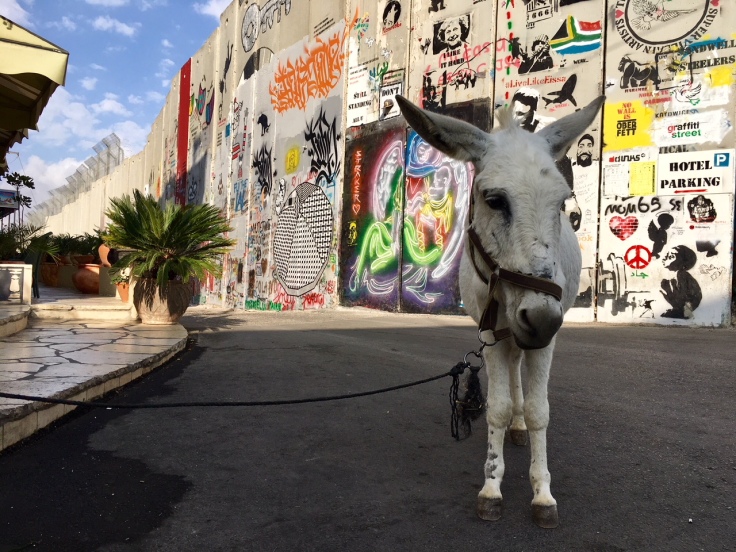
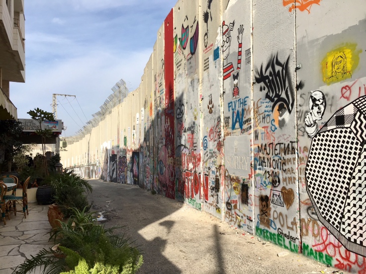
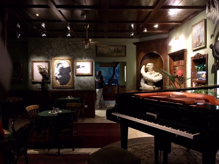
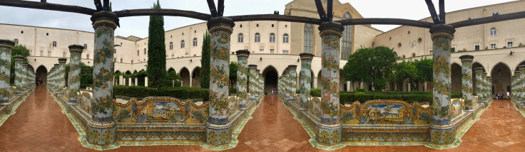
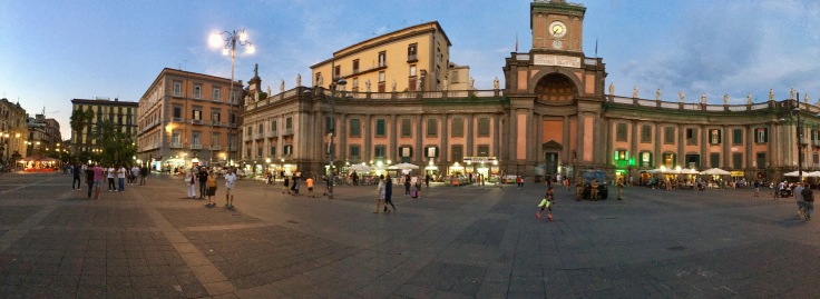
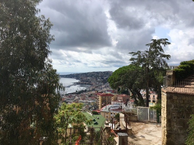
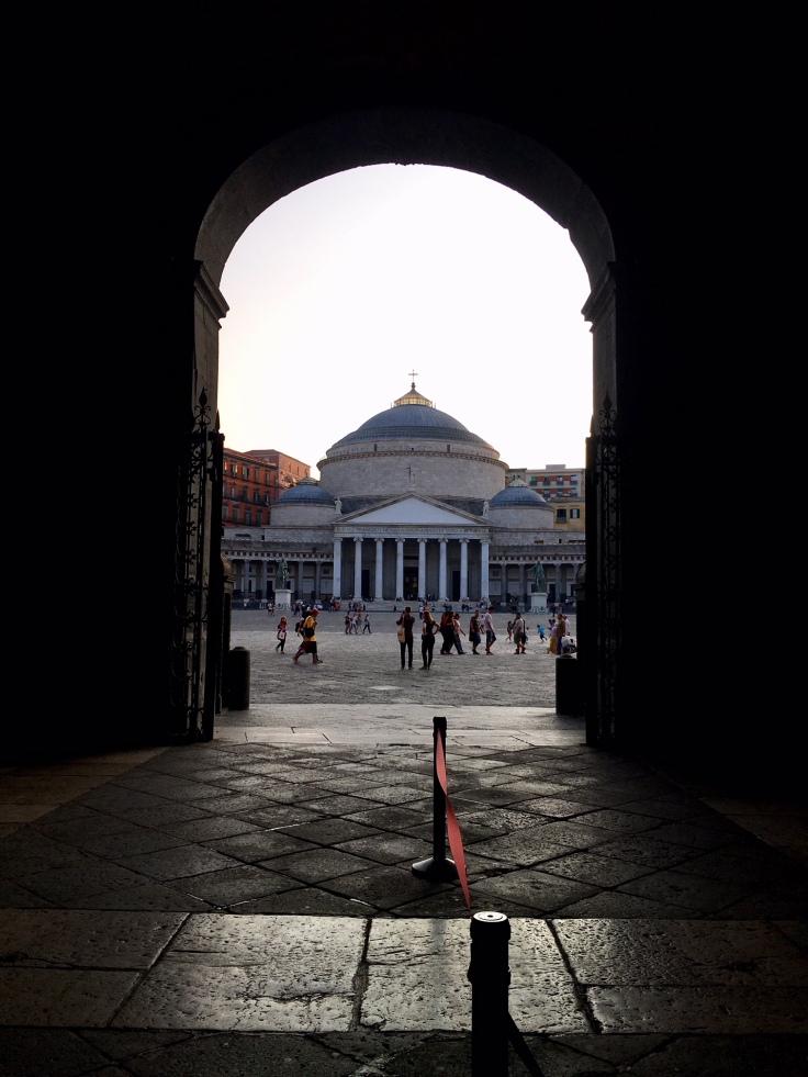
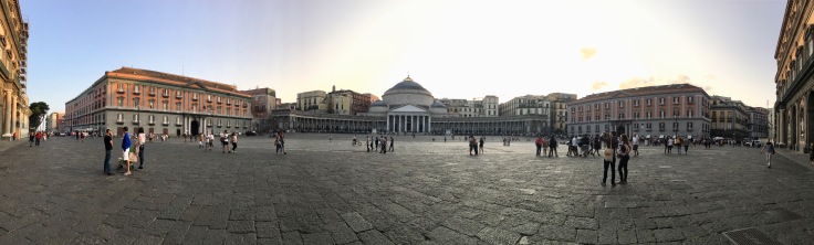
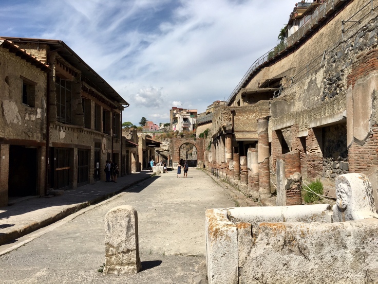
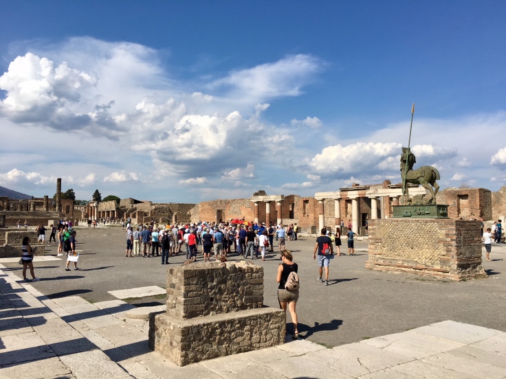
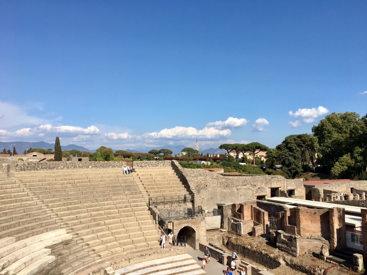
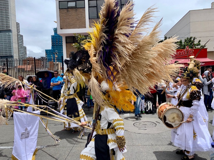
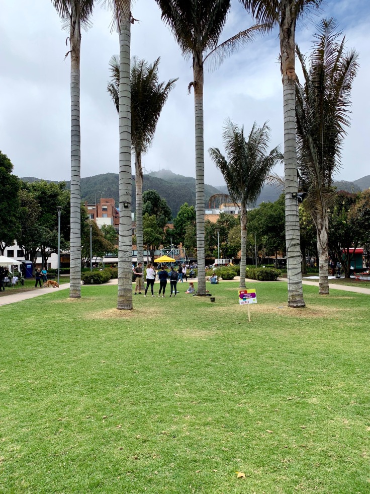
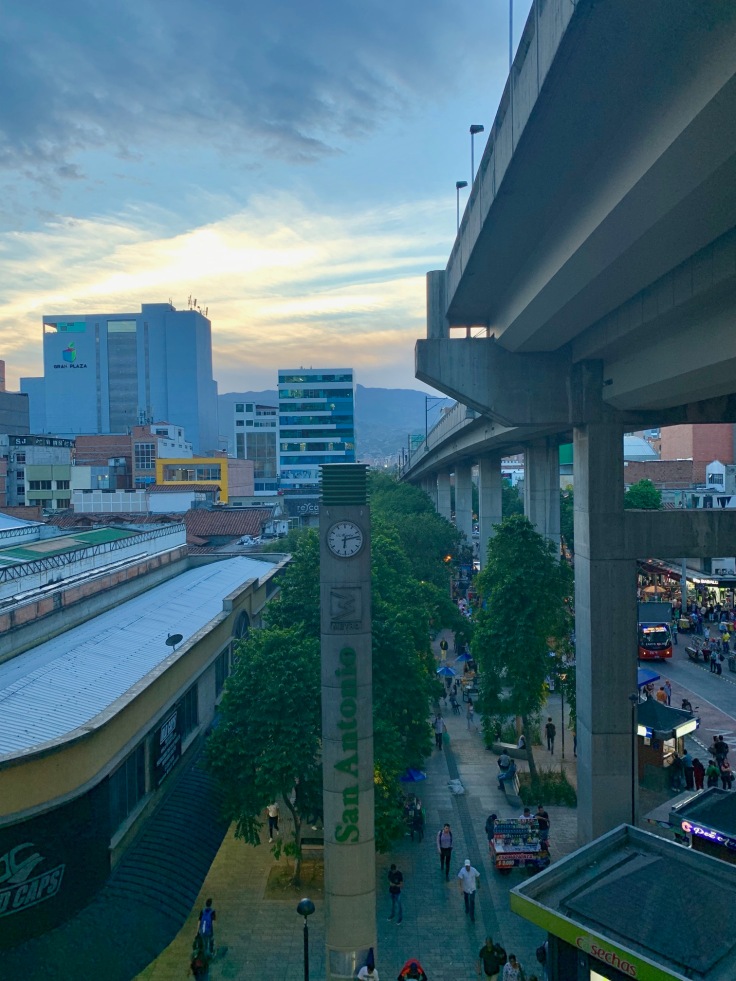
1. Bogota, the capital of Colombia!
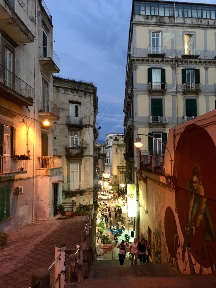
We heard a lot of people during our trip which were not stopping by Bogota – sadly. Bogota is a vibrant city, and although its charm is mostly not in its buildings – unless you love architectural brutalism- its people, bars and places are worth to stop for a day or two!
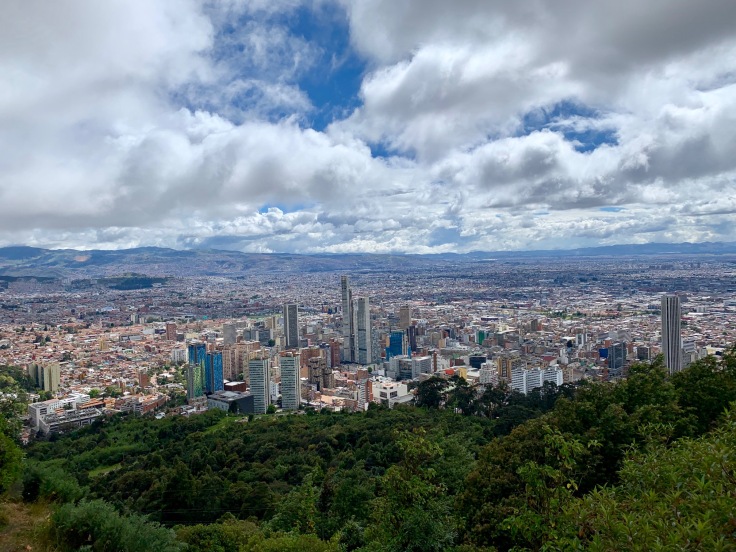
Bogota can be split in three different areas: La Candelaria (which is the historical city centre), Chapiñero (the gay and cool residential neighbourhood with all the bars) and Monserrate, located 350 meters above the city with a stunning view.
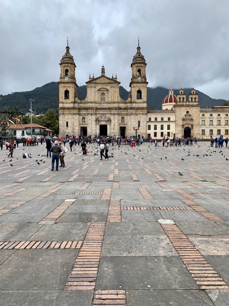
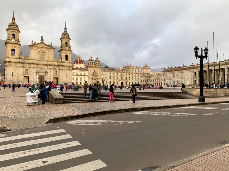
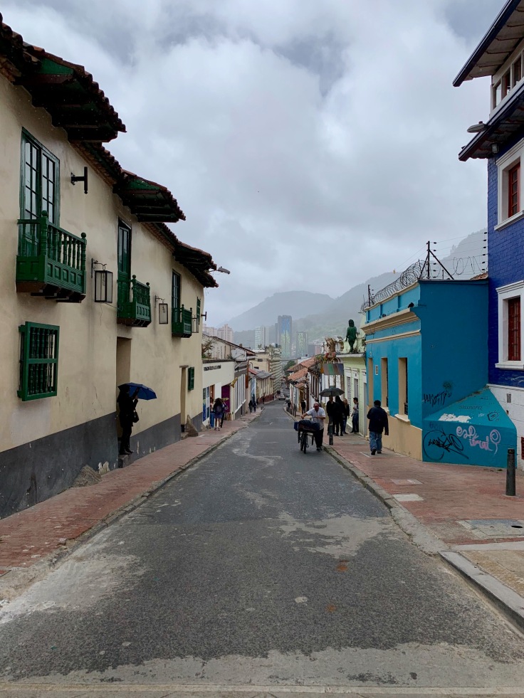
La Candelaria
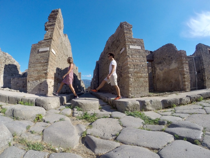
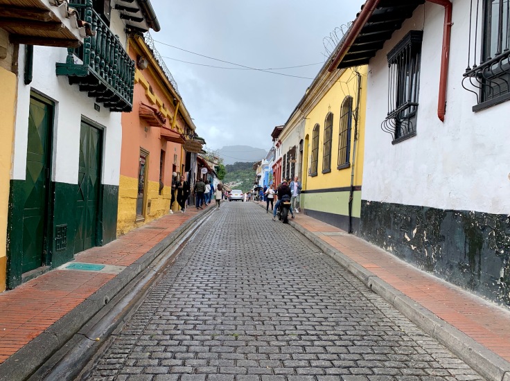
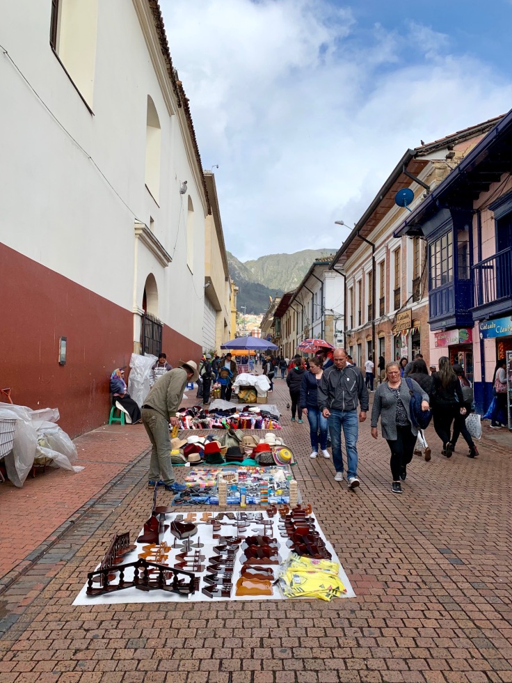
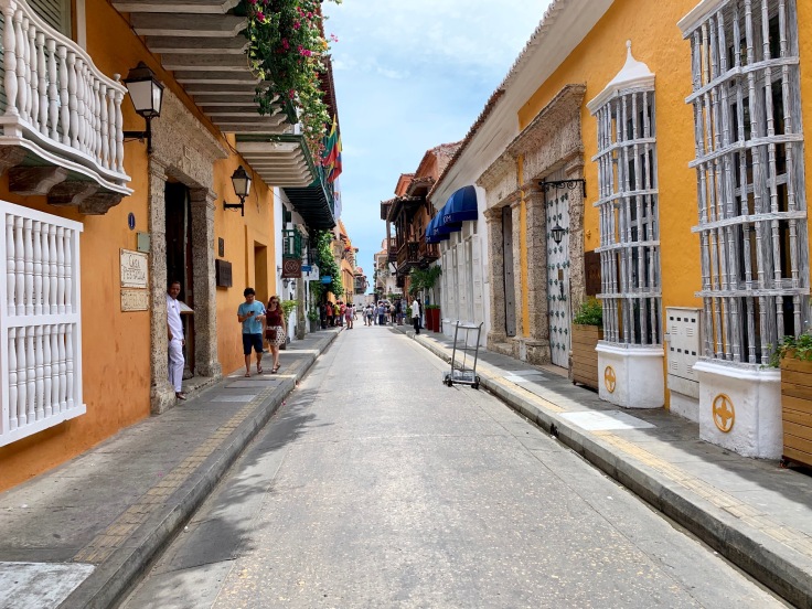
La Candelaria is the old historic city of Bogota. The importance of Spanish influence on the buildings is seizing!
Bogota downtown, as Medellin is a very lively area crawling with people – a few tourists, but mostly inhabitants. However, as soon as you leave the main streets, it becomes quieter with plenty of things to see.
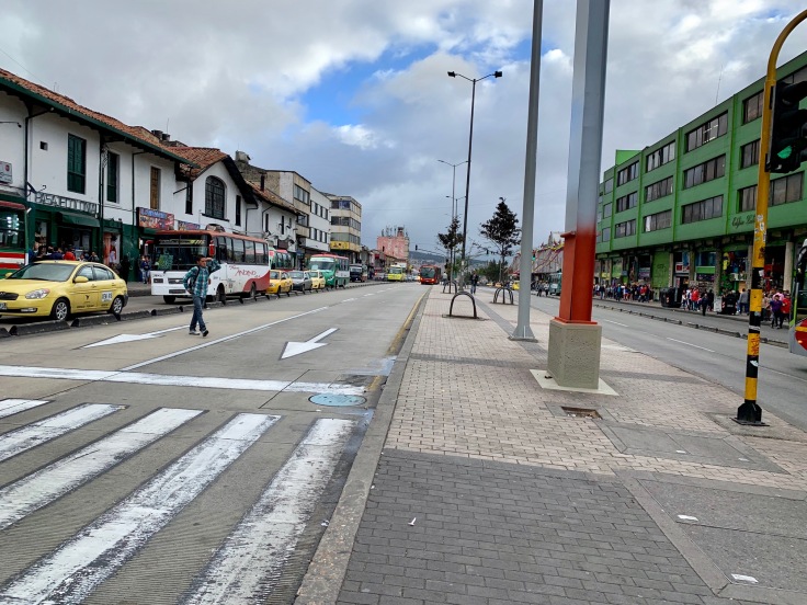
Bus transports in Bogota are very well developed. If taxi is obviously the easiest and not so expensive option, it is cool to take the bus as well and do as the locals to go from Chapiñero to La Candelaria. With dedicated bus roads, it is also the fastest way to go to your destination.
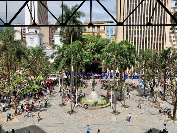
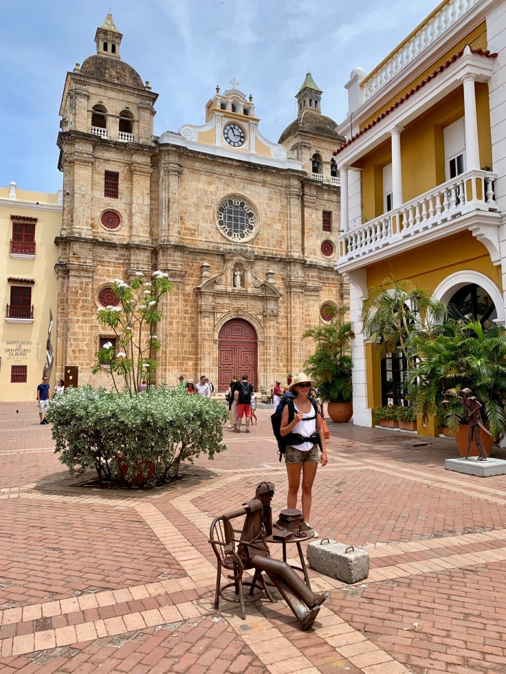
The itinerary offered by the Michelin for discovering La Candelaria is very complete. From the Museo del Oro, it takes you to the Plaza Bolivar and then on the upper streets in order to get around the presidential palace.
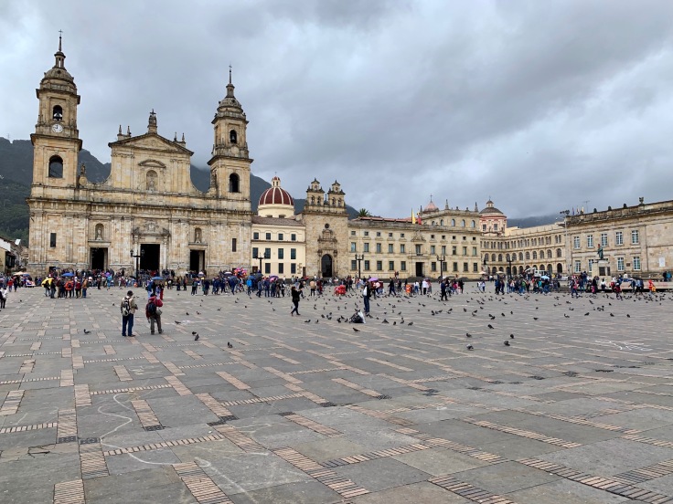
There are plenty of museums in the area – in addition to the Museo del Oro, which owns a stunning collection about all indigenes’ instruments made out of gold: police, traditional costumes, Colombian history etc.
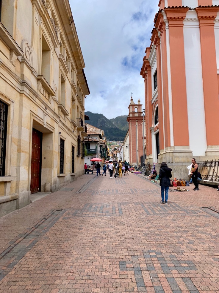
Many interesting things can also be visited in the streets around the presidential palace as the Claustro de San Augustin.
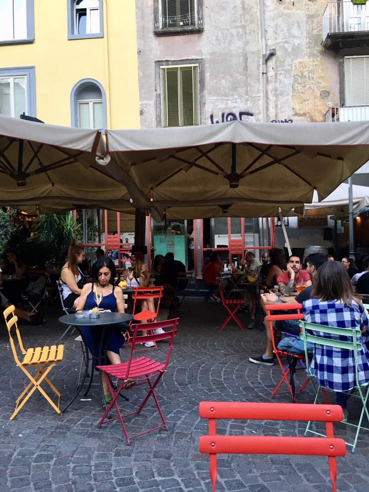
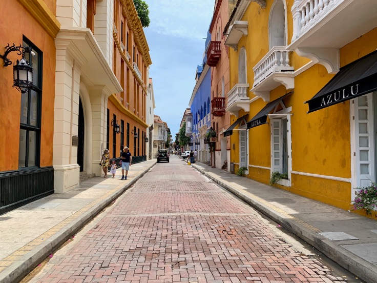
We really liked the upper side of La Candelaria – where the good bars and restaurants are 🙂 You will find plenty of bars in the area of calle 12b and carrera 2.
You must stop to the Plazoleta Chorro de Quevedo and the calle del Embudo. All inhabitants are gathering here, in the square and narrow streets to enjoy live performance outside and music from the bars.
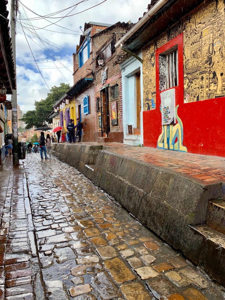
The calle del Embudo is one of the most famous and typical streets of La Candelaria. It is a narrow cobblestone street with colourful houses – mostly bars- serving the local drink, la chicha!
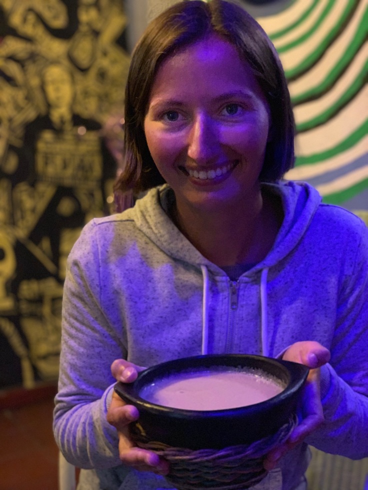
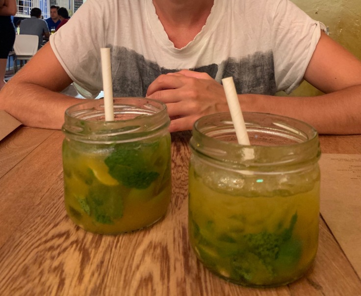
Chicha is a low alcohol drink made with corn. You should try it, but no need to rush to the happy hour, not sure you can make two 🙂
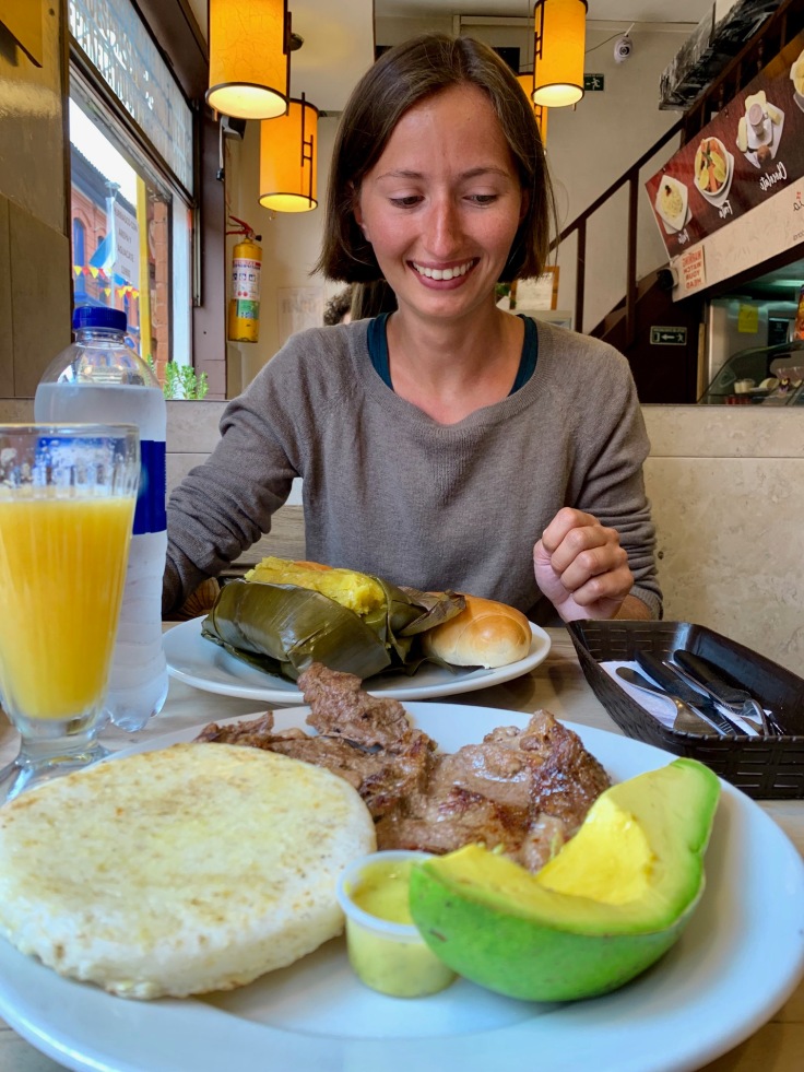
A PLACE TO EAT SWEETS: La Puerta Falsa, Colombian sweets since 1816
From what we saw, the nicest restaurants are located in this area, a bit outside the city centre and Plaza de Bolivar. La Candelaria is definitely a place to go during the day and more particularly in summer, when many events are organized!
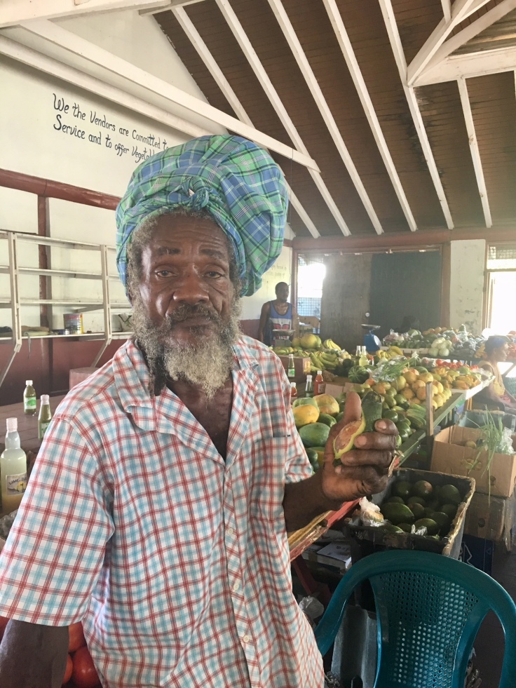
Don’t be surprised, street vendors are everywhere in La Candelaria and that’s mostly cultural. Of course they are here for the tourists, but locals also buy their stuff there!
Chapiñero
Chapiñero is mostly a residential area. It is not a place where you go for visiting historical sites, as the neighbourhood is quite recent and residential.
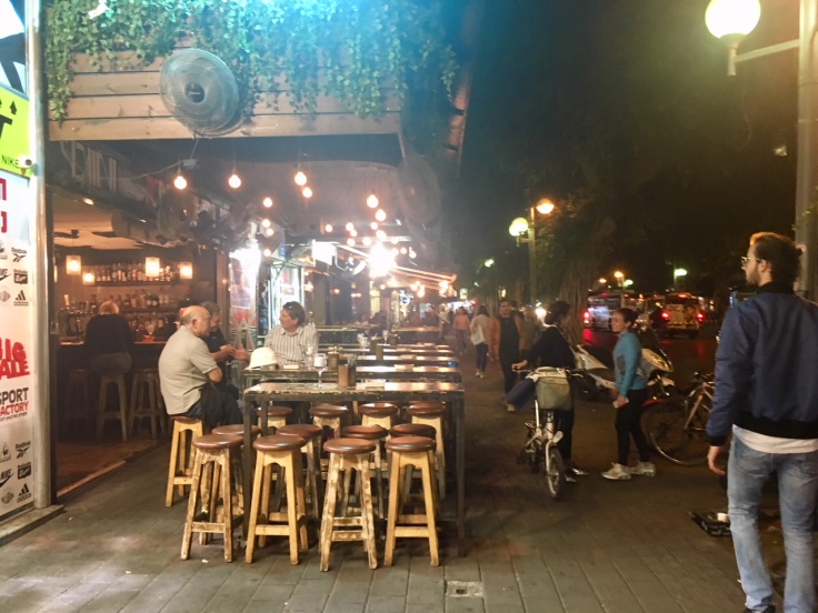
Known as the gay area, it is however definitely the place to sleep in Bogota, have a drink and eat. The architecture of the lower part of Chapiñero is a bit disorganized and archaic, but with a lot of bars, clubs and restaurants.
A PLACE TO EAT: Mini Mal, outstanding sea food
Chapiñero is the place for all the embassies and large corporations! It is super expanded, and the upper side is much different from the lower side!
The upper side, around Parque 13, is wealthier than the lower part. Although quite residential, the area is lovely and in the weekend, the inhabitants invade the park.
A PLACE TO HAVE A DRINK: BBC, for Bogota Beer Company
You will find BBC bars a bit everywhere in Bogota. They brew their own beers and have a great choices of varieties (Lager, IPA, etc) – almost nothing to envy to Belgian beers 🙂
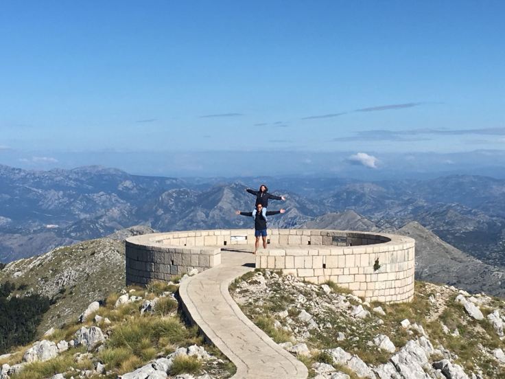
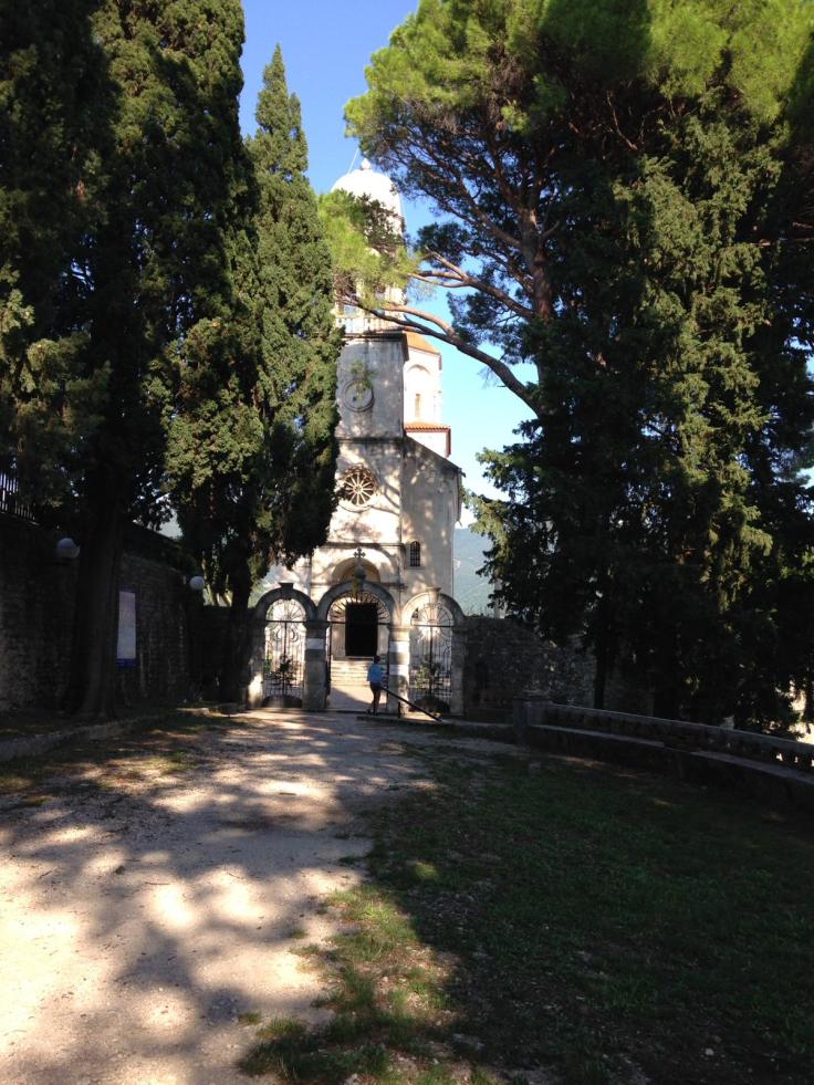
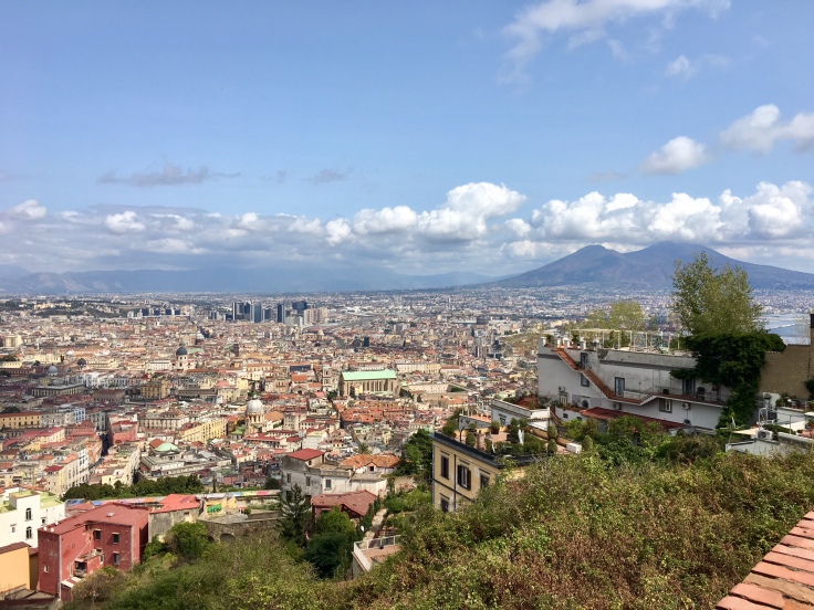
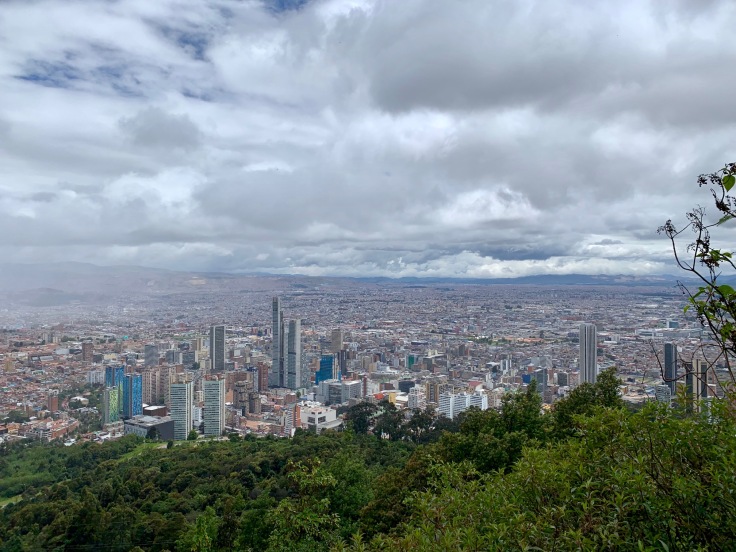
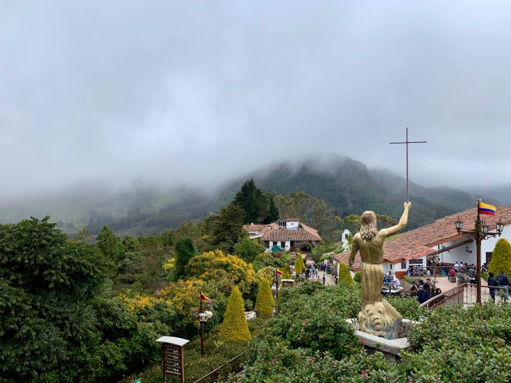
Monserrate
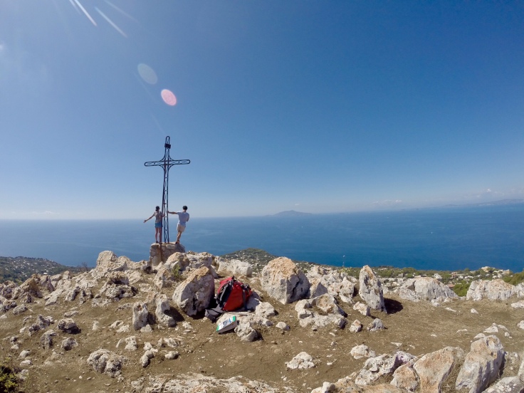
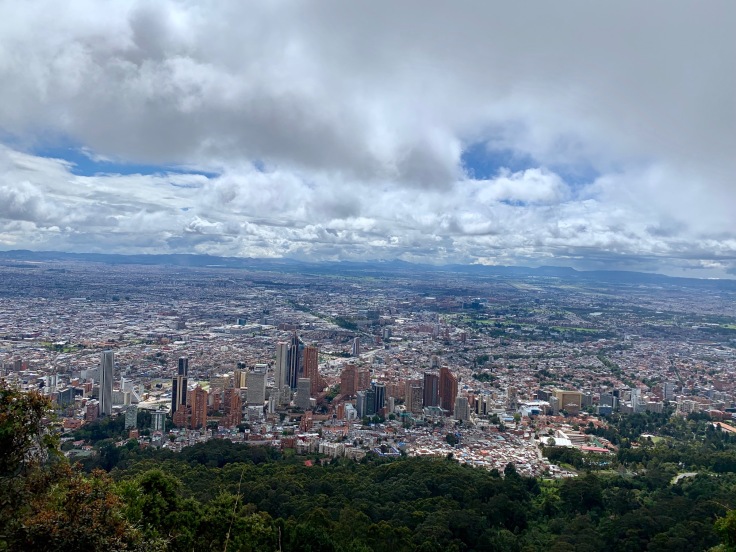
Monserrate is one of the most famous walks for the inhabitants of Bogota. Try to go there on a Sunday morning, and you will be surprised with either the queue on the lift or the number of people in the stairs! The more you climb, the greater the view on La Candelaria is.
Or Chapiñero
We climbed up and went back down by foot, which took us around 2 hours – including a long stop at the top to enjoy the view and the food street at its very top!
The view at the top is sizing and makes you realise how large and spread the city is.
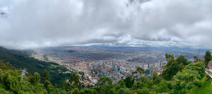
Monserrate is around 3000 meters high, meaning that the weather is changing quite fast! Therefore, if you see it’s foggy at the top when you are down, go up! By the time you reach it, the sky will be clear blue!
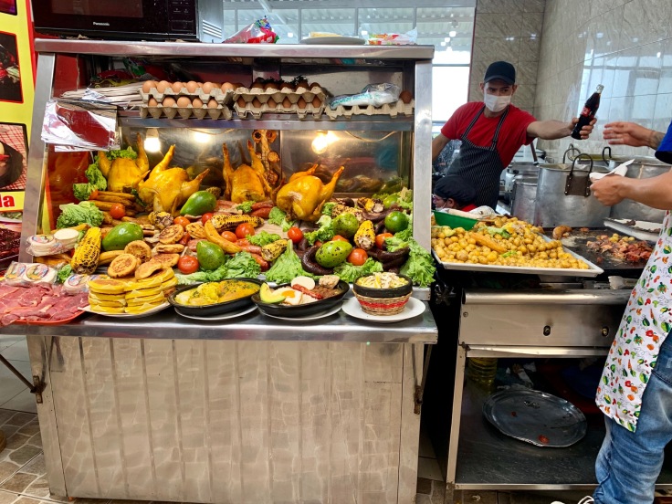
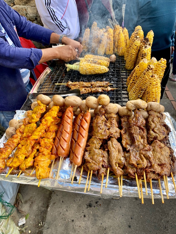
A PLACE TO EAT: the Street of course!
You will see a lot of street food vendors in Monserrate and La Candelaria. Of course, go to the ones where you see Colombian people going, we can tell you they know how to make grilled corn!
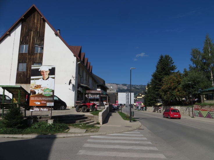
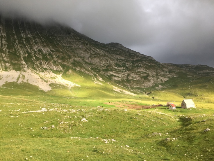
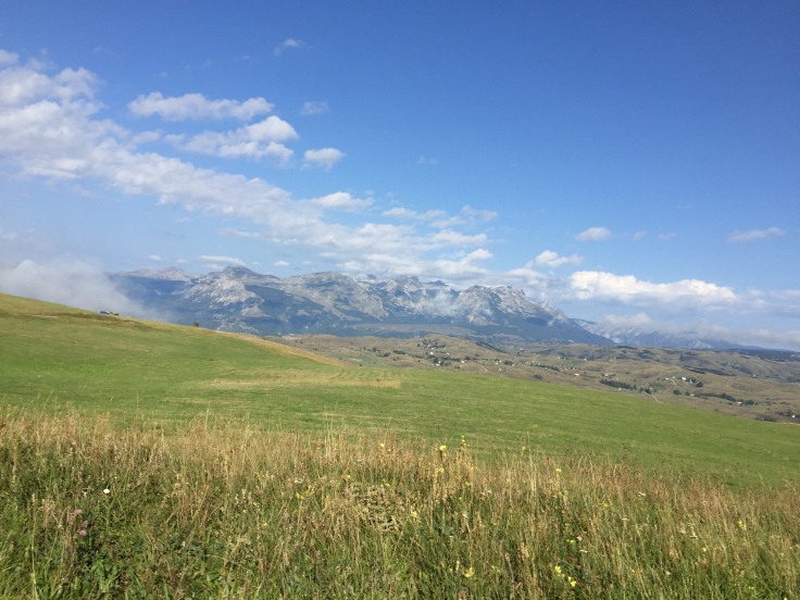
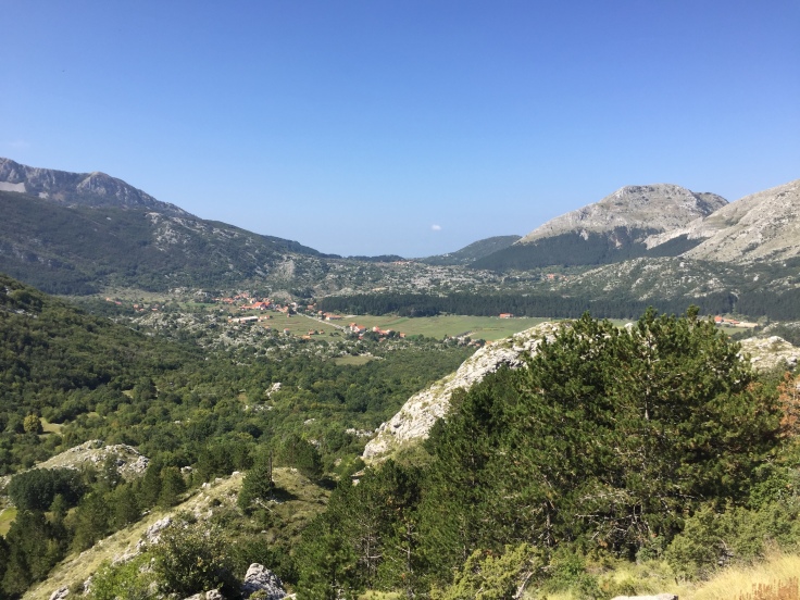
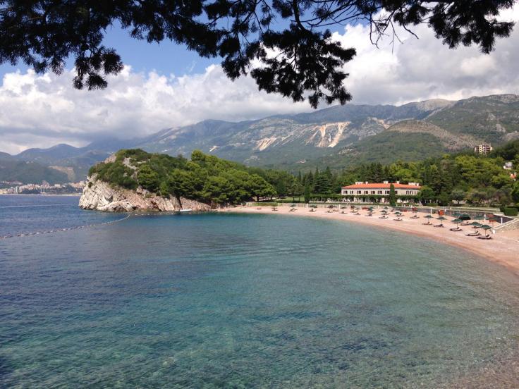
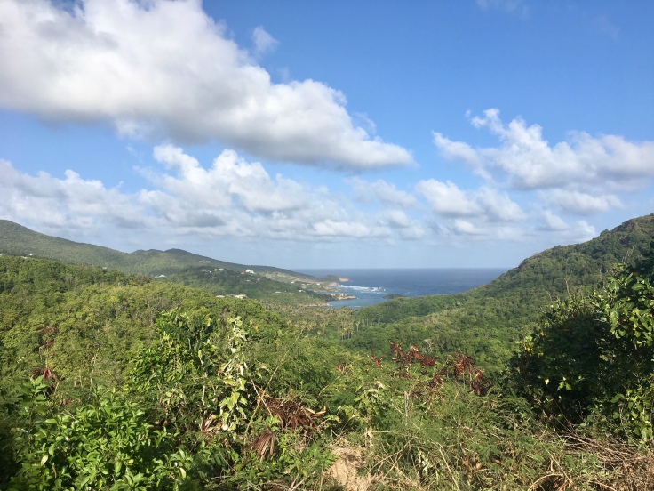
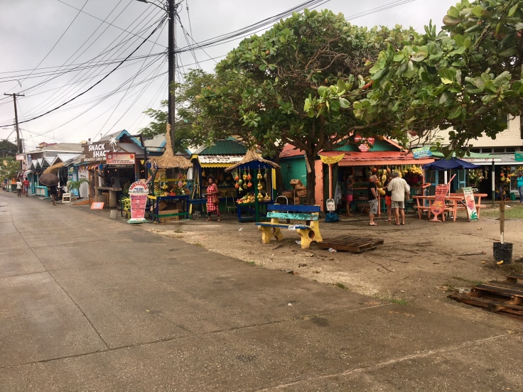
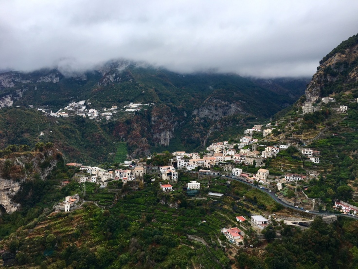
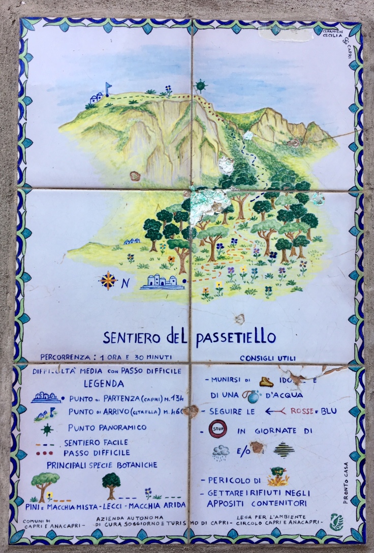
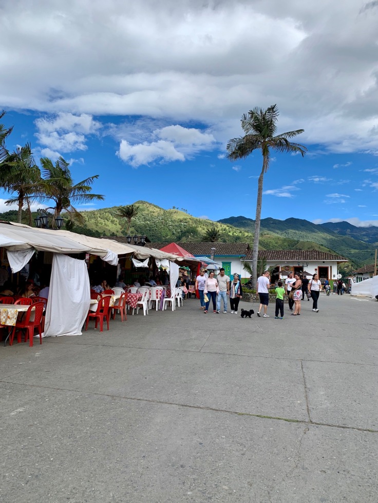
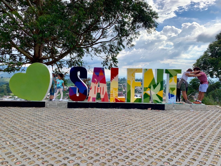
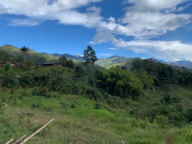
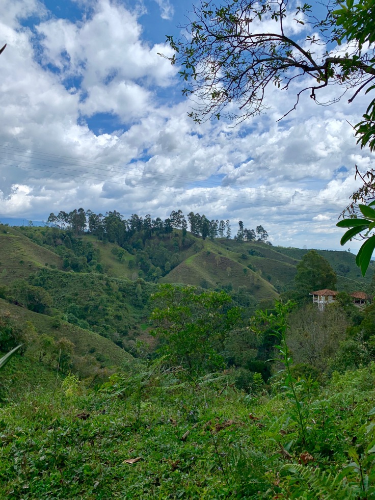
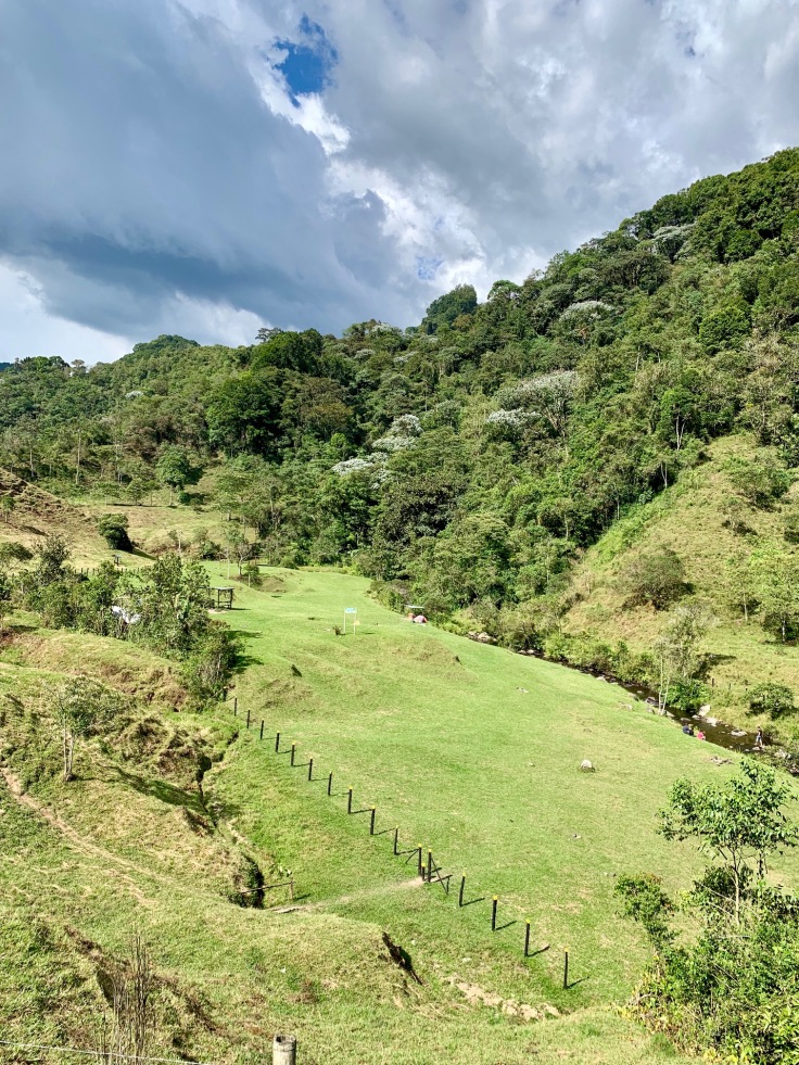
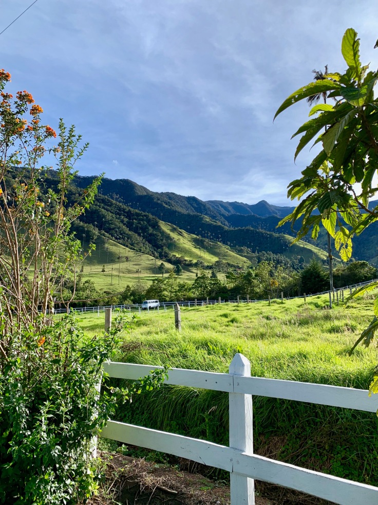
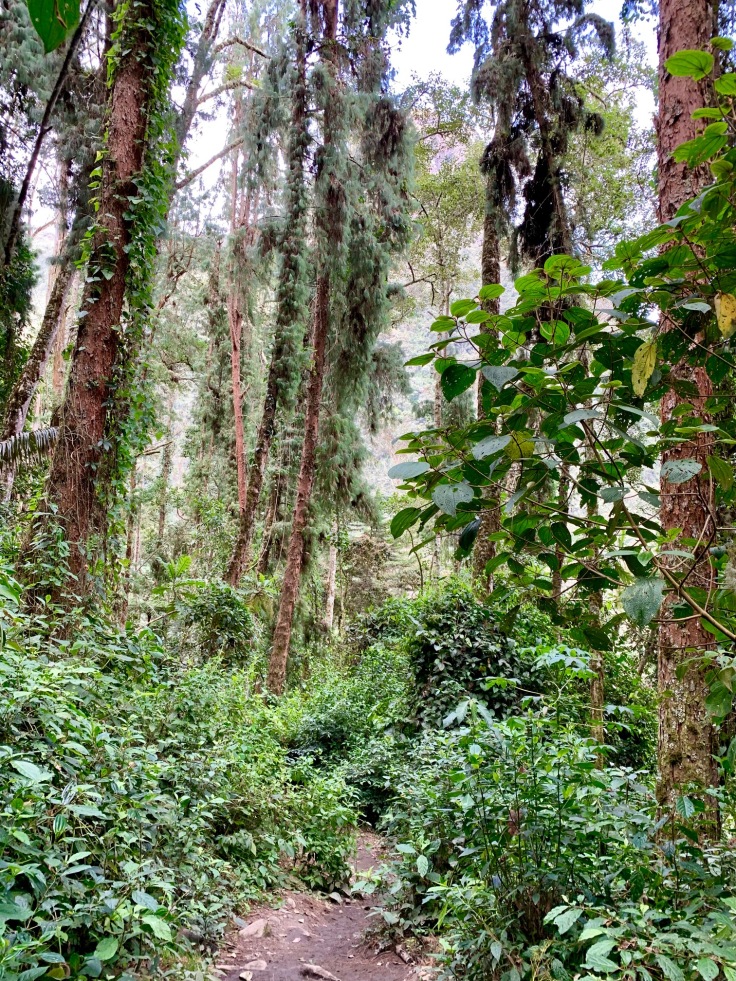
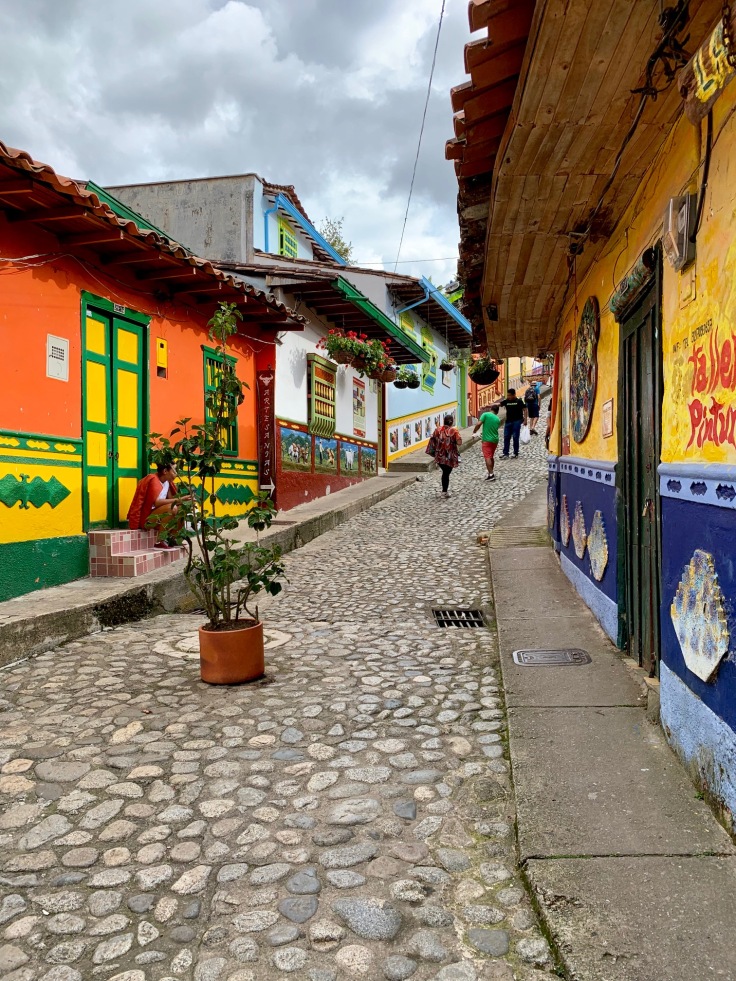
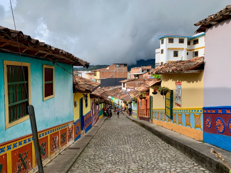
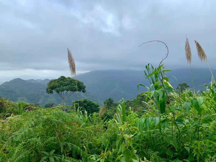
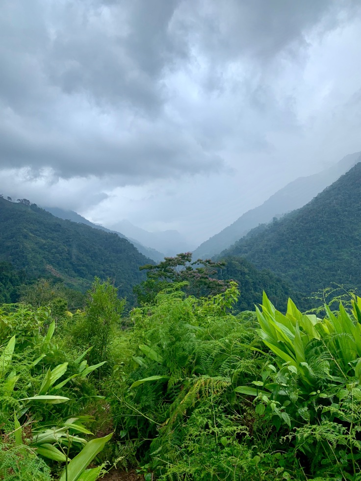
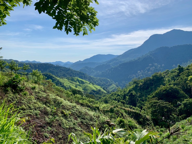
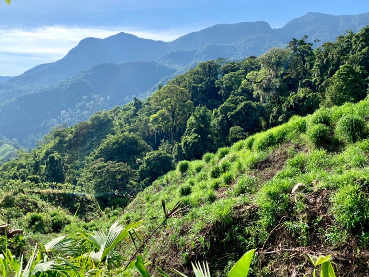
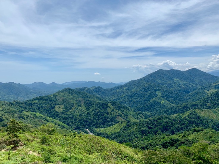
Salento and the coffee area
We will never say it enough, one of the most surprising things in Colombia is its diversity of landscapes – and this comes from a French person J Our time is Salento was definitely one of the greatest we had in Colombia. The nature is simply breathtaking, and the area offers things you see once in a lifetime. Salento, is, with the Lost City and Medellin, what we preferred during our trip to Colombia.
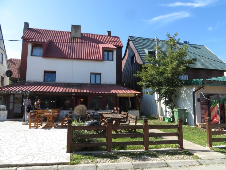
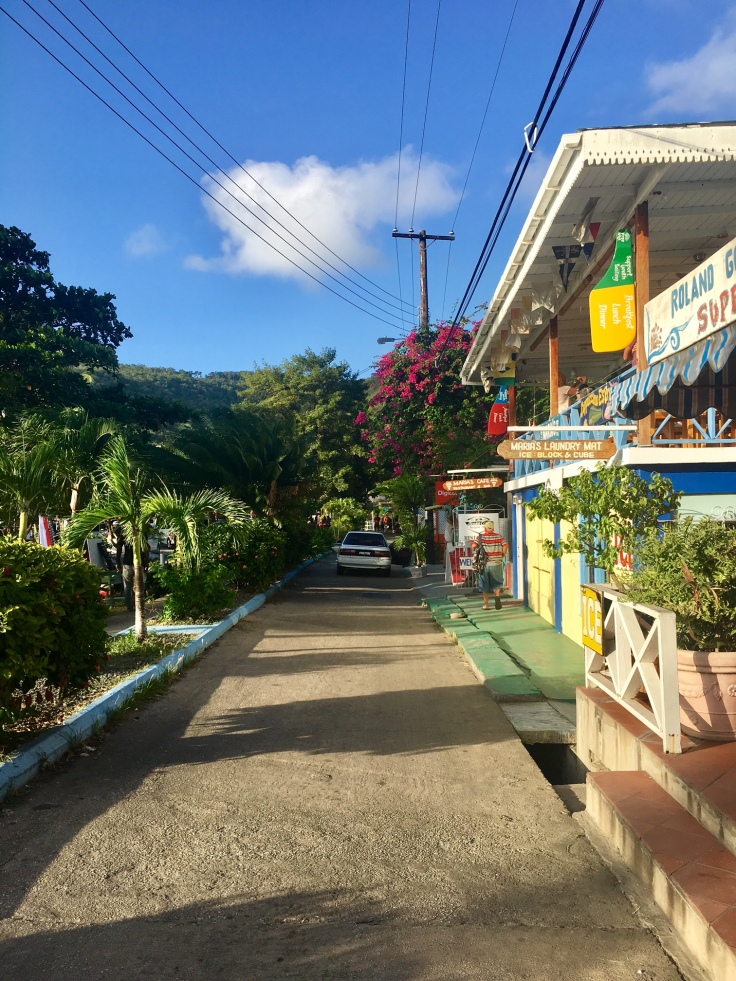
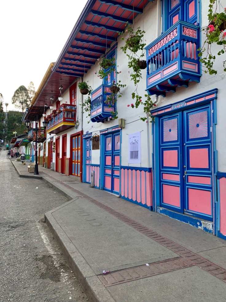
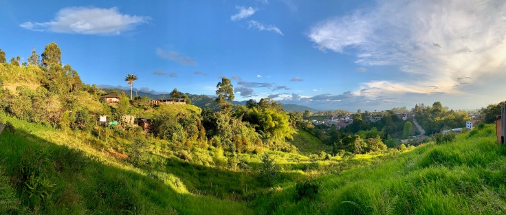
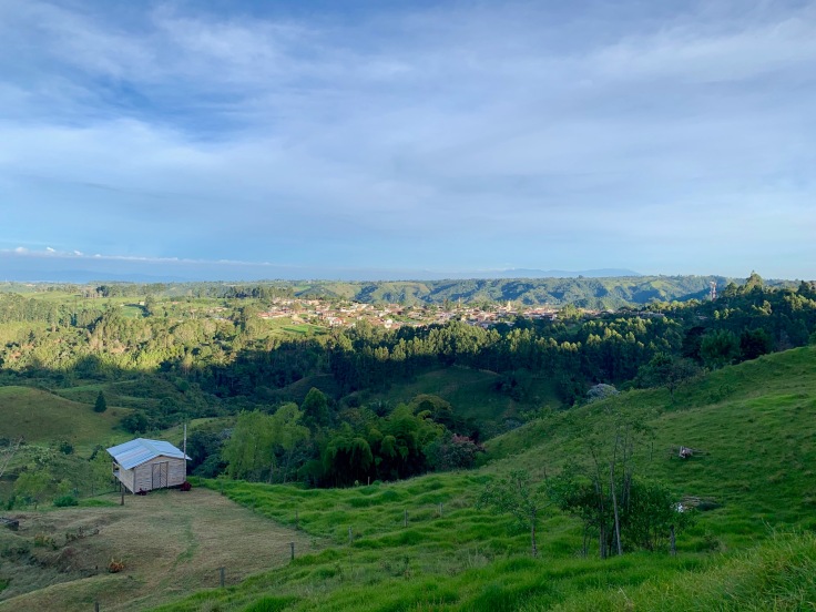
Salento
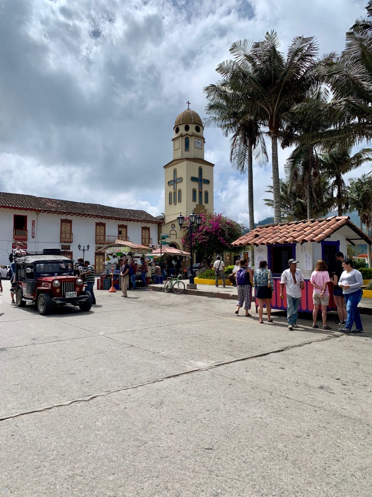
Salento is a small village in the mountain side. It’s all very green, surrounded by forests. The village is charming, as very colourful. The plaza Bolivar and the carrera 6 really get all the attention. The Plaza Bolivar is the place where everything starts in Salento.
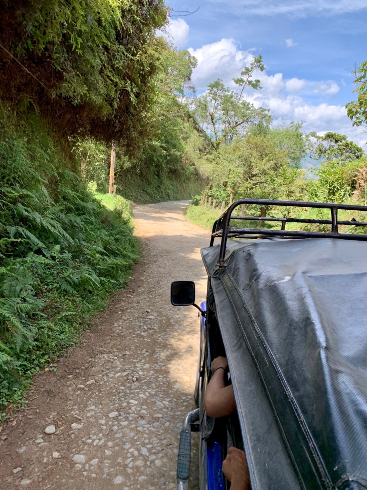
From there and all day long, Jeepstake visitors to the Vallee de Cocora, the Parque Nacional Natural Los Nevados or the coffee plantations. The great thing is that you have one single office for all jeep trips, which avoids confusion.
Salento is really a place full of backpackers, which makes the streets quite lively at night.
A PLACE TO DRINK: Cafe del Alma, great cocktails, local beers and live music
It is really pleasant to walk in the village and see all the colourful houses.
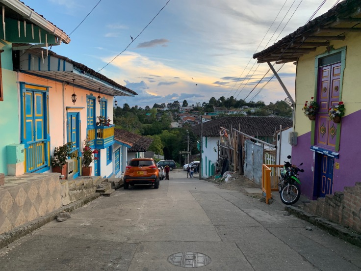
The main street of Salento is carrera 6. Most of the touristic shops are there. The street is beautiful and it is good to go there early so you can see the really typical houses.
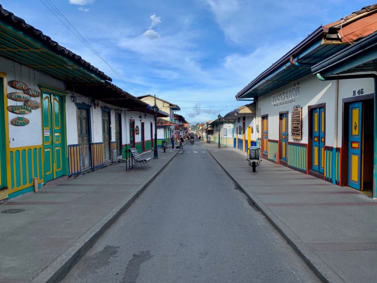
Most of the shops sell local artisanal products such as hats, carpets and obviously locally produced coffee.
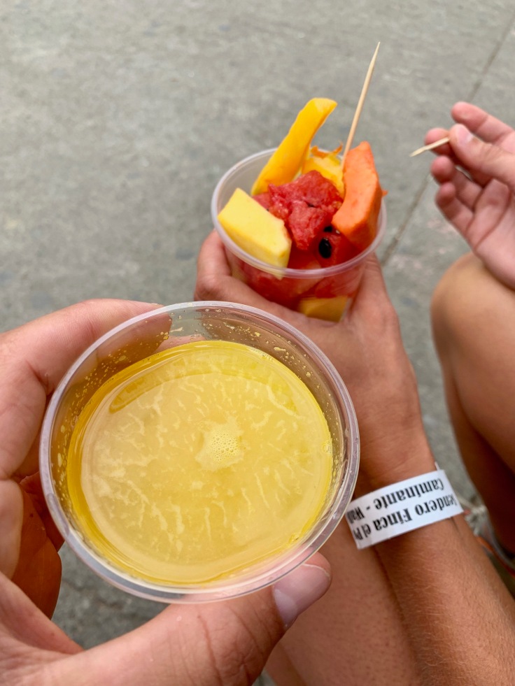
Don’t hesitate to grab fruits and orange juices everywhere, they are simply delicious.
The food in Salento was generally good everywhere. But we really had a blast here.
A PLACE TO EAT: La Herreria, definitely the best place for eating in Salento. Food was simply amazing, and service was great!
There is a mirador, el Miradore Alto de la Cruz, at the end of carrera 6 from where the view of Salento is quite good!
Having said that, you can find a better view following the road on the right before climbing to the mirador. The road goes up slightly in the forest and gives different viewpoints on the village.
And the valley.
A PLACE TO SLEEP: El Mocambo : rustic but charming
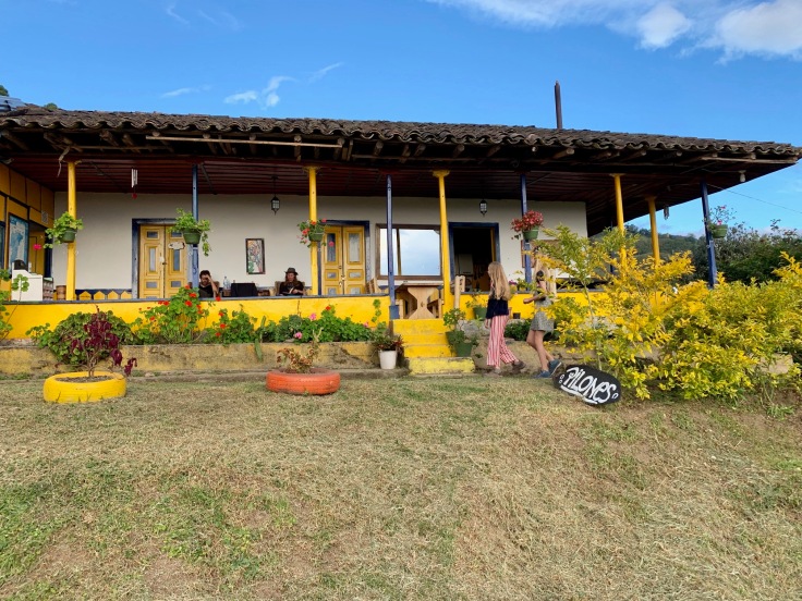
30 minutes walking up from Salento, the place has a beautiful view of the village and the valley.
A simple but typical and delicious breakfast is served on the terrace. Shower’s water is hot only at certain times of the day, but this is part of the adventure 🙂
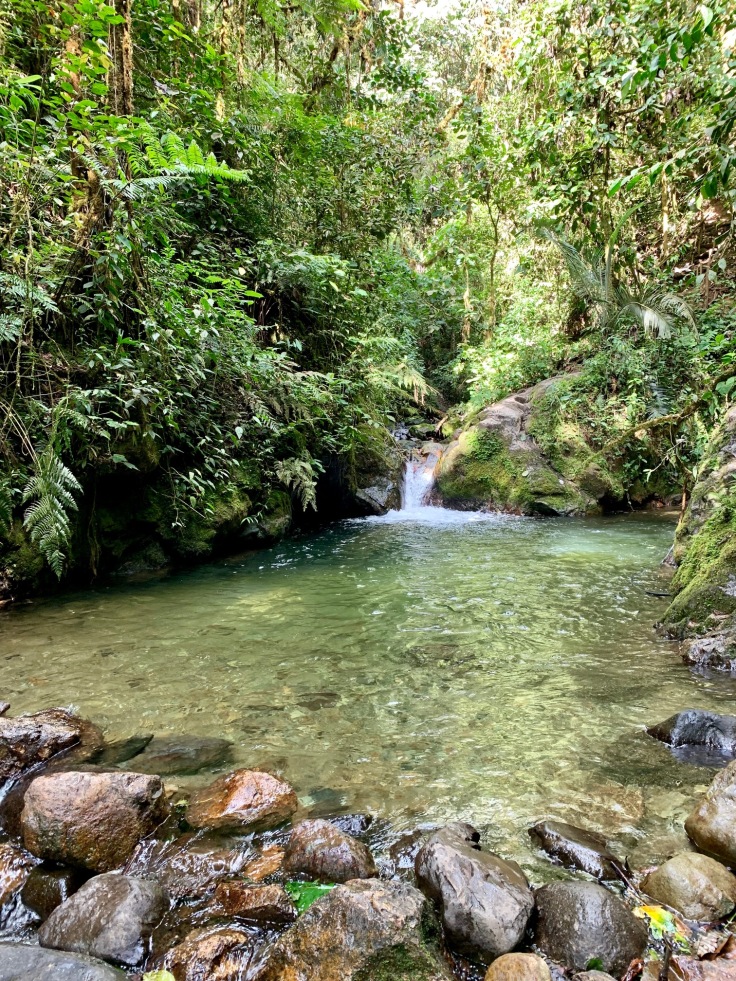
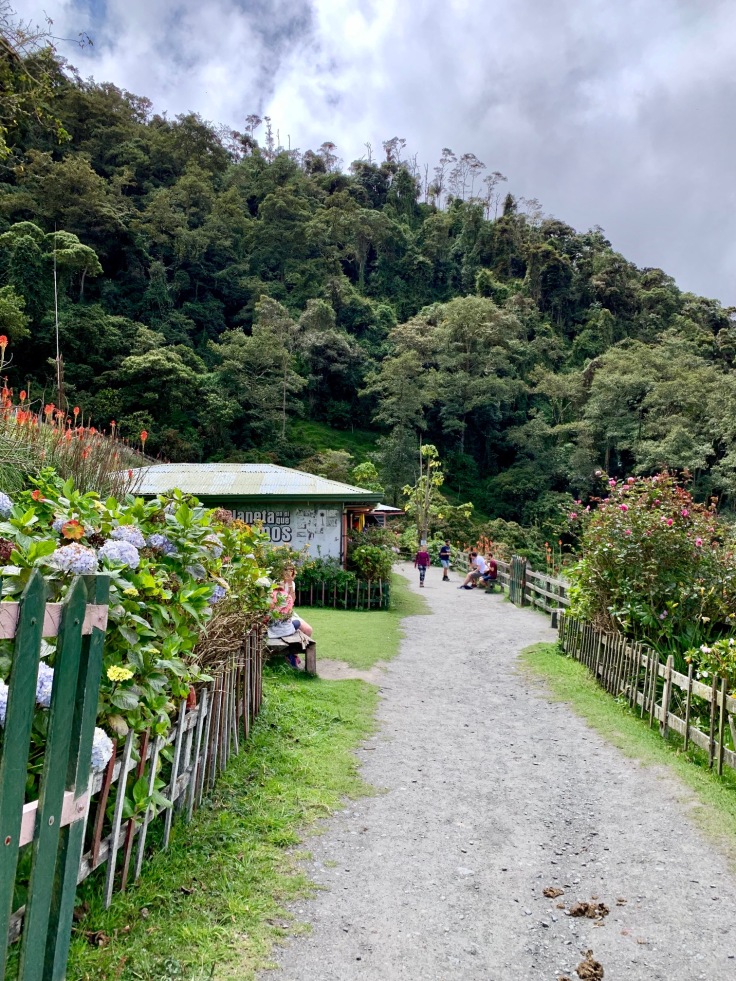
If you have some spare time in Salento, then this is for you. There is a beautiful cascade and natural pools two hours walk from the village.
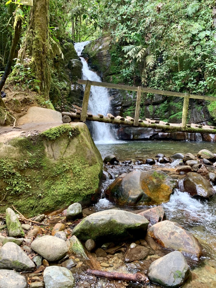
The countryside to go there is different from the Cocora Valley, and with the heat, it’s definitely one place to stop to refresh.
Directions for the cascade are not indicated though. From the Plaza de Bolivar, take the calle 6, fourth street on your left (carrera 2) and then diagonal on your right (calle 7).
Once you reach the road and a campsite, follow the road until you cross a river. Then turn right, and straight until the cascade. If you like camping and nature, this is one place for you, 15 minutes from the cascade and the pools.
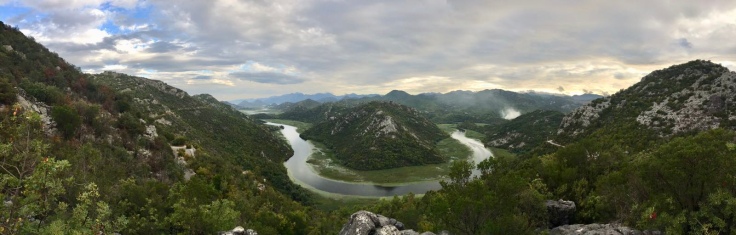
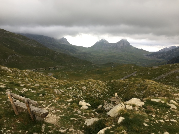
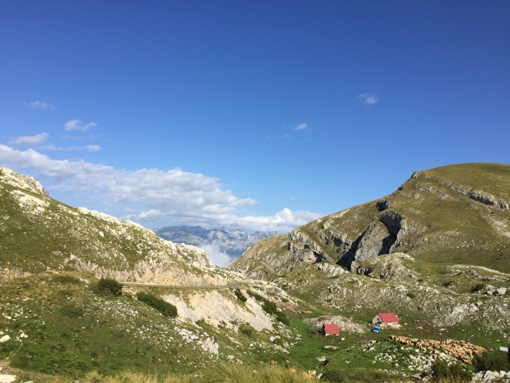
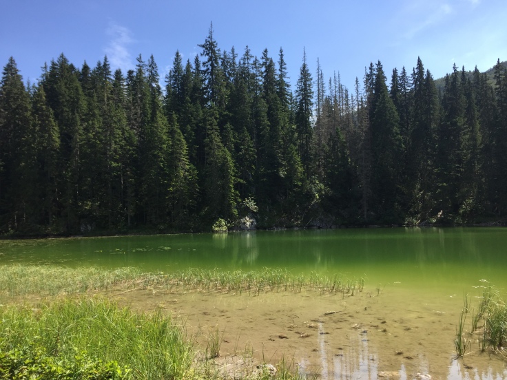
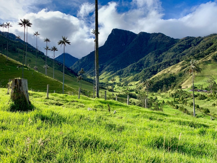
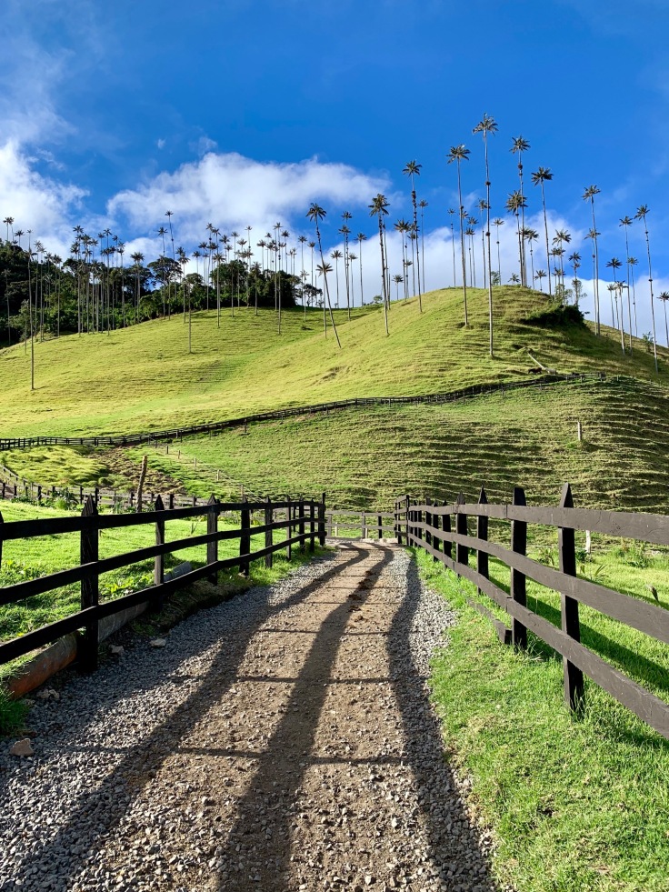
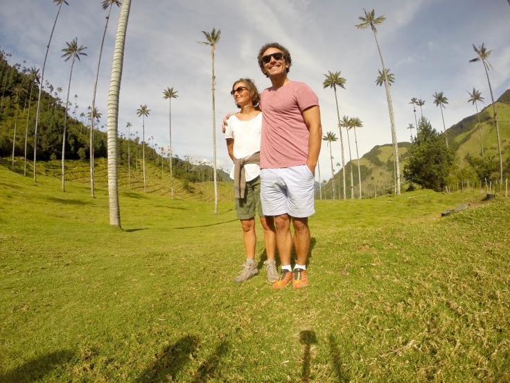
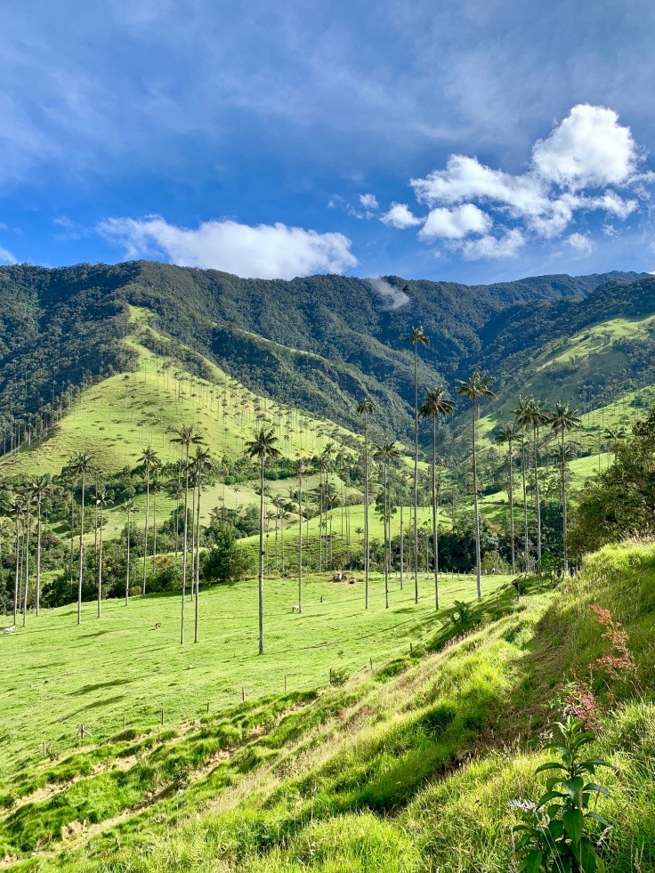
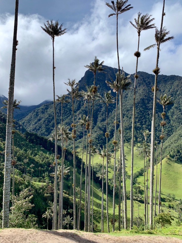
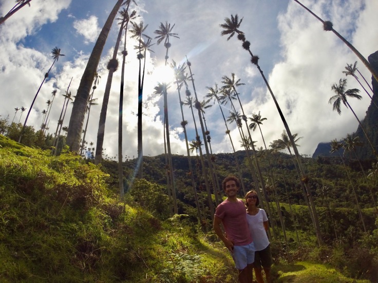
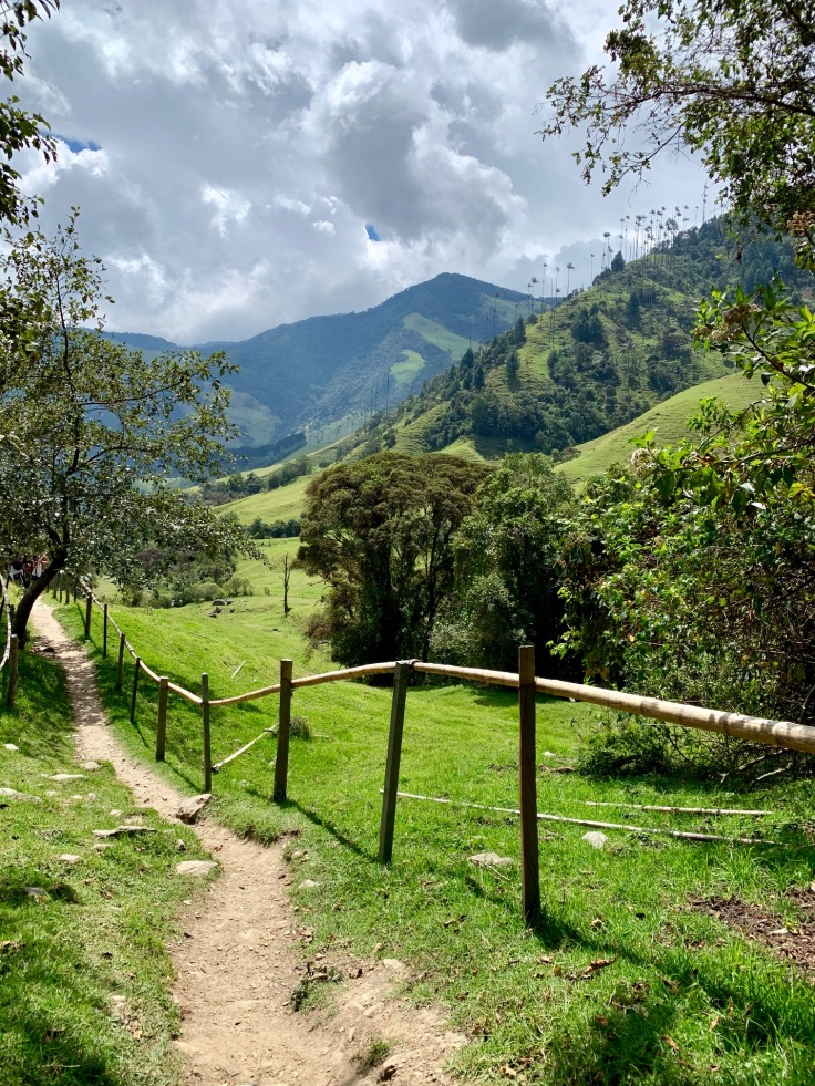
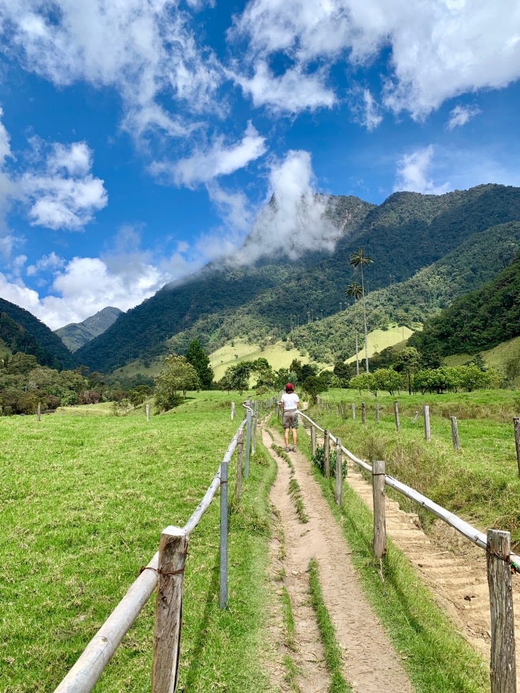
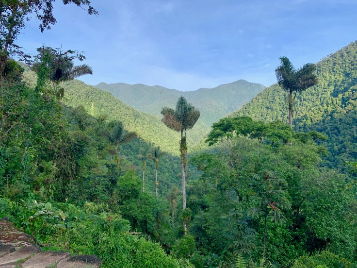
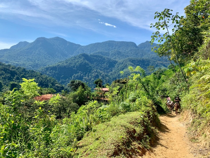
La Valle de Cocora
The Cocora Valley (in Spanish Valle de Cocora) is one of the most beautiful places we saw in Colombia – and in general 🙂
From Salento, a jeep will take you from Plaza de Bolivar to the Cocora Valley in 30 to 45 minutes. We recommend starting early, as the queue to grab a jeep going there can get very long after 9am till lunch time.
Once dropped on the parking, start going up among the few houses. There is just one road so you cannot be wrong! You have two alternatives to make the tour.

Either you climb in the jungle, and enjoy the palm trees going down.
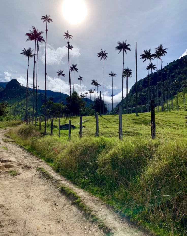
Or you start with the palm trees and finish in the jungle! A local guide recommended starting with the palm trees and finishing by the jungle. As we were there early, we met a very few people on our way in and had the palm trees for ourselves only – and having the palm trees under the light of sunrise is amazing!
In addition, the climb is on a large path which makes it definitely easier, with an outstanding view on the valley – on the contrary, the climb in the jungle is much more humid, on a narrow path and surrounded by a giant forest. Even if you can pick either ways we recommend climbing the way through the palm trees forest.
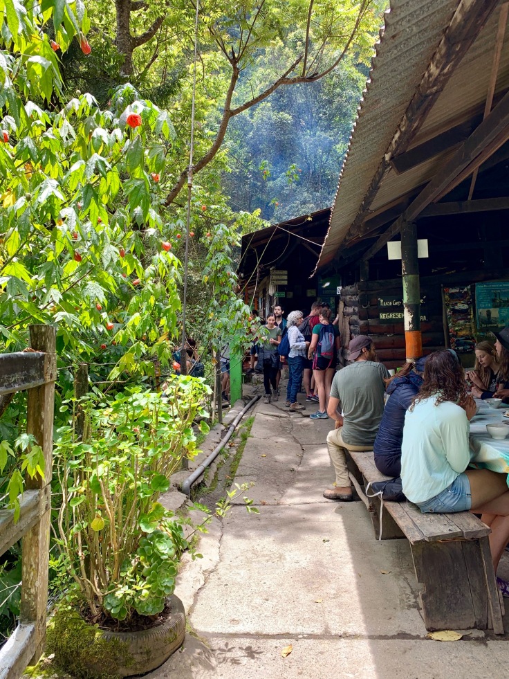
The full tour, including a stop to the hummingbirds’ house, takes around five hours for 12 kilometres. Going up through the palm trees’ forest until Bosque de Palmas, Mirador 1, Mirador 2 and the Finca la Montana takes between two and three hours.
The more you climb, the smaller you feel, that’s guaranteed!
The view from the finca is great and they serve really good home-made lemonade!
The Finca La Montana is really the frontier between the jungle on one side, and the palm trees’ forest on the other side. One side is humid, the other is not and you can clearly see the difference!
From the finca, the path only goes down, through the jungle.
The stop at the hummingbirds’ house is not mandatory of course, but we highly recommend having a stop there.
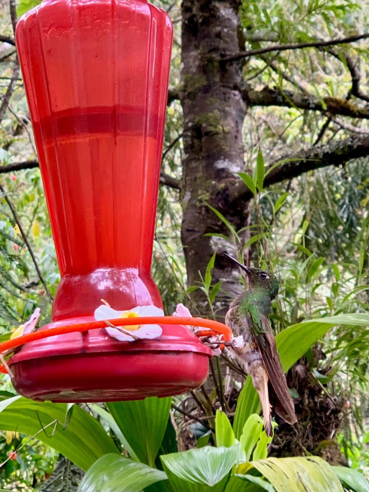
It will add less than an hour to your trip and, in addition to see hummingbirds’ flying around, it will be the opportunity to have one of the specialities of the area: a Chocolate con Queso (hot chocolate with cheese melting inside). Not too bad 🙂
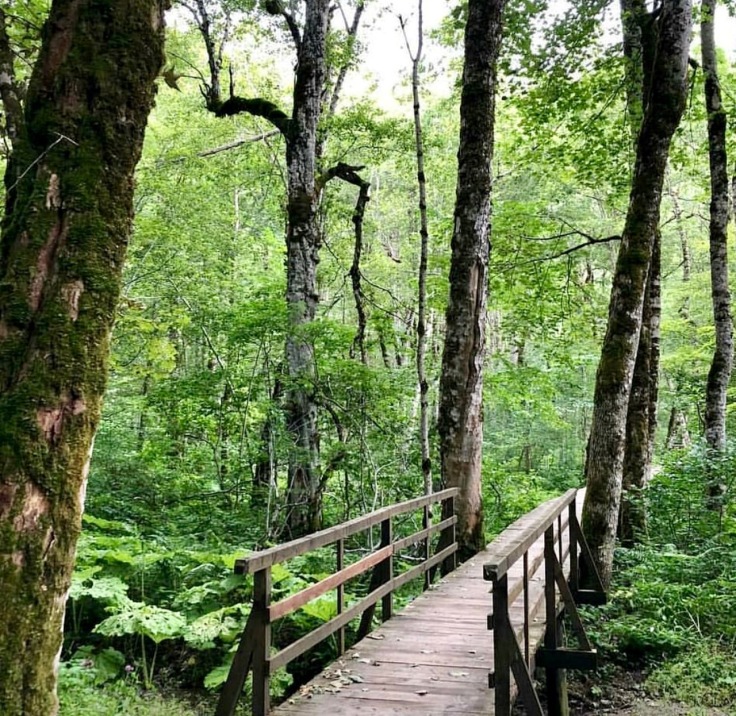
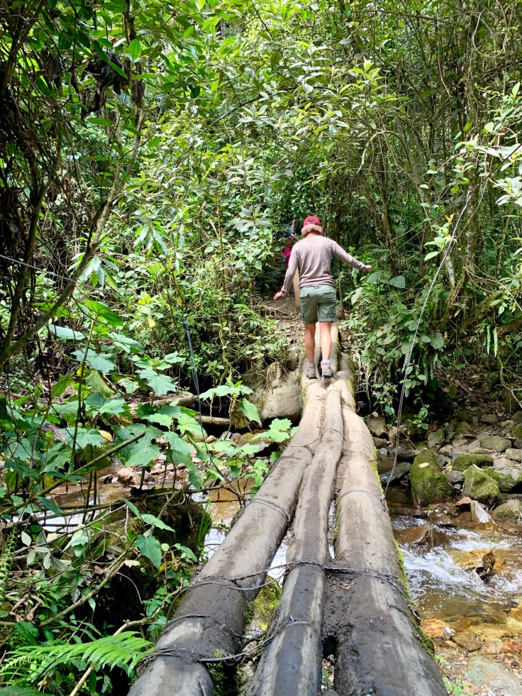
It is definitely easier to enjoy the jungle and the different views going down, as the path is really steep and muddy.The jungle is luxurious with creepers hanging from large trees. It’s really pleasant to go down. The path follows a torrent that you cross several times on old wooden bridges.
After one or two hours in the jungle, you leave it behind to find wide meadows where horses graze with the palm trees in the back. That’s a beautiful view and different from the one you had from above.
Obviously, horse riding is not our thing, but if you like it, that’s also the perfect spot to do so 😀
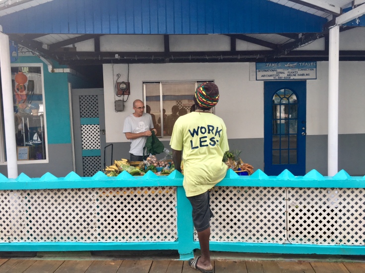
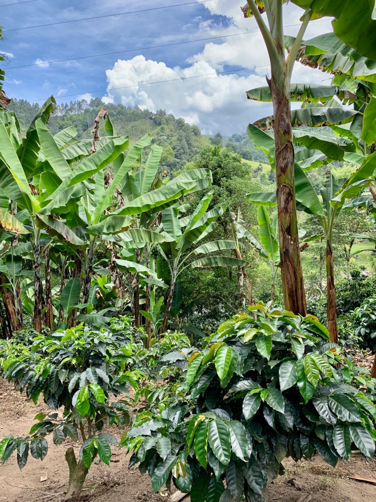
The Fincas and the coffee plantations
Colombia is the third largest producer of coffee in the world, after Brazil and Vietnam! This is mostly due to its location, at the equator, which guaranties all year long huge quantities of sun and a constant temperature.
The majority of the coffee from Colombia comes from the coffee triangle: Salento, Manizales and Pereira. You will also find some fincas in other places of the country, as in the Sierra Nevada Santa Marta, but they are scattered.
A PLACE TO GO: Finca Don Elias – Organic and traditional coffee farm
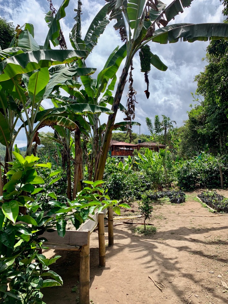
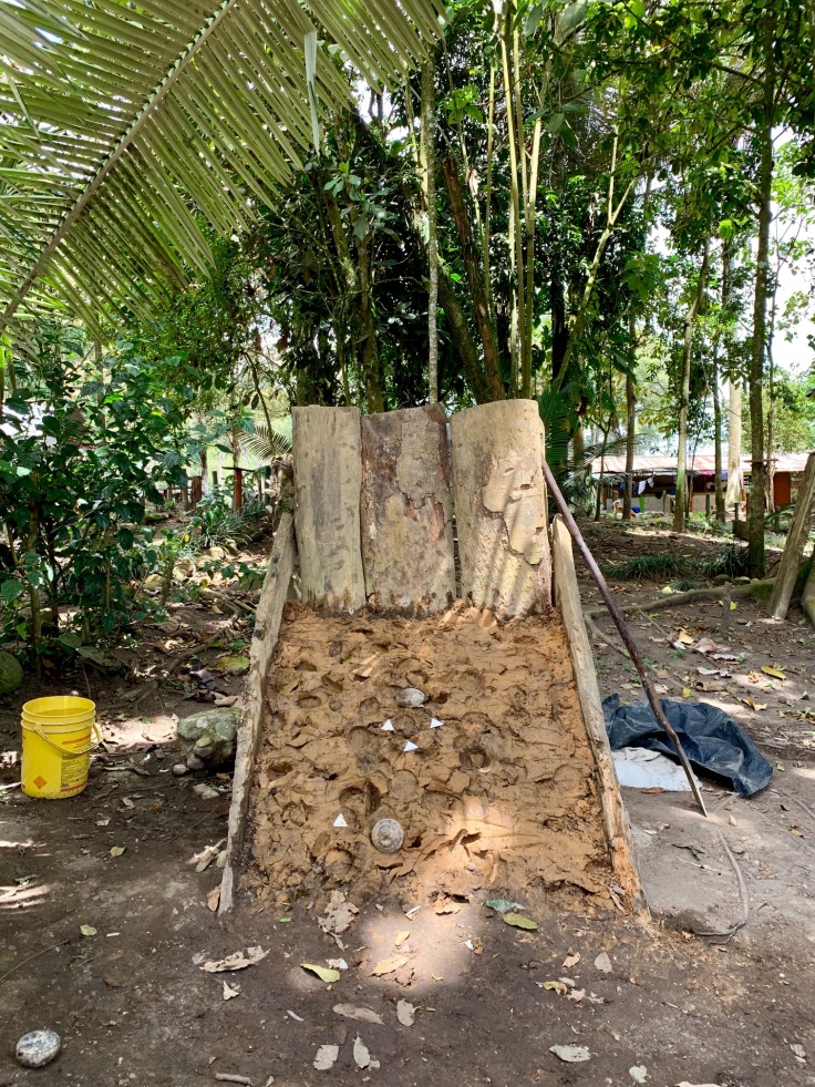
Among all the coffee plantations, we decided to visit the Finca Don Elias. What motivated our choice is that this Finca in particular produces an organic coffee, i.e. they produce it with no chemicals, water pipes or drying engines, which makes it an authentic traditional coffee farm.
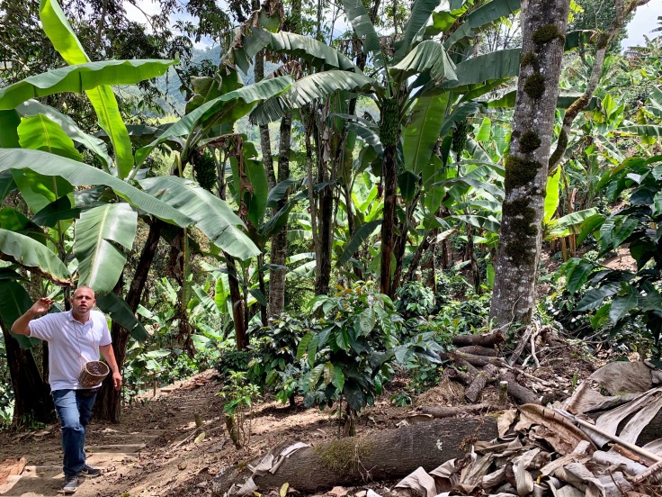
Everything for producing the coffee comes from the earth, the trees, the sun and wood (fire to roast the beans).The coffee produced here is a blend, i.e. a mix between Arabica (70%), Castillo (25%) and Colombian (5%) coffee. These are the proportions at Don Elias, but these are subject to the coffee maker and might change between the fincas. The visit lasts around two hours, and is a full journey through coffee. Everything is super well explained (in English too, not only Spanish – not so common in Colombia). One coffee tree needs two years to grow before producing coffee. Every coffee plant needs to have straight roots in order to hold well in the ground.
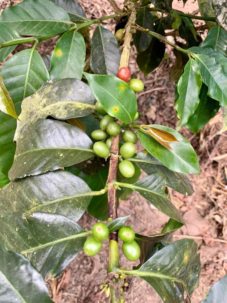
The coffee trees enjoy growing under banana trees! All the water comes from the banana trees.Beyond producing the shadow, they also keep a large quantity of water in their trunks and roots – the guide squeezed the trunk of the banana trees and water was literally flowing from it, impressive! There are usually two harvests during the year: 70% of the annual harvest happens during April and May, 25% during October and November, and the rest during the year.
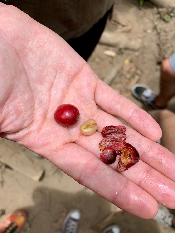
The coffee is ready once red. Then, the peal is taken off and the beans go in a green house for drying for approximately three weeks. Then, the beans are roasted on a fire and grinded.
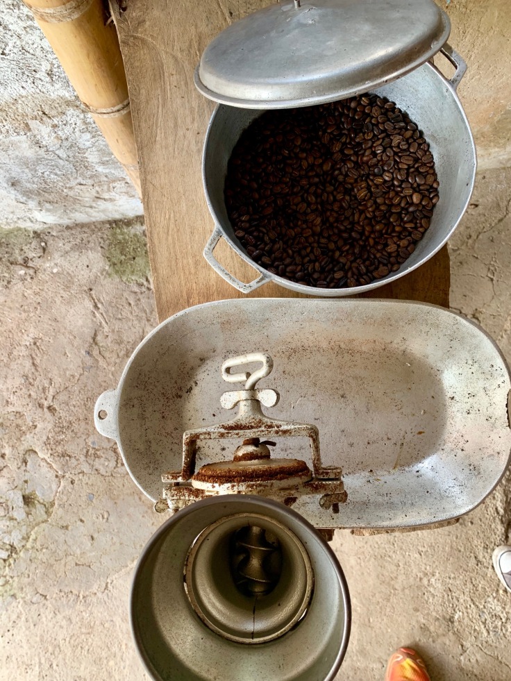
The funny thing is that, before being roasted, the bean doesn’t smell at all. It’s only once roasted – and better, grinded, that all flavours appear.
A PLACE TO EAT – and play TEJO: Finca Don Elias
If you wish to eat at Finca Don Elias, this is possible. The restaurant is not strictly at the Finca, but a bit outside. You eat super well (trout, corn soup, chicken) and of course enjoy a coffee produced in the Finca! Also super important, you can play TEJO while your plate is getting cooked!
The concept of TEJO is similar to bowls – except that here you don’t aim for the jack but four firecrackers arranged in a circle on mud. It makes an explosion once you touch one. Quite unexpected as game but super funny!
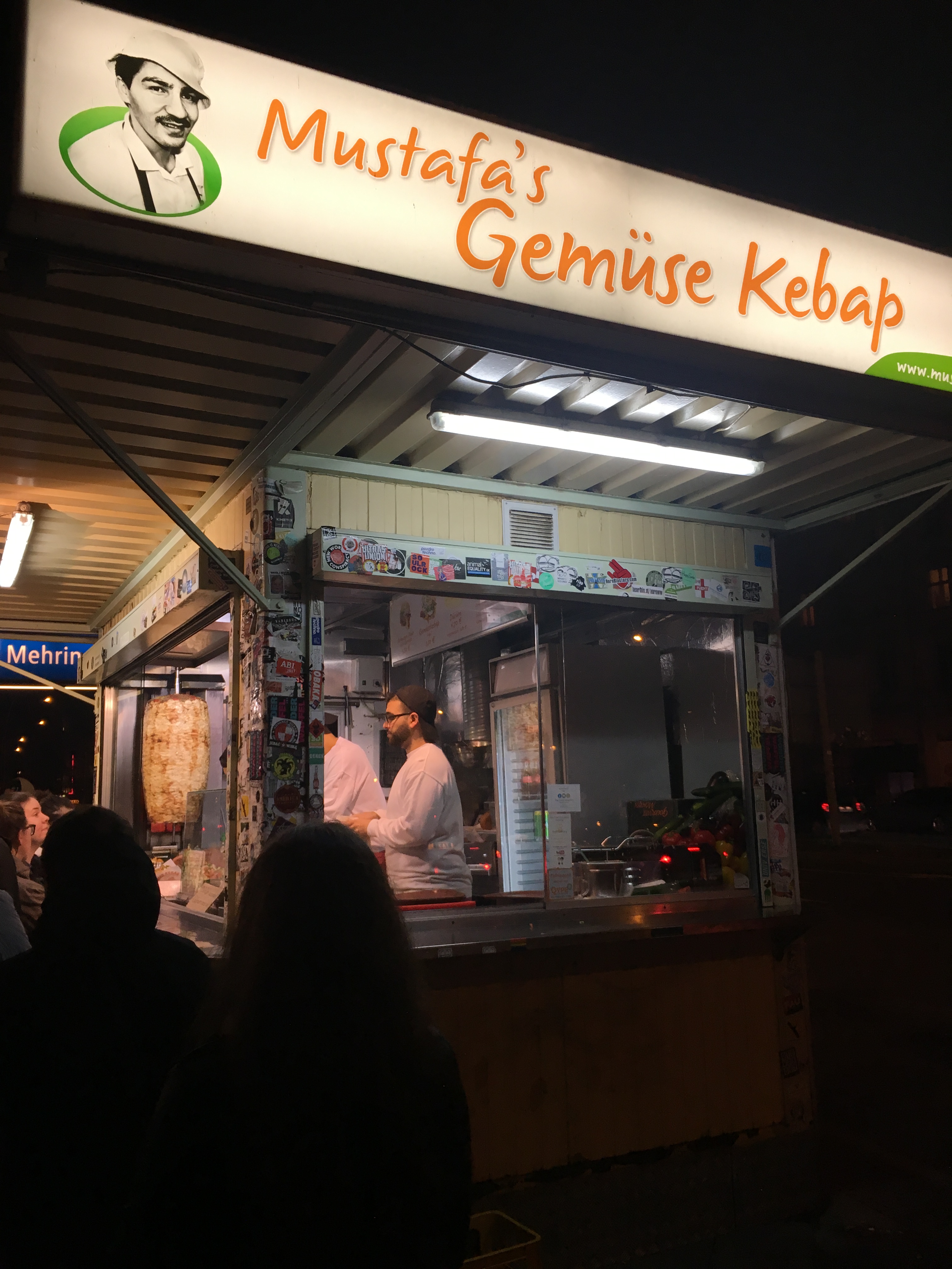
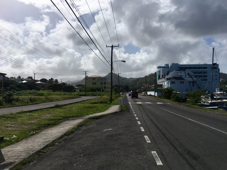
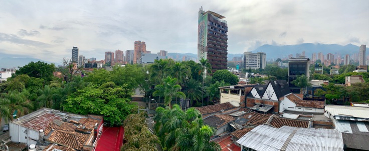
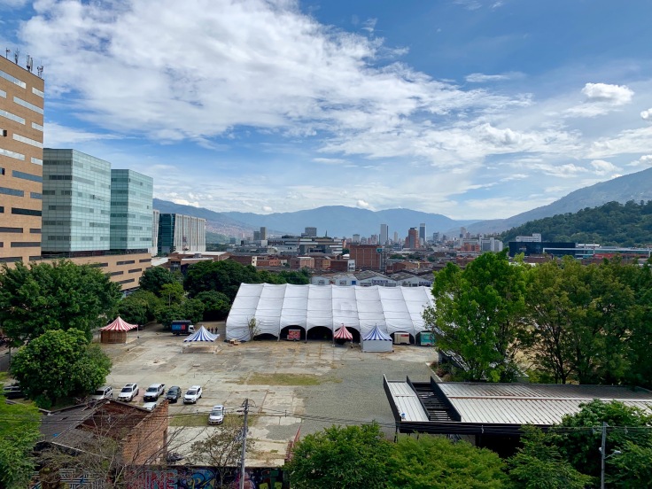
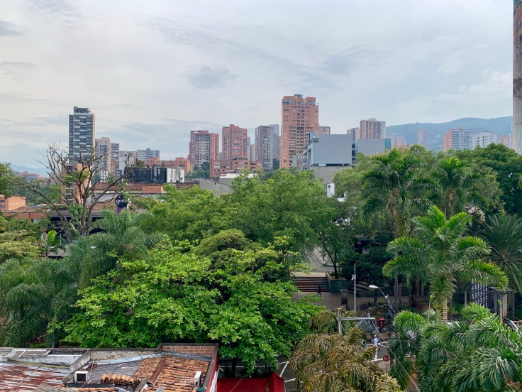
Medellin
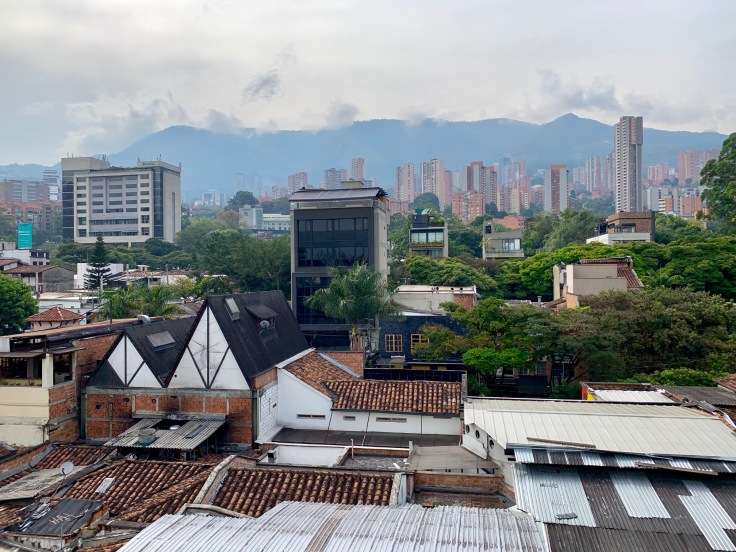
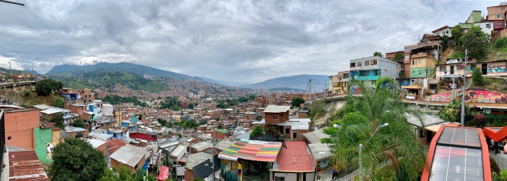
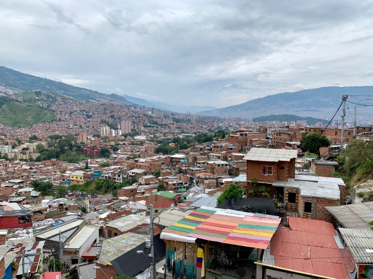
Medellin was a great surprise! The city, concealed and spread between two mountains is flabbergasting. From Communa 13 to El Poblado, stopping by Medellin downtown, Medellin was also a key stop to better understand Colombia!
Medellin is known as the city of the eternal spring, due to a permanent 25 degrees Celsius all year long! No season here!
We arrived in Medellin with the night bus from 11.45pm (there is one bus every hour until 11.45pm to Medellin) from Pereira, which costs you COP 49,000. Although you arrive in the morning in Medellin around 6 or 7am, the trip is tough as the bus essentially takes mountain roads, and sleeping there is hard. So if you can take a flight, probably better!
El Poblado
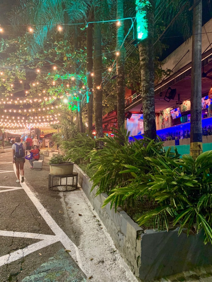
El Poblado is definitely a residential and partying area. From an historical point of view, there is not much to see, but you definitely want to spend all your evenings there!
A PLACE TO HAVE COFFEE: Pergamino, best coffees according to Colombian, served and done in so many different ways
However, the neighbourhood is charming! New and design high buildings juxtapose small houses in red bricks.
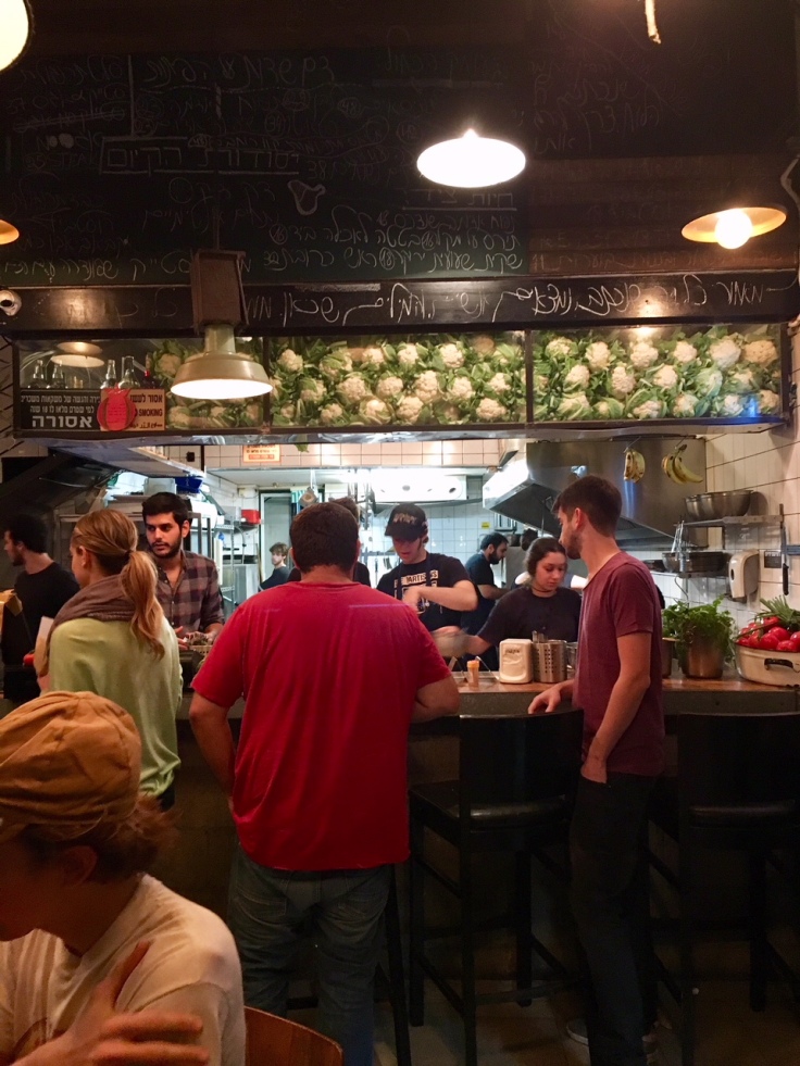
A PLACE TO EAT: Mercado del Rio, street food market!
Great food in great neighbourhood – close to Industriales metro station and Medellin Art Museum
Sometimes with an industrial architectural side, the neighbourhood is a model of urban integration.
But what make the neighbourhood so nice are not its buildings or streets coloured with street art! It is the atmosphere. Close to Parque Lleras, a lot of bars, restaurants, coffee makers, designer shops and much more welcome tourists and inhabitants.
A PLACE TO DRINK BEER: El Craft; local craft beers from Colombian breweries
Although it is quite desert in the morning, the area is crowded by lunch time until late in the night! A lot of people come to work to El Poblado, as you will figure if you stop by the metro after 5pm!
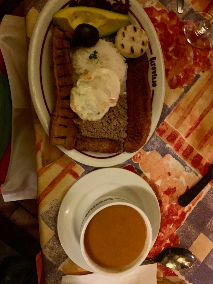
A PLACE TO EAT: HatoViejo for an authentic Bandeja Paisa, the main dish from the Paisa area in las Palmas
You will find a lot of youth hostels and hotels in El Poblado. However, check if the place has a bar downstairs or a rooftop upstairs, as it could be (very) noisy until 2am 🙂
Medellin Downtown
It’s fair to say that Medellin downtown is really different from other areas of Medellin. It’s swarming with people. To go to Medellin downtown the first time, we walked from El Poblado, following the carrera 50. Impressive, for more than 2 or 3 kilometres, there are only car sellers and fixers.
At first sight, discovering downtown Medellin for the first time, downtown Medellin at first sight was oppressing and not beautiful at all. We were expecting a downtown similar to Bogota, witness of the history of the city. It is not the case.
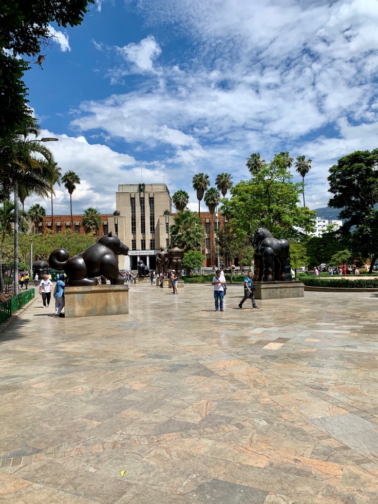
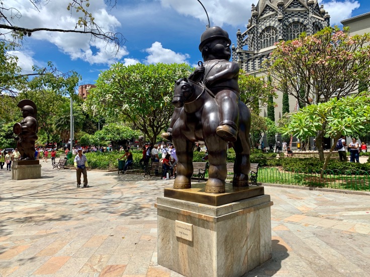
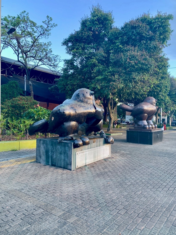
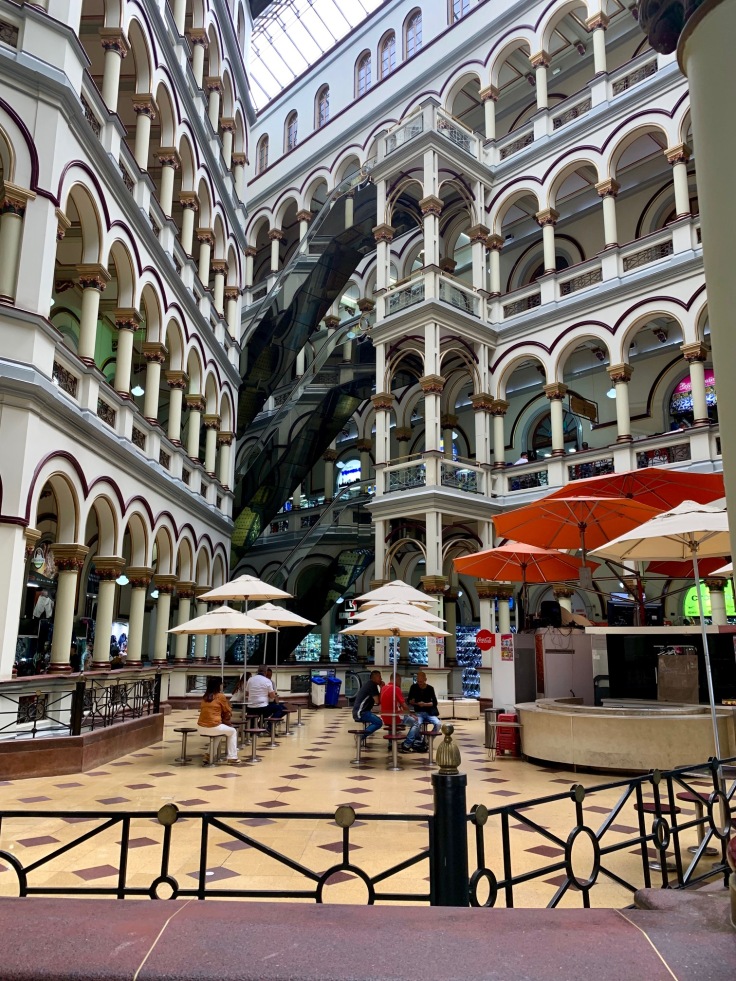
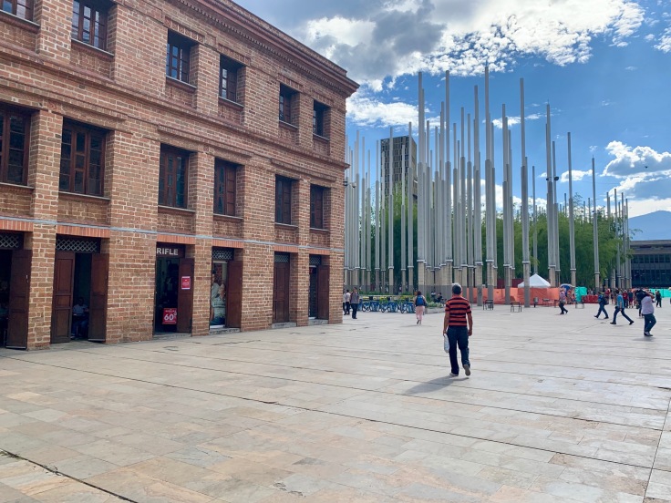
The architecture of Medellin downtown is brutal, which makes hard to see the elements of history between them. The plaza Botero is a breath of fresh air in the city. Shinny and bordered with the Antioquia museum on one side,decorated by all the statues on the other side, it is a really nice place to stop by.
If you wish to go to the fruit market, called Minorista, it may be a good alternative to go there by taxi. Not far from Plaza Botero, we tried to go there walking, but streets are full of junkies and homeless people, it’s definitely not a pleasant walk.
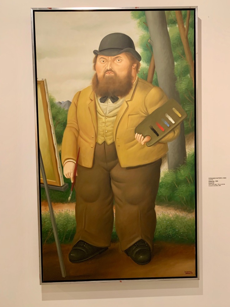
A PLACE TO GO: Museum de Antioquia
The museum de Antioquia is very good and has an impressive collection of what can be considered as the most famous Colombian painter, Fernando Botero! The other collections are nice too!
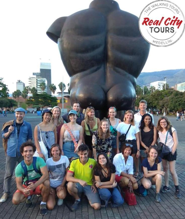
A THING TO DO: Real City Tours, visit with a guide of Medellin Downtown! So important to understand the Colombian history, past and present, but also the way Medellin downtown works!
If you have to do one thing in Medellin, it is not El Poblado or Communa 13, but a guided visit of Medellin downtown with one of the guides from Real City Tours.

Real City Tours is different from the other guided tours you can find in town. Here, the visit is free, and you pay the guide at the end of the tour what you want, depending on how he performed and how you liked the visit. Our guide was named Edgar, and was absolutely brilliant!
In addition, all guides from Real City Tours must have gone abroad for a long time – i.e. living, not simply travelling, in order to speak English first; but second, to have a step back on their own history and understand the occidental mindset.
A PLACE TO EAT: La Hacienda, recommended by Colombians in Medellin downtown for their Bandeja Paisa
The tour lasts more than four hours, and we were delighted by it. Although we didn’t like at all Medellin downtown the first time, the guide took us through all the key places of the city.
The guide explains a lot, from the Conquistadors to the actual political regime, going through, of course, Pablo Escobar! – without mentioning his name though. As inhabitants mostly don’t speak English in this area, he doesn’t want them to misinterpret what he says. Indeed, these last few years, some tourism around Pablo Escobar and his activities, presenting him like a cool guy, started to be developed, and is very badly seen from the locals.
A PLACE TO EAT ICE CREAM: Astor – according to our guide!
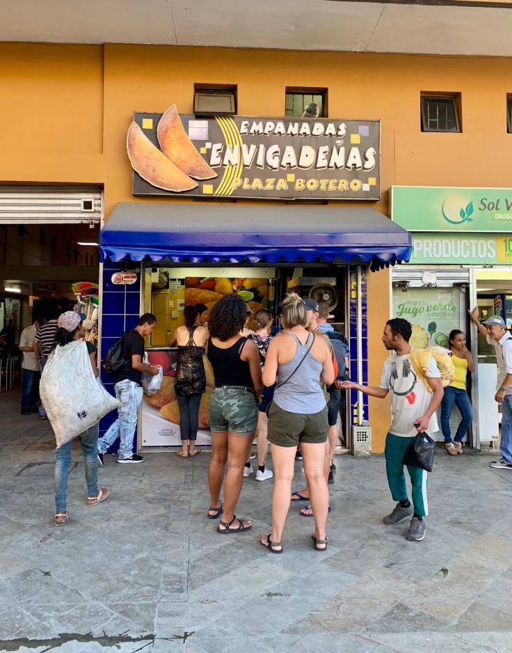
The guide doesn’t take us to the main view points but also tells facts and stories about every place, as a vendor of plants and drinks which are supposed to make you rich, find love and so on, or the best place in town to eat empanadas! All these things, you cannot know them without a local. And it makes you having a complete different opinion on the place.
A PLACE TO EAT EMPANADAS: between the church Parroquia de la Veracruz and the Plaza Botero, on your left
There is a small church(Parroquia de la Veracruz) not far from the Plaza Botero. If you look carefully, a lot of women are alone and shortly dressed. The temperature is relatively hot, meaning you don’t notice this at first sight. Butin Colombian crowded areas, prostitutiongenerallytakes place close to churches, so men can confess right away after and seek absolution from their sins. Ironical isn’t it?
A PLACE TO EAT BUNELO: one of the Colombian specialties
In front of the church (Arroquia de la Veracruz), the street food shop at the corner makes a delicious – and heavy – buñelo,ball of fried cheese.
What was impressive with the tour was that they manage somehow to be quite objective and lucid about what happened and what happens now. They are factual and let you make your own opinion.
What is also funny is that what we considered sometimes oppressive when we visited Medellin downtown the first time was in fact misinterpreted curiosity. When we were doing the tour, a lot of Colombian people stopped by us, and were listening although they don’t speak English. A lot of them asked the guide to wish us welcome in Colombia!
In a nutshell, without this tour to understand the story of Medellin and Colombia, but also to understand how the city works now, we would have had a complete different opinion of it! The guided tour with Real City Tours of Medellin downtown is definitely something to add to your list!
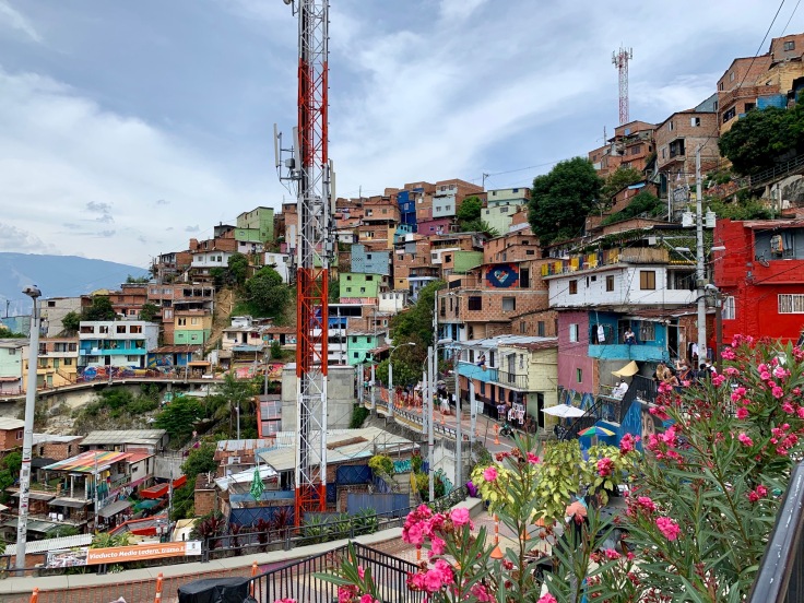
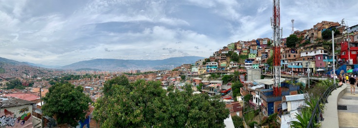
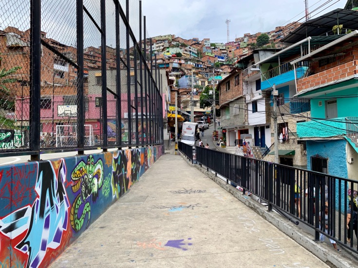
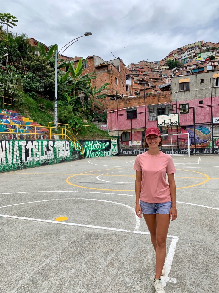
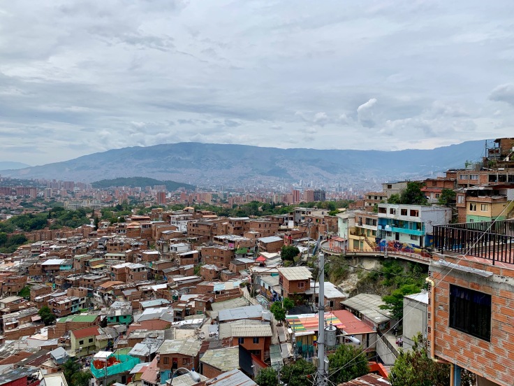
Communa 13
Probably the most famous area of Colombia is Medellin, and in Medellin, la Communa 13 thanks to Pablo Escobar – and Netflix! This area is a blast. It is once again definitely different from the other neighbourhoods of Medellin, but has a lot of character!
The area has a strong past. Ruled by the guerrillas, the paramilitaries, both being generally paid by the cartels, it was considered as a strategic point in the city, as it is the part with the closest access to the Atlantic Ocean.
For a long time, the area was a lawlessness zone and no policemen or military were allowed to enter – especially when Pablo Escobar was paying Medellin citizens for every policeman killed. In total, more than 37,000 locals were killed during the time of Pablo Escobar due to urban guerrilla activities.
Two assaults in 2002 liberated the area, which is now perfectly safe. Houses are way more different than El Poblado, usually one or two stairs max, with, as roof, pieces of metal sheets.
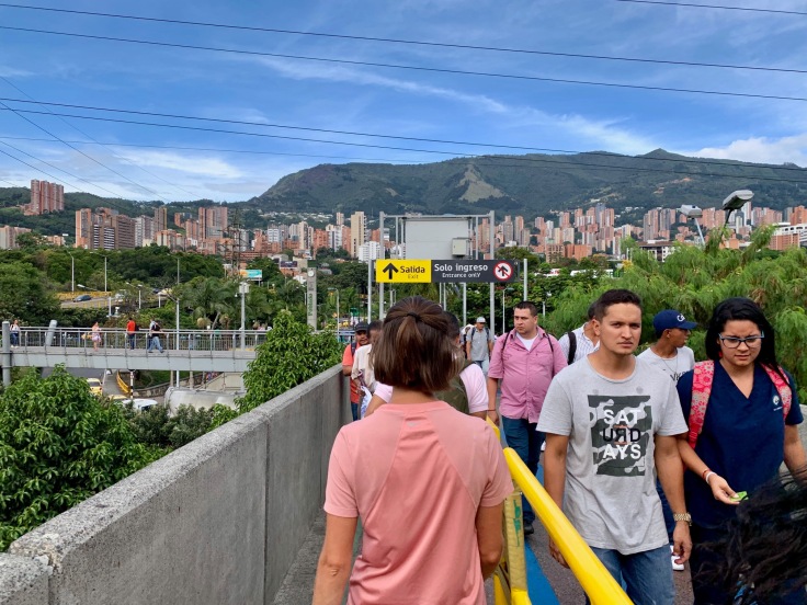
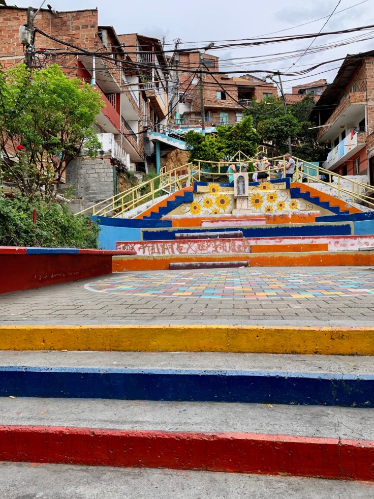
The genius idea to connect this neighbourhood to the city was taken and installed in 2012. As Communa 13 is a bit away from the city and the subway, the city built escalators connecting the bottom of Communa 13 to the subway.
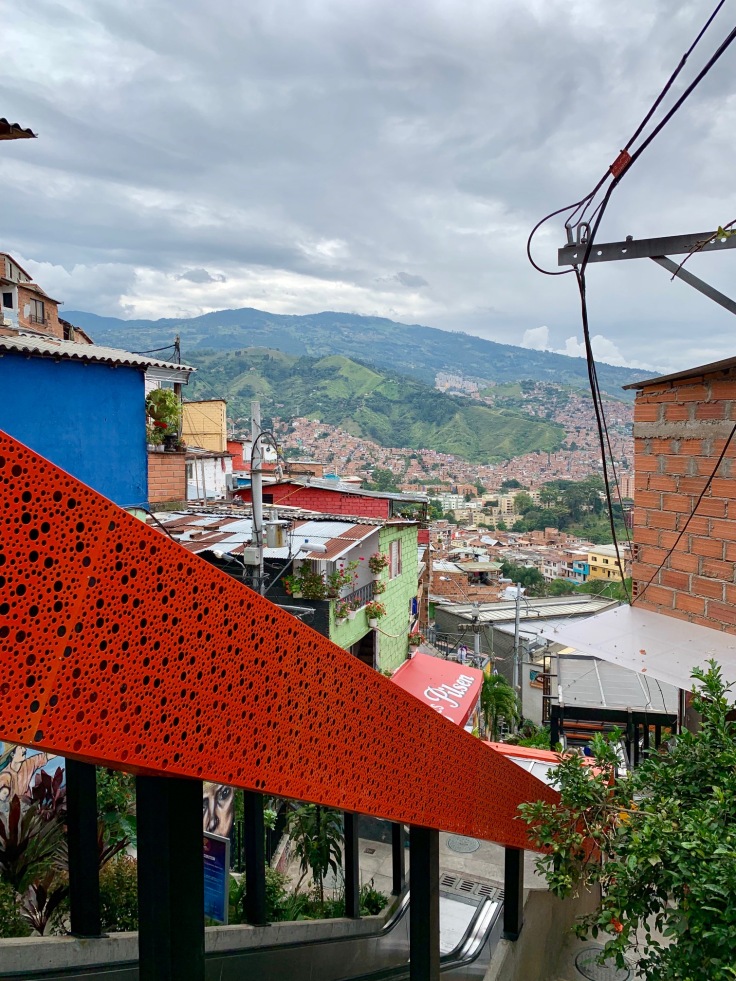
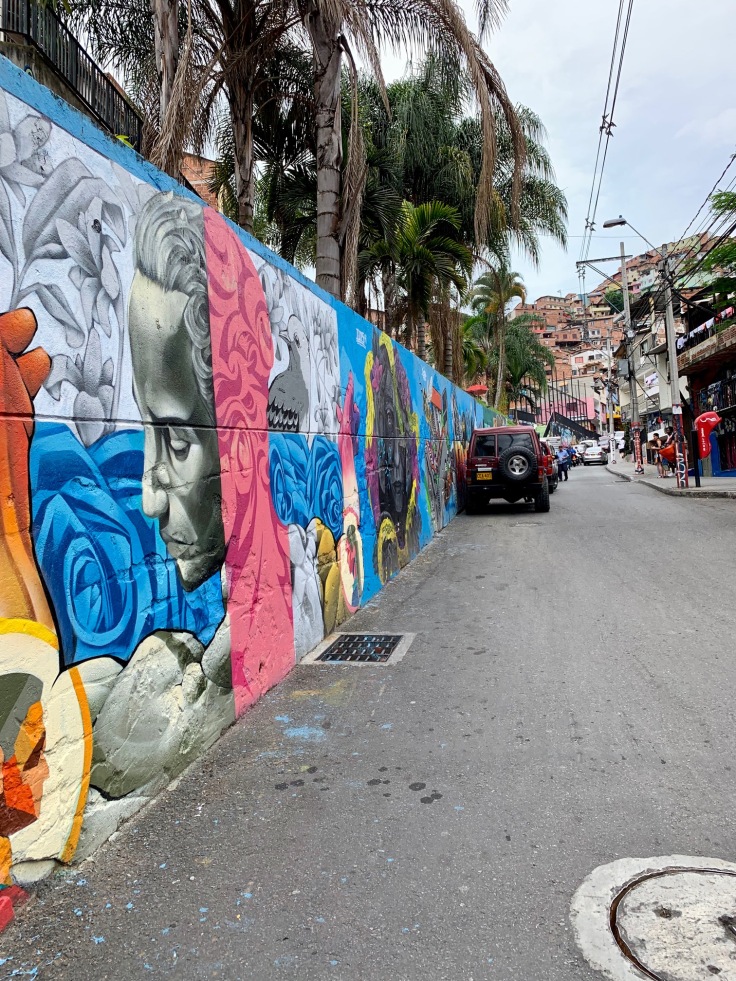
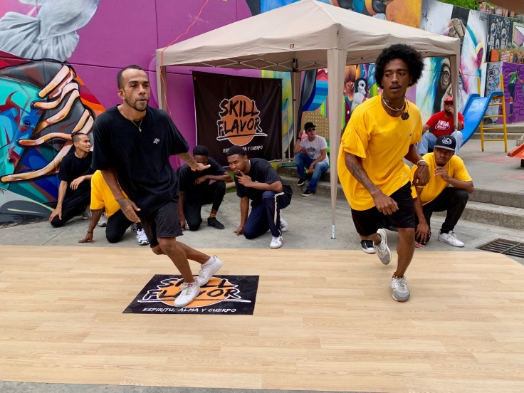
Today, Communa 13 is a place for street art, hip hop and all types of expressions. It is a great place to visit.
Once again, the architecture is different from the rest of Medellin.
The view on Medellin is gorgeous though, and just for this, it worth to go to the top – no excuses with the elevators.

It is good (and recommended) to visit Communa 13 with a guide. We were disappointed by the tour we had, Graffiti free Zippy Tour (same principle as Real City Tour, you pay what you want), especially in comparison to the one we had the day before when visiting Medellin downtown. Hence, we would recommend you to try other tours.
You need to go there to understand how much the elevators could change the city. It connects the entire neighbourhood to the rest of the city!
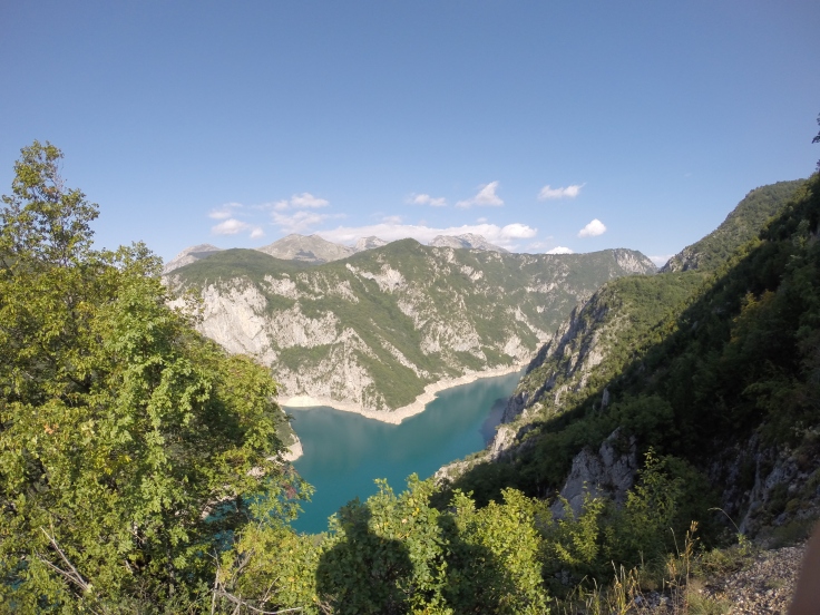
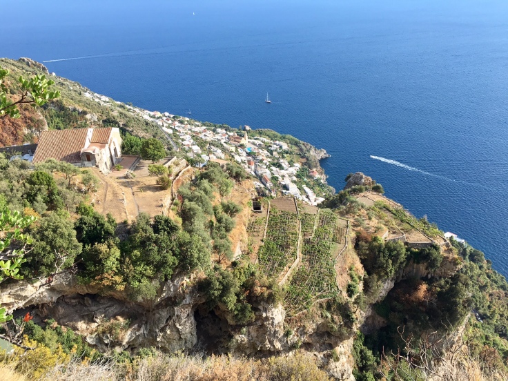
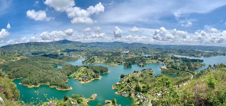
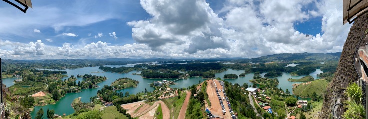
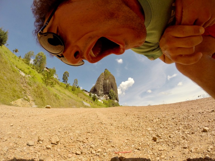
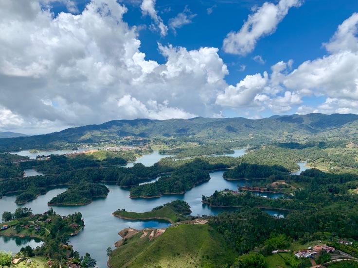
Guatapé and Piedra del Peñol
Guatapé is a small village two hours drive by bus from Medellin. The place is mostly known for two things. Its artificial lake from the late 60s, which created a multitude of islands.
Piedra del Peñol
The Piedra del Peñol is a large rock overhanging the area, similar to the Corcovado in Brazil.

Buses leave to Guatapé from Medellin North Bus Terminal (get off at Caribe on metro line A). One bus leaves every 2 minutes from 6am to 7pm with the bus company “Santa de San Vincente”. The bus makes a first stop atPiedra del Peñol – the giant rock. The easiest is to get off here and start with the ascent.
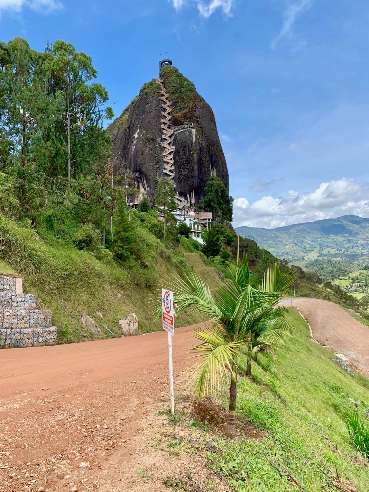
In total, there are 659 steps to climb to reach out the top.
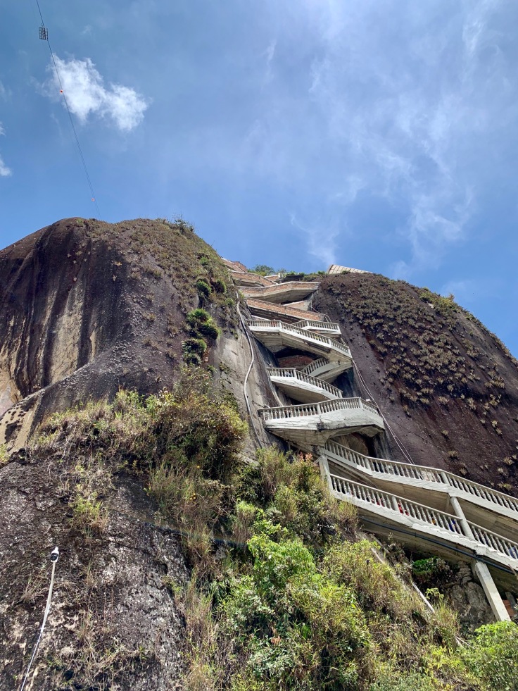
Although from the base of the rock, it looks smaller 🙂
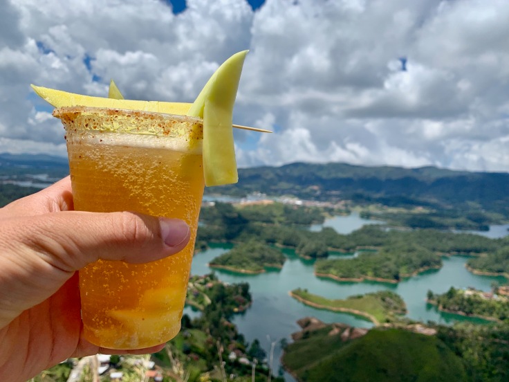
The lake dwells at the feet of this giant piece of rock; the more you climb, the nicer the view of the Antioquia countryside is.
One thing to keep in mind as well is that they serve a delicious mango beer and coconut lemonade at the top!
To go to Guatapé, nothing easier – take one of those tuktuk commuting between Piedra del Peñol and the village. Otherwise you can walk for 40 minutes, but along the road, the ride is not particularly nice.
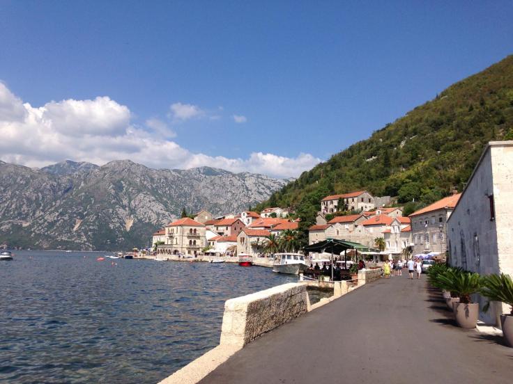
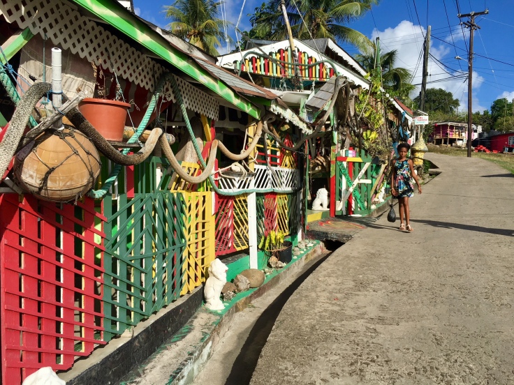
Guatapé
Alongside the lake, Guatapé is a charming small city, with colourful houses and cobblestone streets.
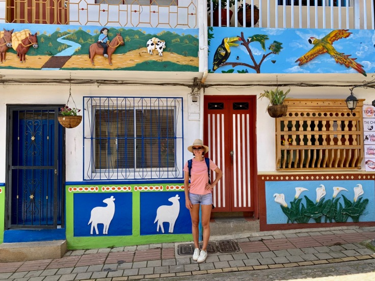
The village is known for its “zocalos”, a Spanish tradition consisting in fixing decorated wood baseboards on houses to prevent from humidity and wear.
Traffic within Guatapé is limited, which contrasts with Medellin. All streets are showing different types of decoration, it’s stunning.
In August 2019, the shores of the lake were under construction in order to build a Malecon – same as the beach front in Havana: a road and a pedestrian area to walk by the lake.
A PLACE TO EAT: La Fogata, typical Colombian food with great view on the lake
Good to know, the bus station for Guatapé is also just next to the restaurant!
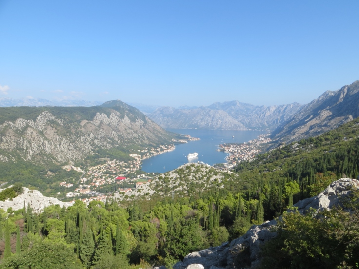
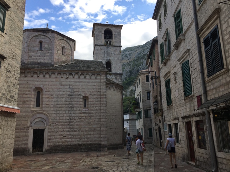
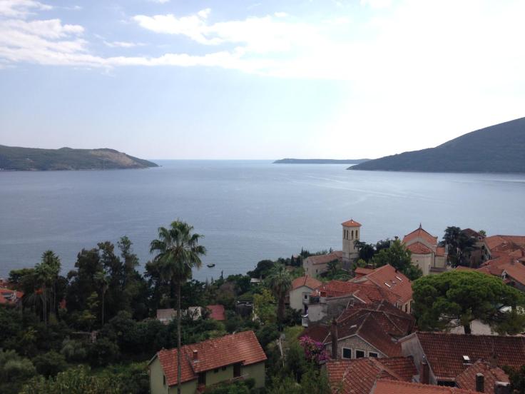
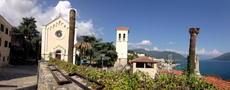
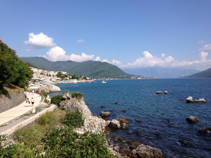
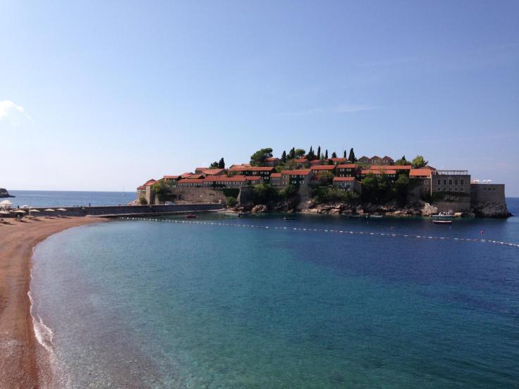
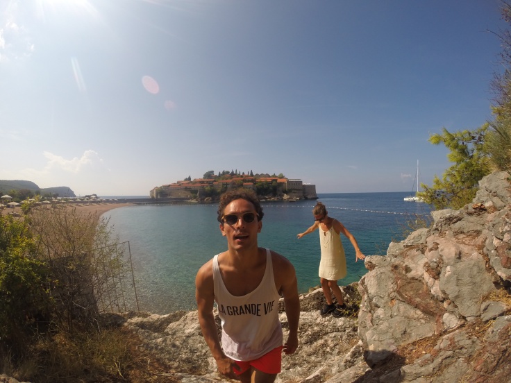
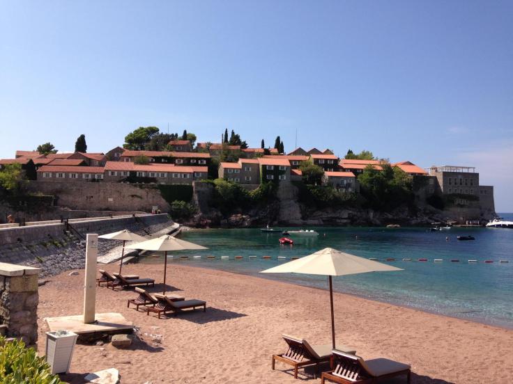
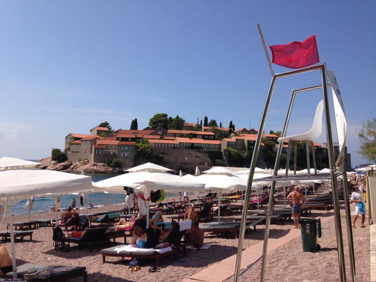
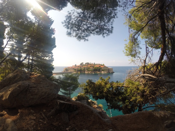
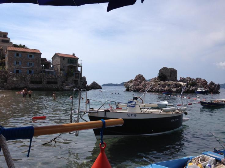
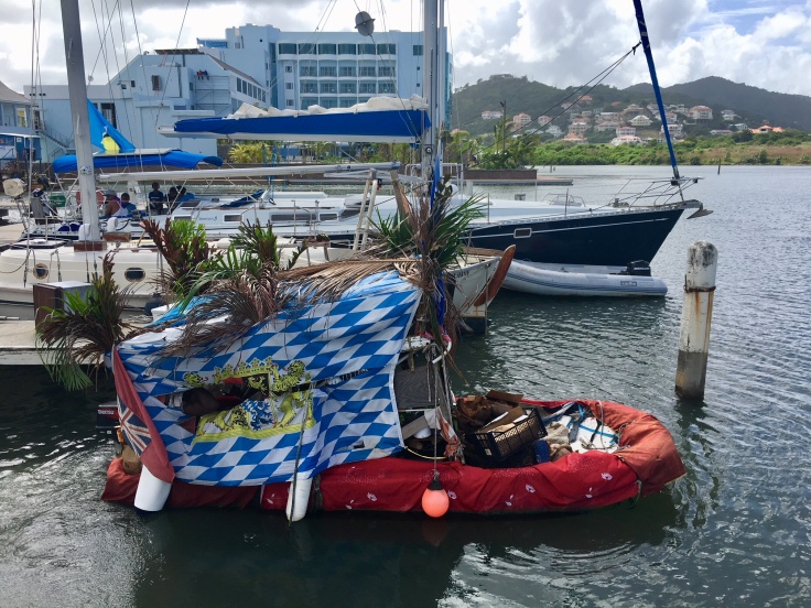
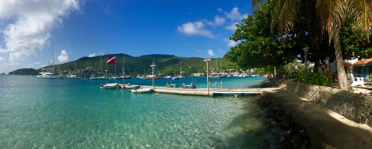
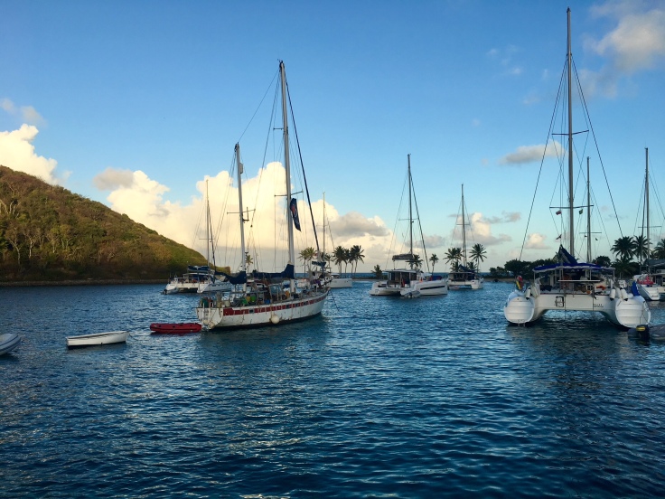
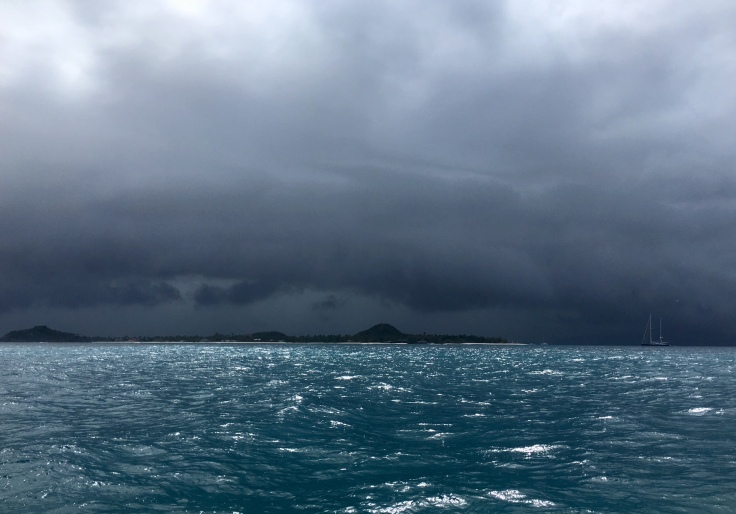
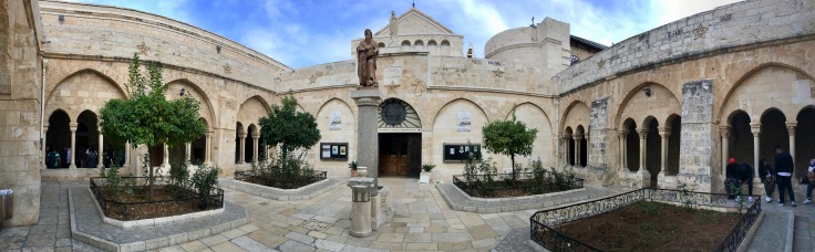
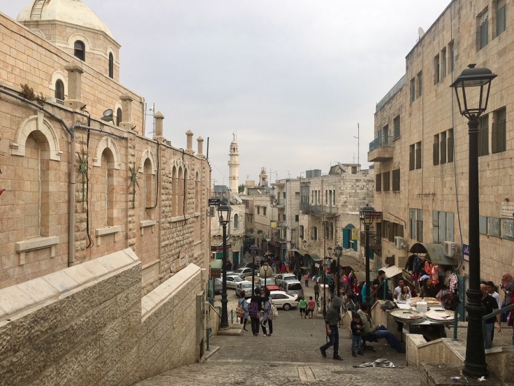
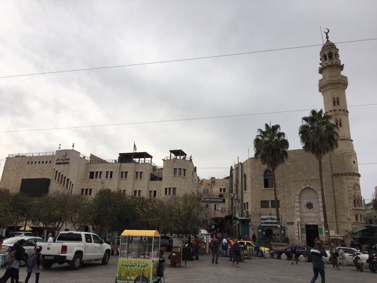
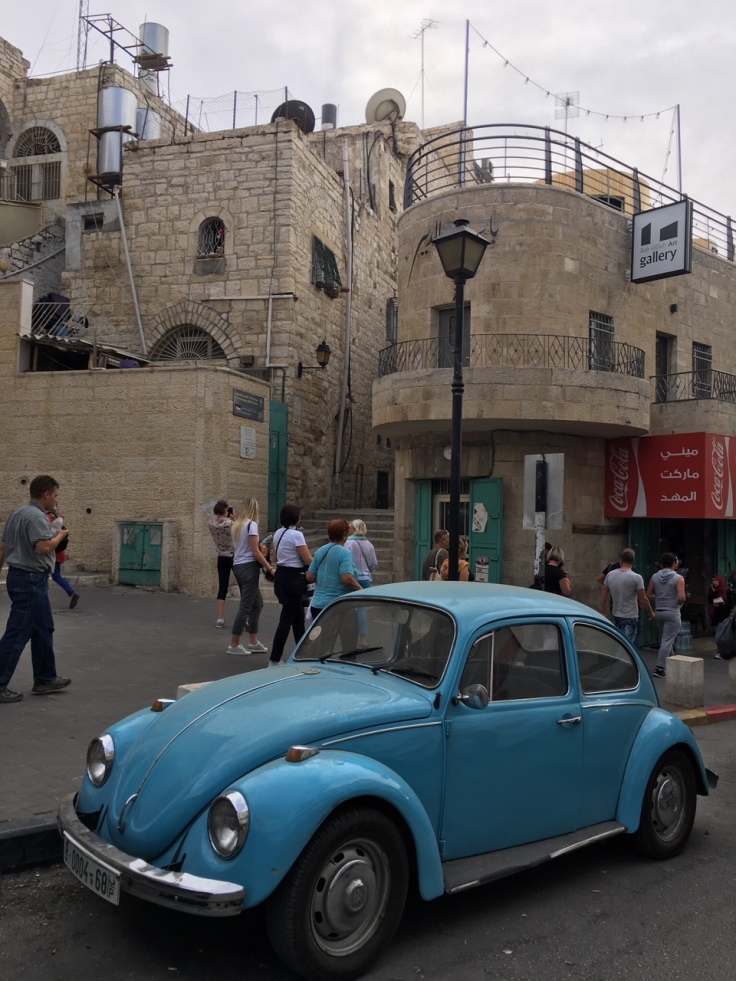
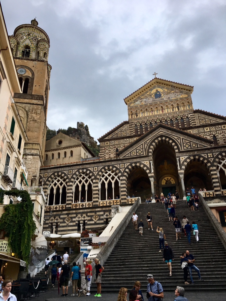
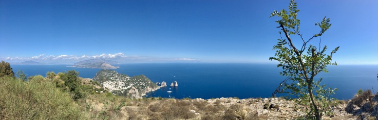
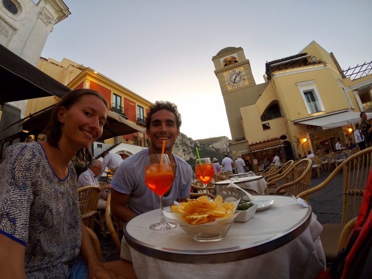
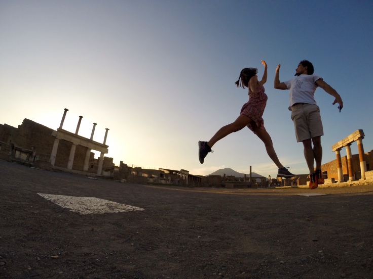
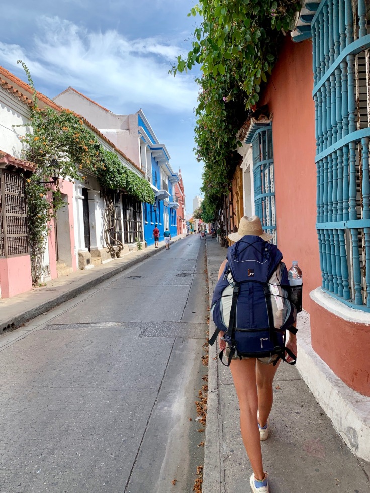
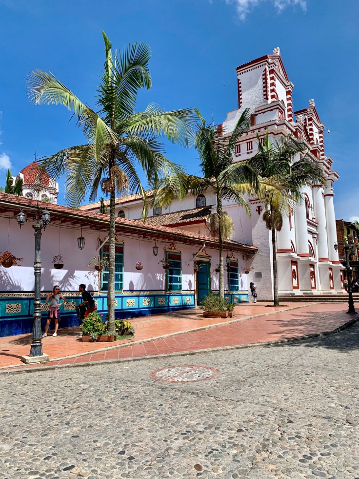
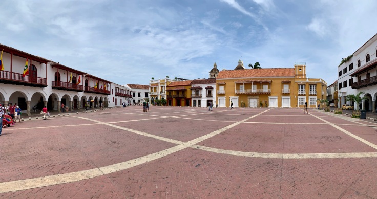
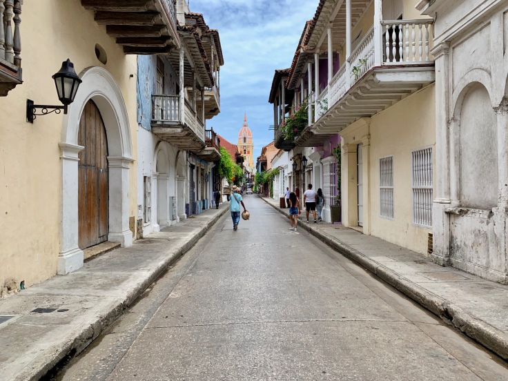
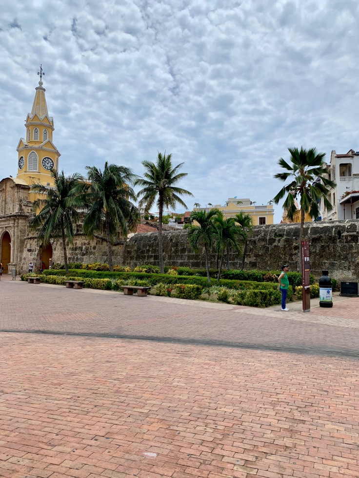
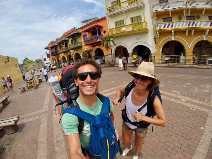
Cartagena de Indias
Cartagena is a beauty. Reference city alongside the Caribbean Sea, it is an important town to visit in Colombia because of its past and the entire colonial heritage it carries with it.
We had mitigated opinions about the city. It is a very beautiful city, but you need to get off the beaten path to like it!
A PLACE TO EAT: La Mulata, amazing typical food and great cocktails in one of the most beautiful part of the city
Most tourists follow the same streets around Plaza de los Coches and Plaza de Bolivar. The tour proposed by our guide book (Michelin) was great, as it took us off the most touristic streets.
A PLACE TO DRINK: Café del Mar, on the beachfront on the fortifications
Walking alongside the fortifications is something to do in Cartagena, as having a drink to watch the sunset in Café del Mar
If we can recommend one area, it would be the following. From Plaza de San Pedro Claver, Take calle San Juan de Dios and turn right on calle de Sante Domingo. At the end of it, turn right and right on calle de Don Sancho. Once you have reached Plaza de Bolivar, reach out the Santa Clara Hotel going through calle de la Factoria.

A PLACE TO EAT: La Esquina de Pandebono, on plaza El Estudiante
The place is known from all inhabitants for their arequipe (caramel donut) and their exceptional juices.
The guide book also led us to another neighbourhood of Cartagena which is a bit outside the central area, more popular. Although things to see there are limited, it brought us to a popular restaurant where mostly Colombians were eating. The lunch was exceptional. Waiters are filling the big tables in the order of people arriving, and we ended up sharing a table with two 60 years old Colombians. Although our Spanish is limited, this was such a good experience and sharing moment! The food, usually fish (the catch of the day and a fish soup), is also great and typical!
A PLACE TO EAT: El Coroncoro
Alternatively, if you spend more time to Cartagena, the Fortress needs to be added to your list! Also, Plaza Melayuna and the covent La Popa, 15 minutes in taxi from the city center, have both a great view on the entire city.
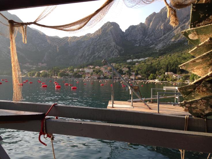
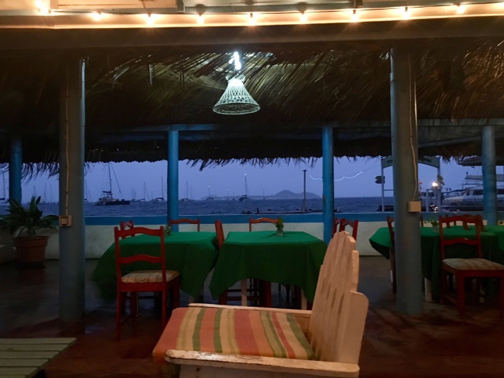
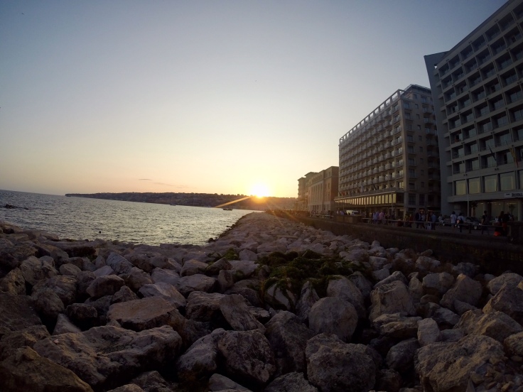
Santa Marta
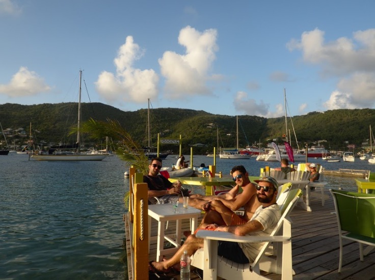
Santa Marta is not a city with a great past and heritage like Cartagena. Although the city also borders the CaribbeanSea, there is not many things to see as a tourist in Santa Marta and the city is more to be seen as the door to Parque Tayrona, Minca, treks to the Lost City, the Sierra Nevada Santa Marta and the Guajira at the border with Venezuela.However, it’s cool to have a stop in the city, as downtown and beachfront are lively neighbourhoods with plenty of bars and restaurants and where tourists mix up with Colombian people to party.
Carrera 1, where the Sunset bar area is quite lively at sunset. The other place to go is on Carrera 3, between el Parque de los Novios and el Parque Bolivar.
ONE PLACE TO EAT: Lulo, great food and outstanding cocktails
Privilege to eat inside as a lot of people will be coming to you during lunch and dinner for money and selling stuff.
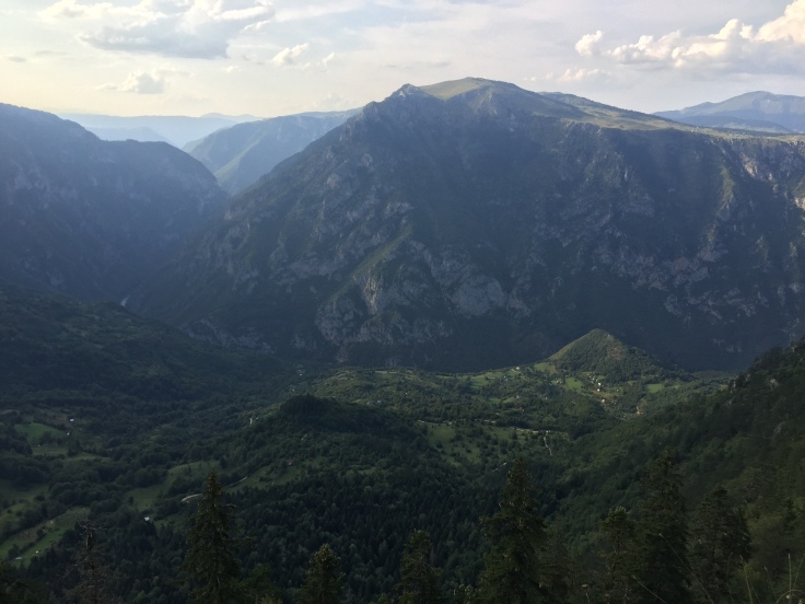
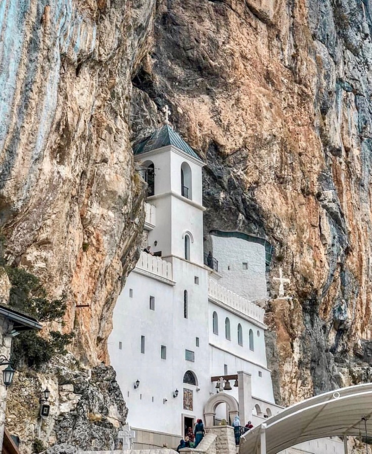
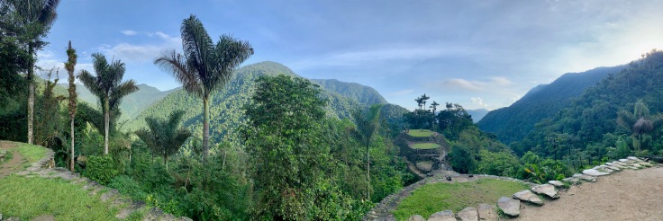
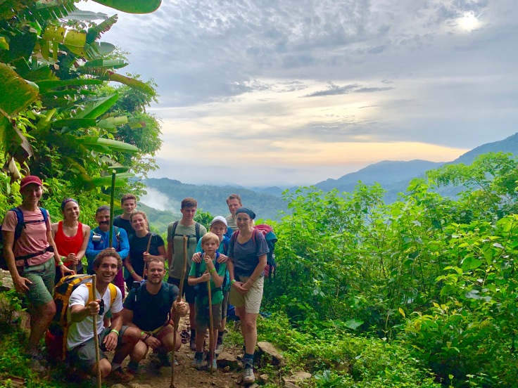
The Lost City – Four days in the jungle
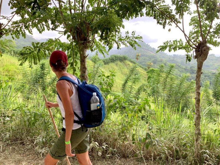
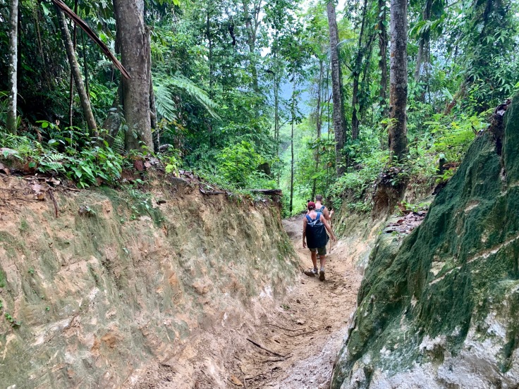
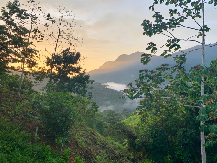
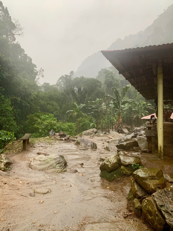
The trek of the lost city in the Sierra Nevada Santa Marta is the greatest thing we did in Colombia. Four days trekking in the jungle, walking up to 12 hours a day, seeing absolutely astonishing landscapes … A real blast! Although the trek remains physically demanding at some point, the pleasure and the excitement to cross the jungle, do something outside of your comfort zone and – mostly, discover the lost city, makes the overall experience memorable.
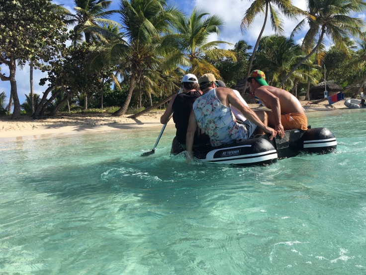
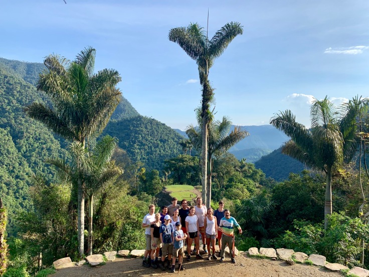
In total, six different agencies are proposing the trek to the lost city and offer to reach the lost city in four, five or six days. Every group is composed of one guide, one translator (most often, the guide speaks only Spanish) and around 10 people. We went with Baquianos for this adventure and, from what we saw, they were definitely the best.
Our guide, Carlos, 62 years-old (but still, walks super fast), was the personal help of Frankie Ray, the man who officially discovered the lost city (technically, hedid not discovered it, but was the first one to take pictures of it and bringthose to the local authorities). Carlos is a gold mine of information and knowledge about the place and knows all the places aside the path to stop and enjoy even more the ride.
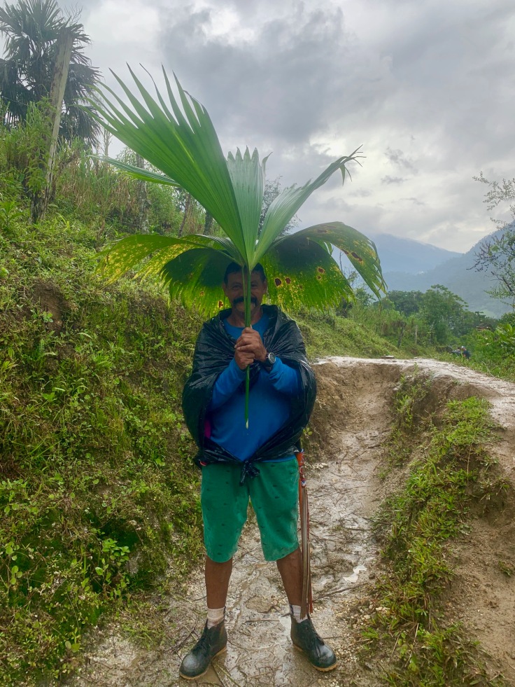
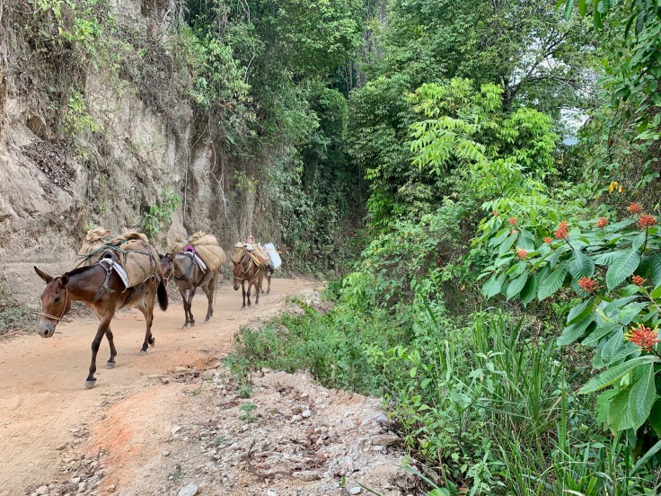
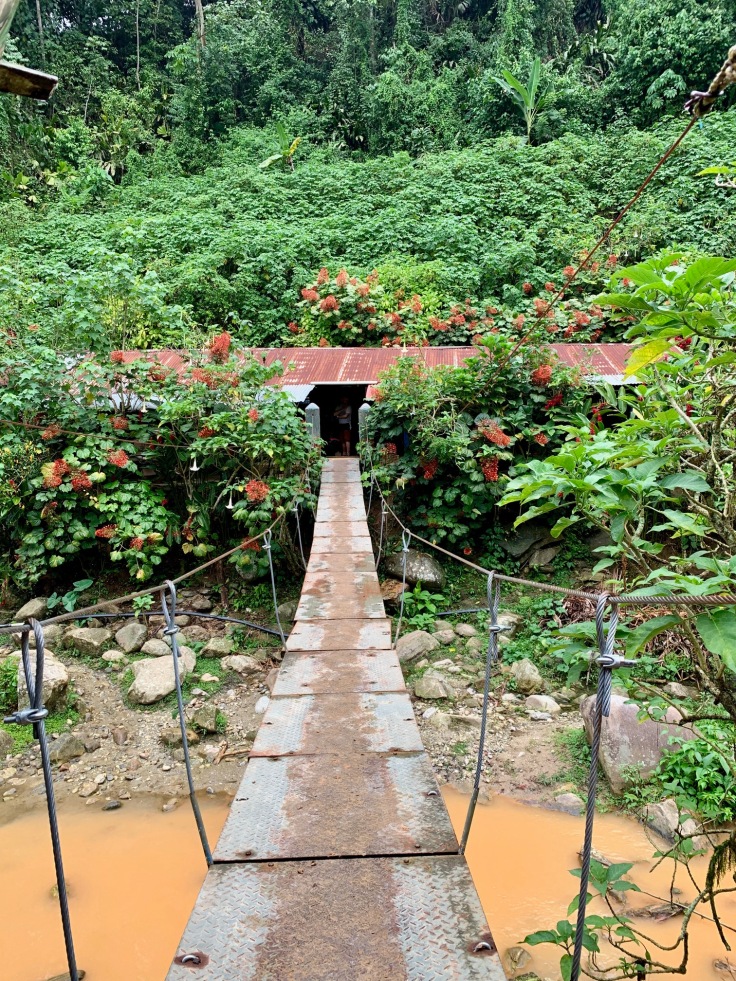
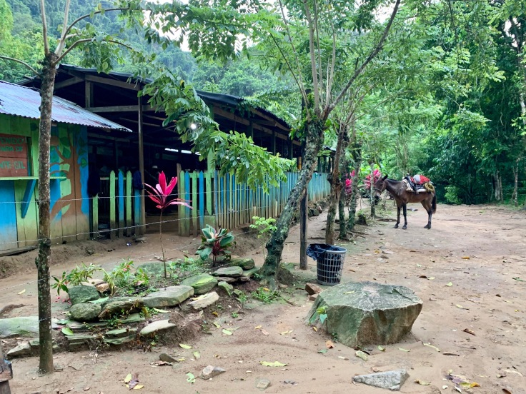
The organization is very smooth for the four days. Baquianos picks you up at their office in Santa Marta or close to Palomino, at the park entrance. For four days, Baquianos has a personal cook who takes care of all the lunches with mules carrying all the food. Most of the walk is in indigenes’ land, and therefore they are responsible of the organization in the various camps where we will spend the night. As most of the path is not practicable for motor engines, mules are carrying the food for the entire trek.
In a few words, the trek to the Lost City lasts four days, and represents 75km walking for 1500m of positive elevation! The park is closed every year in September in order to allow the local tribes to celebrate their rituals and in order to allow the park to regenerate some energy, according to the Indigenes’ beliefs.
Day 1 – Getting to the Sierra Nevada Santa Marta
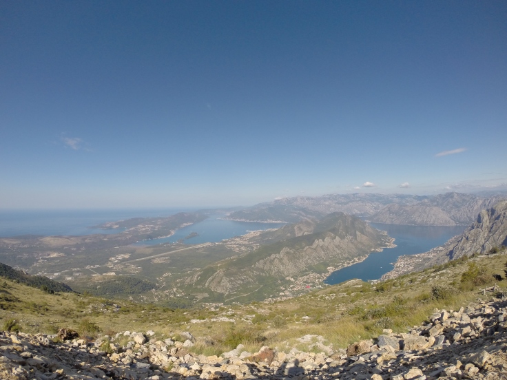
Baquianos comes at your hotel in Santa Marta to pick you up to bring you to Baquianos office close to the beach front. There, we can leave our main backpacks and just take a small one for the four days (waterproof is better). After one hour drive, we reach the park entrance, between Tayrona Park and Palomino. From there, we need another hour drive in the mountains to reach the village of El Mamey (also called Machete).
After a quick lunch, we started walking at 1pm by a big climb of three hours. But what a view!
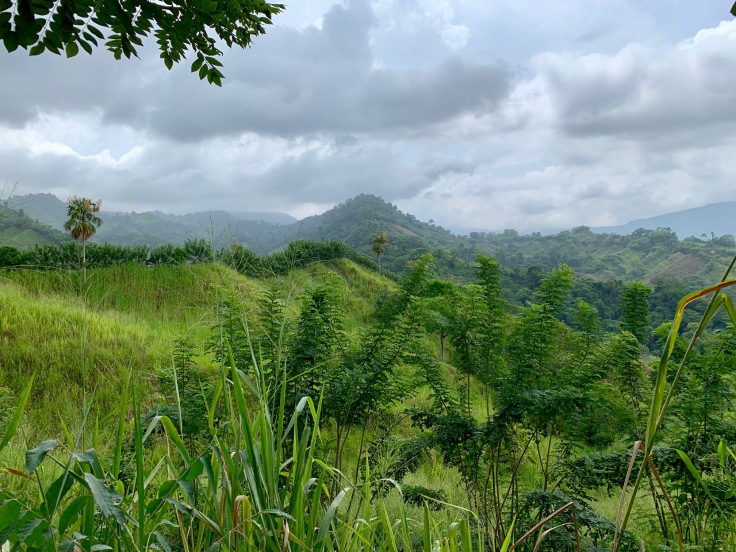
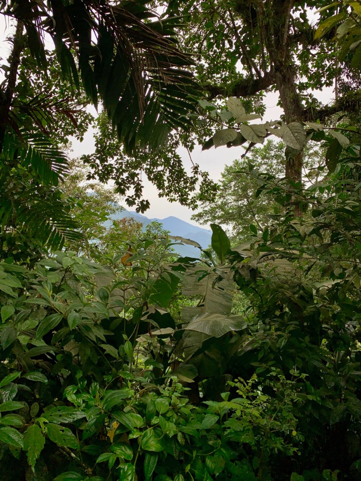
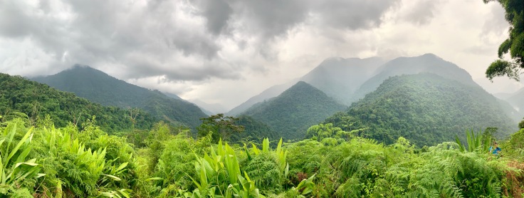
The foothills of the Sierra Nevada Santa Marta are breathtaking and entering into the jungle is quite exciting.
The air is really hot and humid, but this is something you get used to. Along the way, stops for watermelons and orange juices are planned (fruits definitely taste different in comparison to Europe!), under the calm eyes of some cows or mules waiting for some fruit pieces.
At the top of the first hill, the path becomes narrower and a small canyon leads you to a first camp.
The nature becomes greener and wilder as you are entering into the jungle, as no motorcycles can come in.
The first camp for us to spend our first night overhangs a small valley in border of Indigenes’ land.
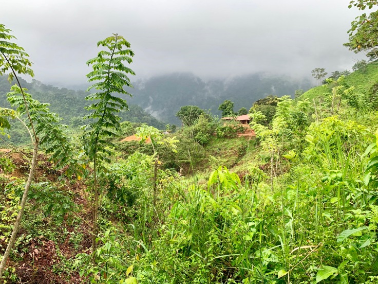
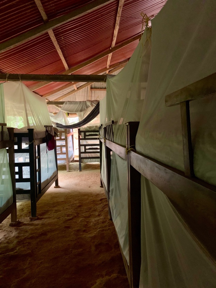
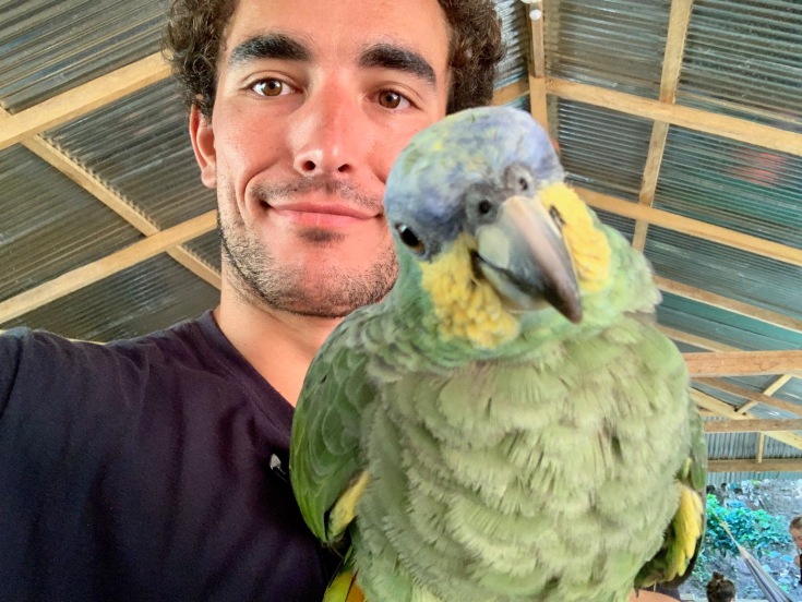
The camp is called Alojamineto de Alfredo. Pleasant surprise, all beds and hammocks have a mosquito net, and (cold) showers, with some parrots around.
After dinner, the guide spent time to explain us for one hour the story of the mountains, what were the impacts of the marijuana and then coca cultures. In 1965, the Colombian government forbad the marijuana culture in its soil and destroyed all marijuana plants in Sierra Nevada Santa Marta by fumigation. A few years later, farmers started to grow up coca trees.
At the end of the XX century, the government also prohibited the culture of coca trees on its soil, but this time, an agreement was found between the government and the farmers in order to avoid fumigation (very polluting and wildlife destructive). You can still find many coca trees in the jungle, but not in fields. Indigenes are allowed to have up to five coca trees per house for their own consumption (mostly tea and poporo – coca leaves chewed with calcium to make a stone, the bigger the stone, the more knowledge you have).
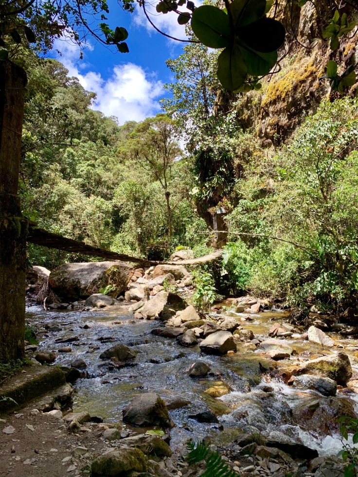
Day 2 – Going through the jungle
The day starts early, as we started walking at sunrise around 6am. The first part of the trek until lunch break is through a dense and lush jungle.
From time to time, our guide stops to tell us stories about the places and we are now walking in the Cordillera de la Guaca.
The morning walk is in a deep and luxurious jungle, which completely differs from the walk of the day before. In the middle of the trees, we can see, on the back, the mountain where the Lost City is.
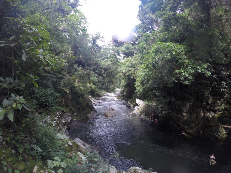
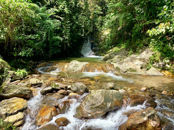
The lunch break seems like heaven. After sweating the entire morning in the jungle, we make a stop alongside a river which forms natural pools!
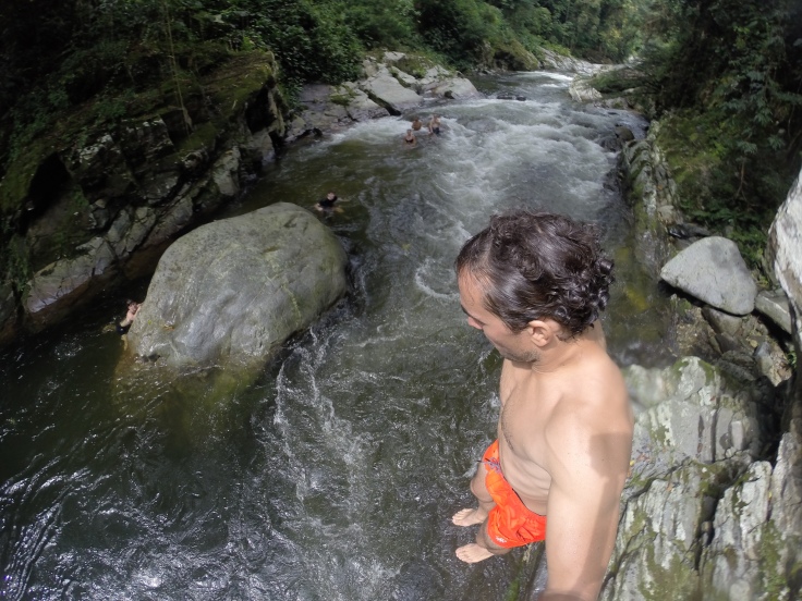
There were not so many people in comparison to all the people we met in the trek, which was a blast!
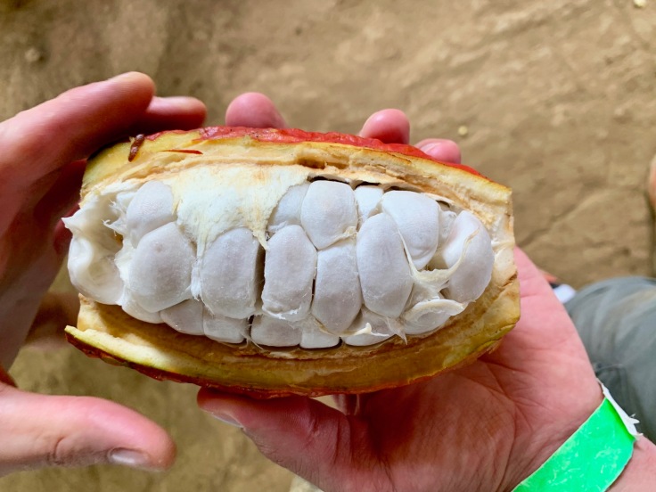
On the way, several things to try, as a cacao bean just ripe (it tastes like mango).
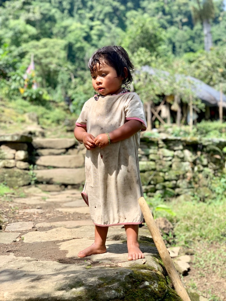
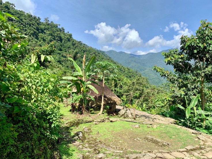
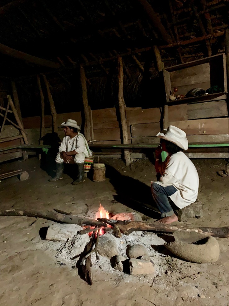
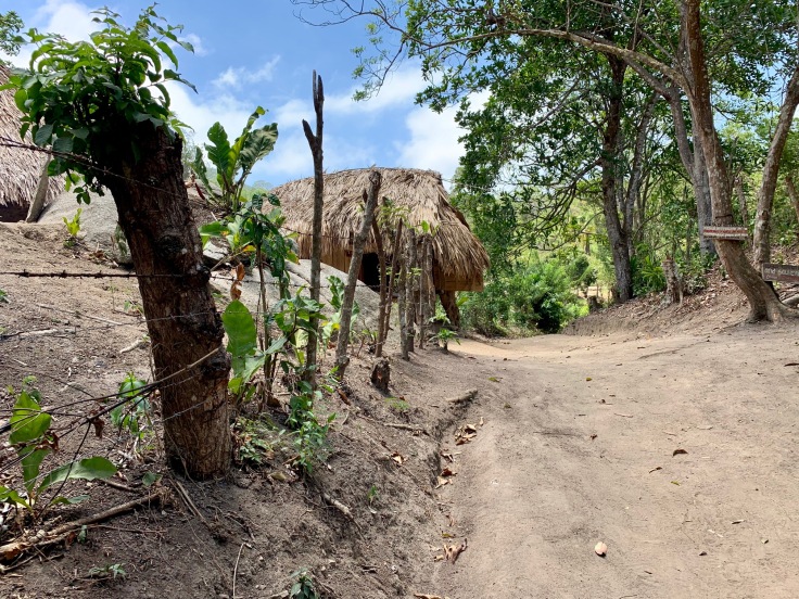
The second part of the day consists in entering into Indigenes’ land! They are protected by the Government and therefore are allowing us to enter their lands to visit the lost city. On our way, we cross one village, Mutanje and meet local “indigenes” families.
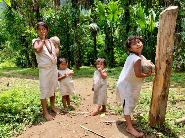
In total, four different indigenes communities live in Sierra Nevada Santa Marta: the Wiwas, the Koguis, the Aruhacos and the Kankuamos.
Indigenes’ houses are circular, which represents three elements: the Sun, the Earth and the Air. The Indigenes have two gods in which they believe: Saranqua (sun god) and Mother Earth Senica (Earth/Air God).
Most of the afternoon’s hike was under the rain, but landscapes are magical all along the way.
The camp, Paraiso Teyuna, in Indigenes’ land and 1 km from the lost city, was reached around 6pm, under a heavy rain but with a large smile on our faces for finally having reached our destination.
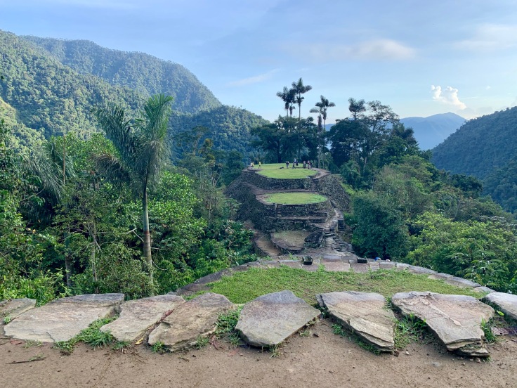
Day 3 – La Cuidad Perdida!
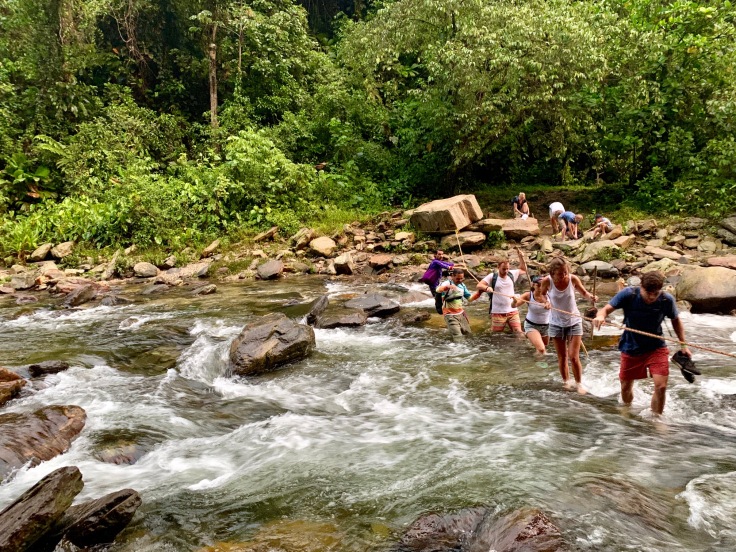
The day starts early. At least 10 different groups intendto reach out the lost city today and our guide wants us to be the first ones out there so we can enjoy the site without anyone else. We all agreed to leave the camp at 5am. A river to cross with a rope as only help and here we go for the last steps to the lost city.
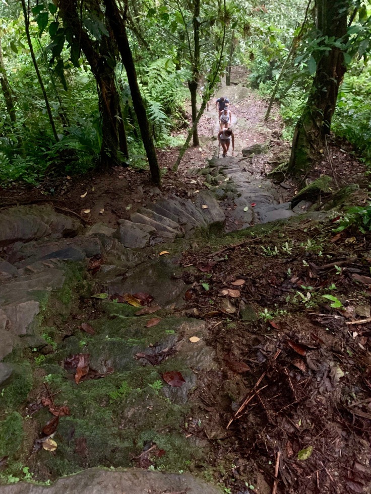
We had to climb 1200 stairs (it goes from 800m to 1200m high) before reaching out the lost city, but it goes pretty fast.
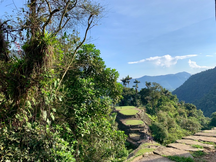
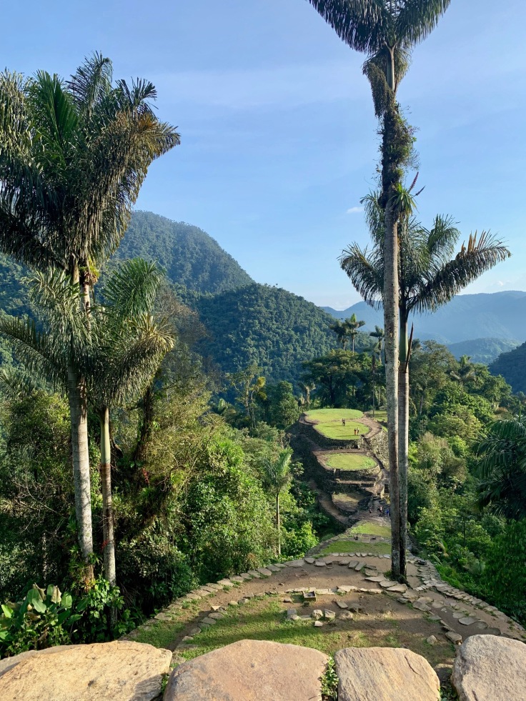
Reaching out the lost city at sunrise with no one else on the site is a wonder!
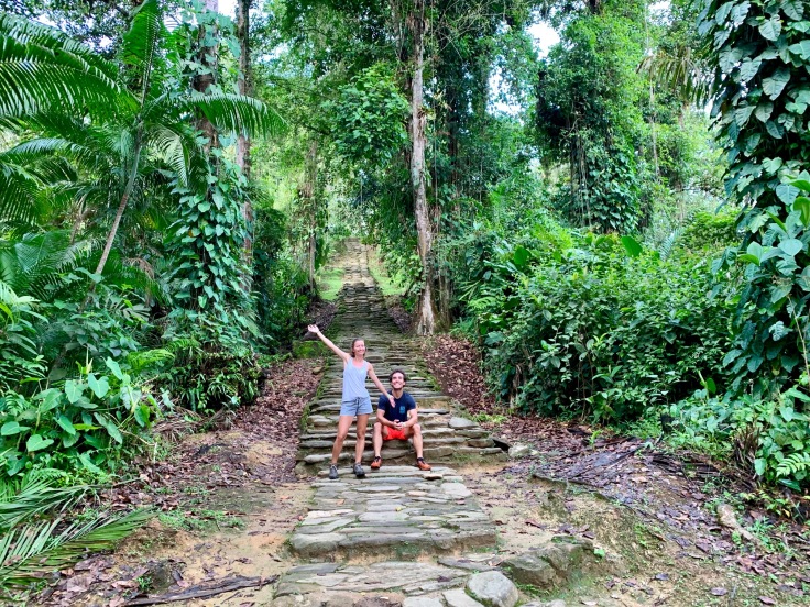
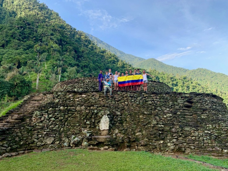
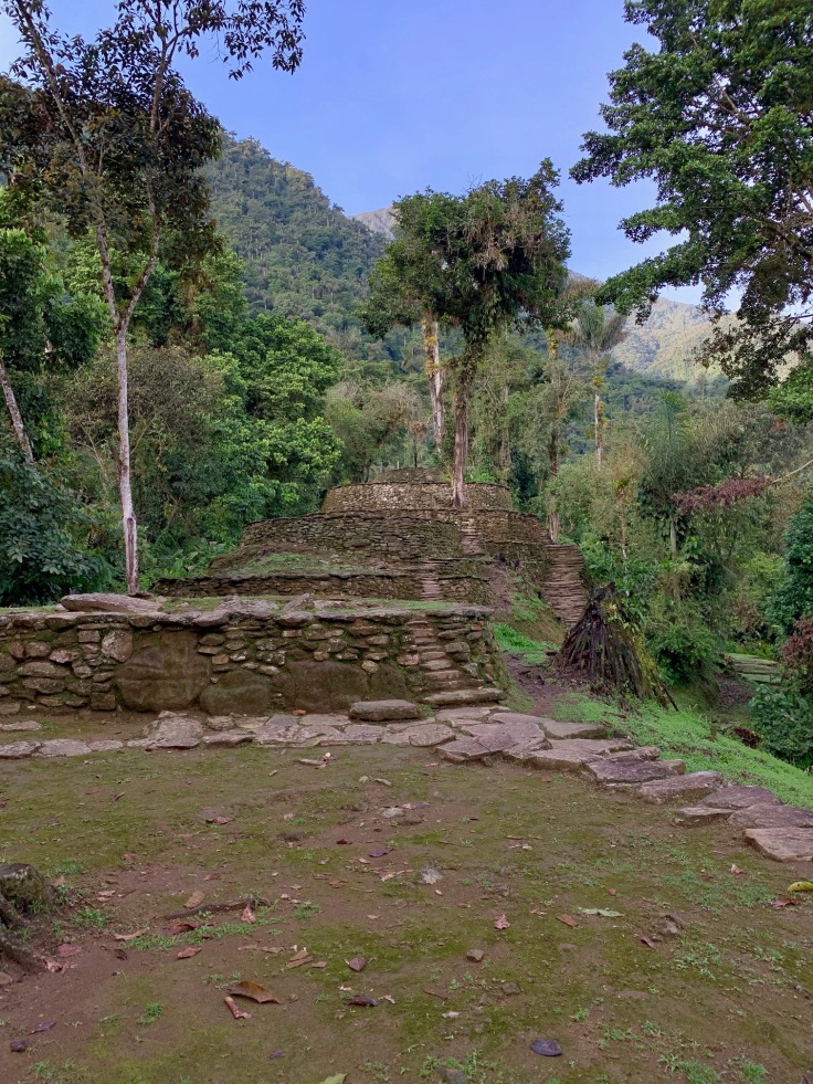
The entrance is at the bottom of the lost city and an additional pair of stairs needs to be climbed before reaching out the top and the stunning view on the jungle.
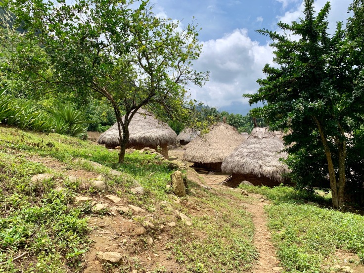
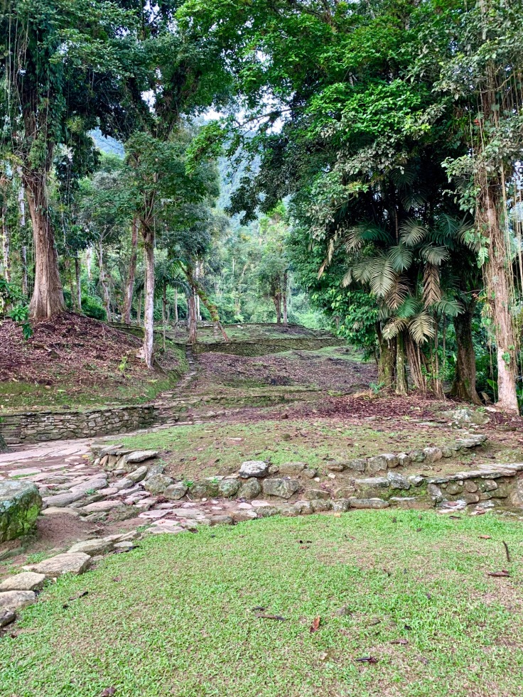
The entire city is organized in terraces; in each of these terraces was previously a house shaped similarly to the ones we saw the previous day in Mutanje, called “Boios”.
The name “Lost City” comes from its history. In the 16th century, the Spanish conquistadors arrived in South America. At this time, everything built by the Indigenes was in gold – armours, jewellery etc. At the beginning, the conquistadors started trading with the Indigenes: gold in exchange of trinkets, such as mirrors for instance.
At some point, the Indigenes were less interested about the gifts from the Spanish and started to mix their gold with copper before selling it to them. The Spanish realized it and invaded them. Threatened by the conquistadors and also decimated by the new diseases brought by the Europeans, the Indigenes started to believe that their city was cursed, and therefore abandoned it in 1650.
Two gold diggers discovered, in the middle of the 20th century, the lost city. They didn’t find the gold mines of the indigenes but they discovered their graves, full of gold objects. Lured by the potential money, several adventurers (“waqueros”) took their chances, until at some point in 1966, the Lost City got into a war zone. One of the waqueros, Frankie Ray, took at this time pictures of the place and brought them to the Colombian government in Bogota. Thanks to this first picture of the lost city, Frankie Ray was considered as the man who officially discovered the lost city.
The Colombian government sent militaries to secure the site and, from 1966 to 1972, paid the Indigene tribes to re-build the city as it was supposed to be in the past. Of course, in three centuries houses were completed destroyed by the jungle, but the terraces are still the witness of the size and the importance of the city at the time of its activity.

In 1966, the Lost City had up to four names. It was called Tajunaby the Indigenes, the “Infierno Verde” (the green hell) by the waqueros, as it was super hard for them to survive there, “CuidadPerdid” (“Lost City”) by the Government and Buritaca 2000 by the anthropologists. The Lost City expands on several kilometres and Indigenes still live close by.
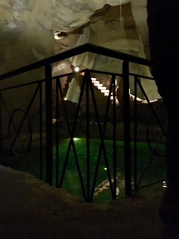
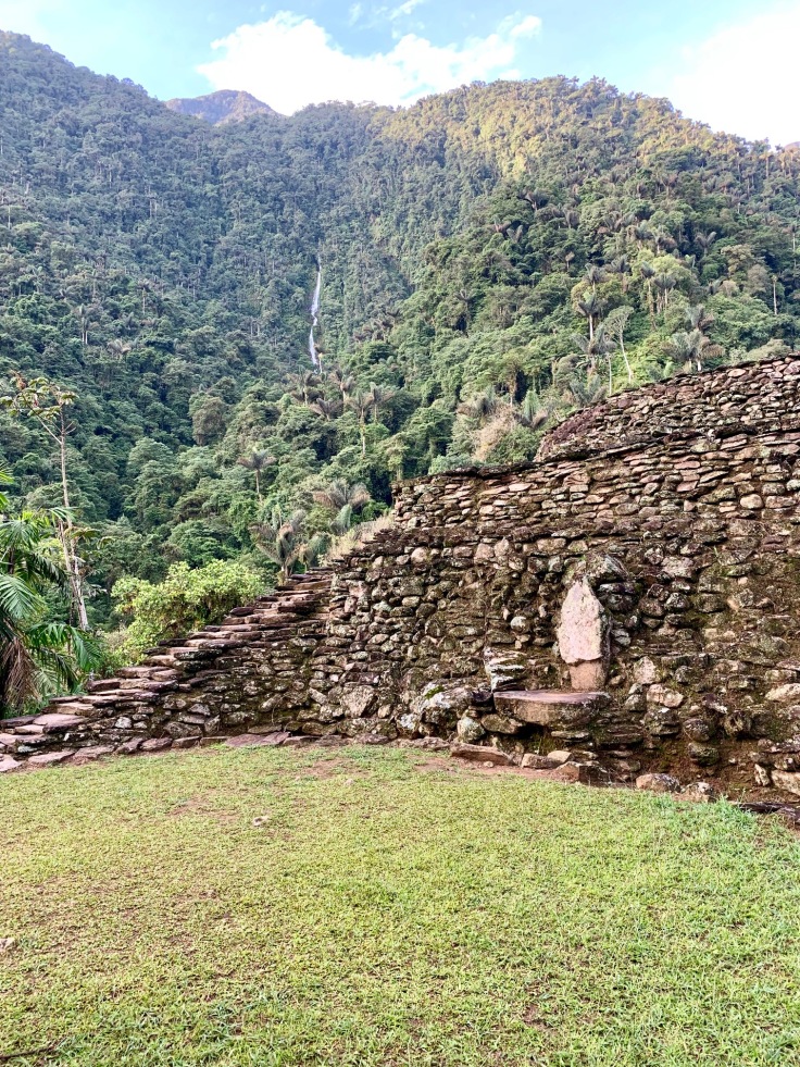
Close to the throne where the chief of the Indigenes was seating lie two large rocks in the shape of a frog, as a symbol of fertility. Both frogs have nonetheless no legs, so they cannot escape from the place. Behind the throne of the Indigenes’ chief cascades a waterfall.
In the middle of the labyrinth that constitute the lost city lays a cascade, which was known as the fountain of youth. All Indigenes used to come here in order to get purified before getting to the lost city.
The term “Baquianos” used by the agency refers to the Indigenes’ name of the guys who know the mountain properly without having to go to school for it. The term was particularly well chosen for our guide, Carlos. Carlos lived in El Mamey for the past 42 years, and was the camp assistant of Frankie Ray himself when he started to organize treks for tourists to the Lost City in 1978. Saying that he knows the jungle is an understatement.
After 5 hours in the Lost City, it’s time to go back. The path follows the same itinerary than the way in. Although the excitement to discover the Lost City is gone now, it is also great to discover the path the other way, as we see things differently. The third night is at Alojamiento Wiwa, where we stopped on the second day for lunch and go to the natural pool.
On the third night, some exchanges are also planned with the Indigenes, which is a great initiative for helping us understanding their culture.
Day 4 – Coming back to El Mamey and the civilization
It is a strange feeling to come back to El Mamey and the civilised world: a feeling balanced between this extraordinary adventure and the pleasure to be cut from the rest of the world for some time on one side, and the pleasure to take a real (hot) shower and sleep in a real bed after a fresh beer on the other hand.
The path follows the same itinerary than the first and second day, but you see things differently taking a path in the other direction.
In July and August, the morning is usually sunny while the afternoon is usually rainy. As we discovered most of the landscape rainy in the first day, it is a pleasure to see it again under the sun.
We made a short stop to Alojamiento de Alfredo where we were welcomed by parrots.
It is a strange feeling to find motorcycles on the way back to Machete. That symbolises the end of our hike, which was the greatest thing we did in Colombia.
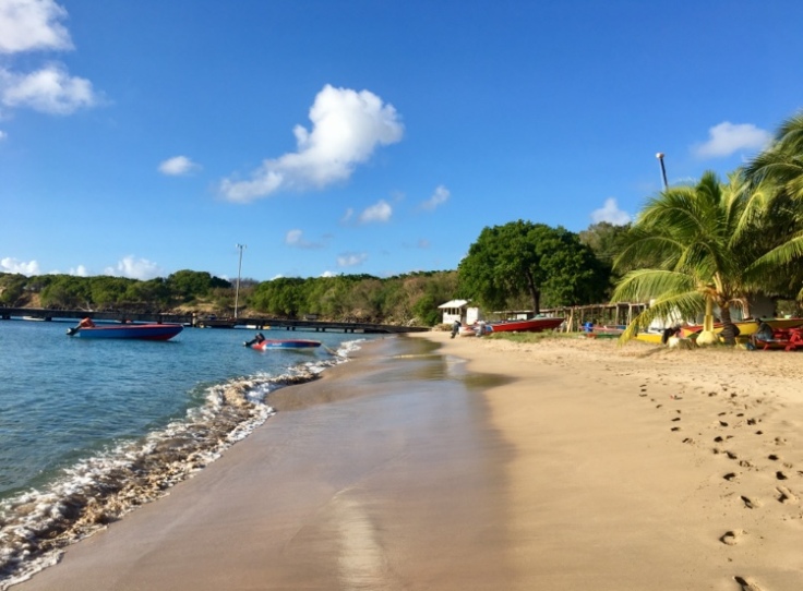
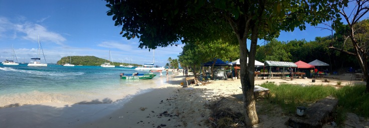
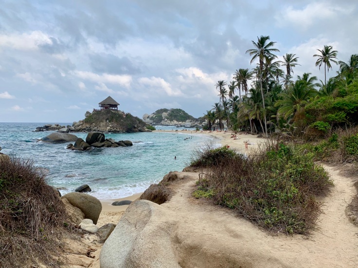
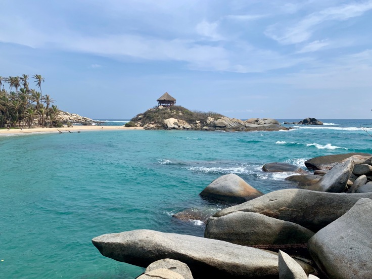
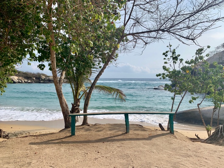
Tayrona Park
All buses from Santa Marta in the direction of El Parque Tayrona and Palomino are leaving from the same place, at the corner between the calle 11 and carrera 11. The bus ticket is around COP 10,000 and you pay directly in the bus once it leaves the city.
We decided to spend two days in Parque Tayrona in order to enjoy the park at its fullest from the Calabazo entrance to El Zaino, with one night in the park.
The park closes a few weeks during the year. As it remains Indigenes’ land, this was part of the agreement they found with the Colombian government in order to allow the energies of the park to balance and recover.
The park is opened every day from 8am to 5pm. The park entrance is COP 63,500 and is valid as long as you stay in the park (same price whether you stay one day or one week).
We privileged to enter in the park in the Calabazo entrance.
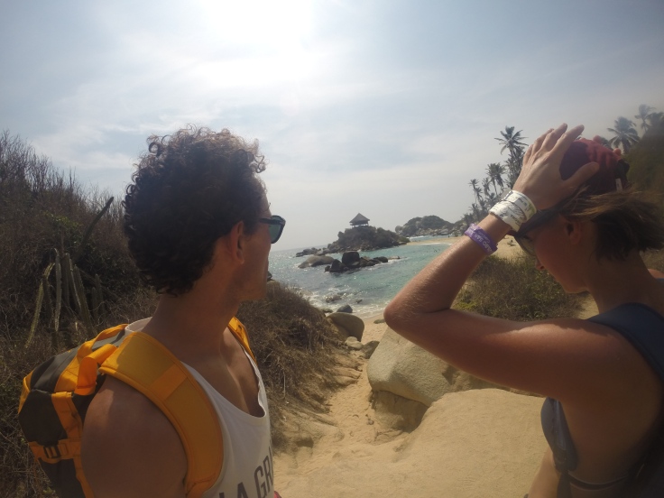
Day 1: From Calabazo to Cabo San Juan
We decided to enter the park from the Calabazo entrance for two reasons. The first one is because we read that the walk was nicer in the way Calabazo – Cabo San Juan rather than the other way around. The second one is because most of the people entering into Tayrona Park are entering through the main entrance in El Zaino and the queue can last for more than two hours.
The hike between Calabazo and Cabo San Juan lasts four hours in total. Think about bringing with you enough water as you will hardly find some along your way.
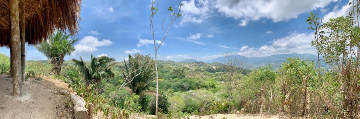
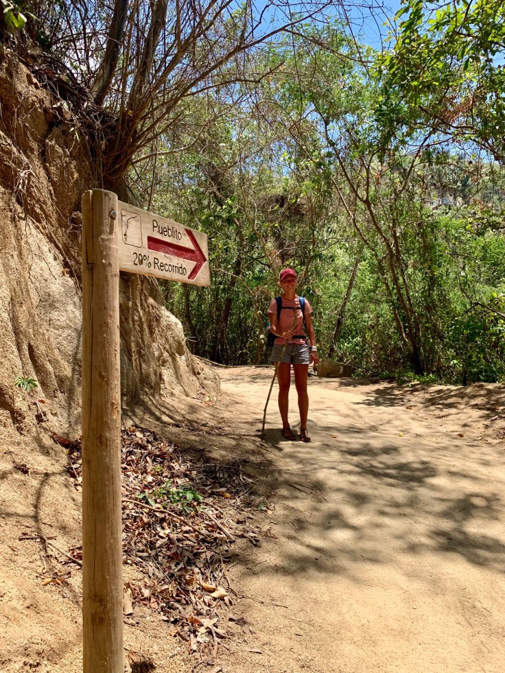
The path is very steep from the beginning but large. The jungle is different from the one in Sierra Nevada Santa Marta, much dryer, but still beautiful. Although Pueblito (an Indigenes’ village) was closed at the time we went (August 2019), the view on the jungle becomes clearer and clearer as long as the climb goes on.
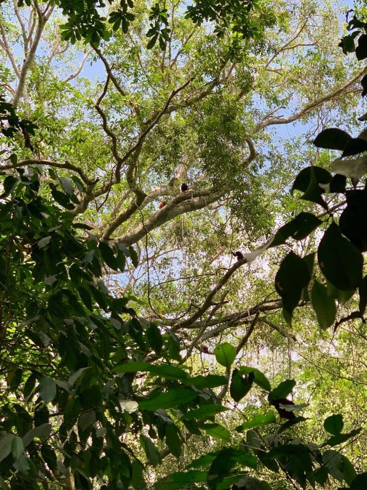
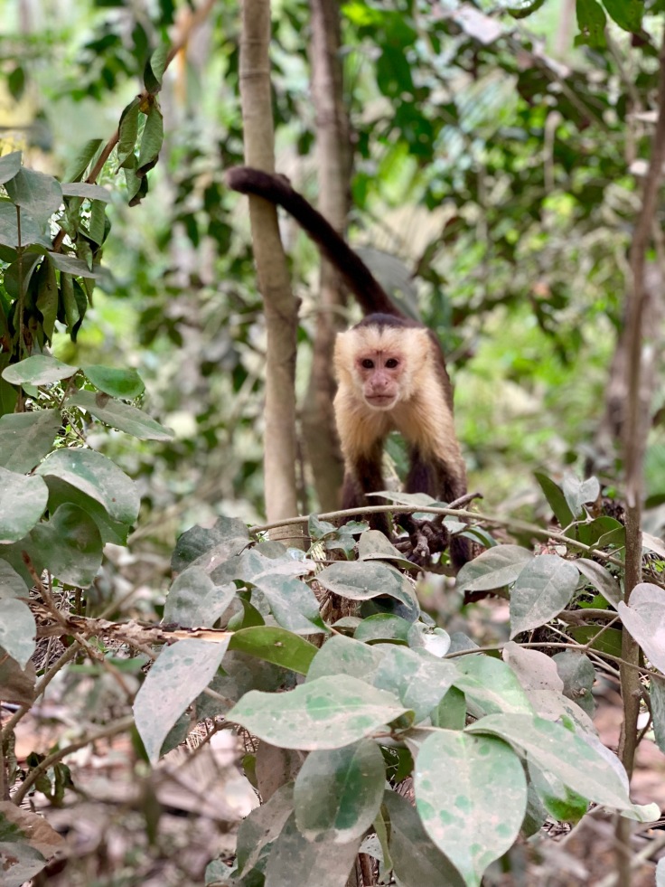
Very important as well, think about looking around you. It is a real blast to see monkeys in the trees, even from far, in their natural living conditions.
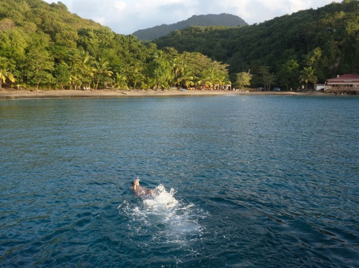
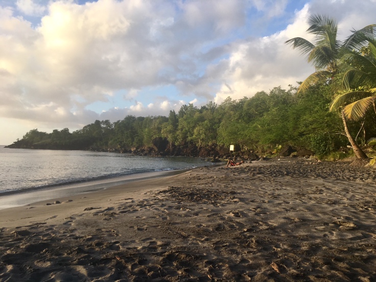
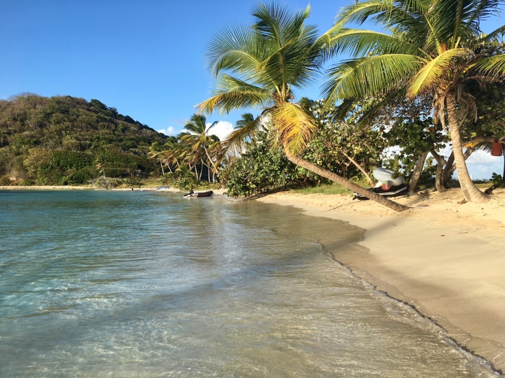
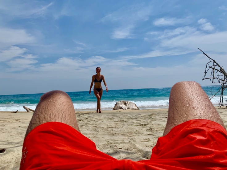
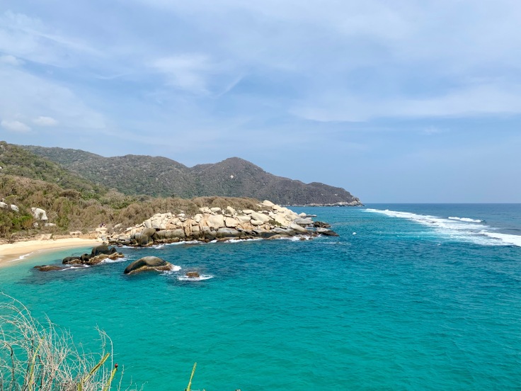
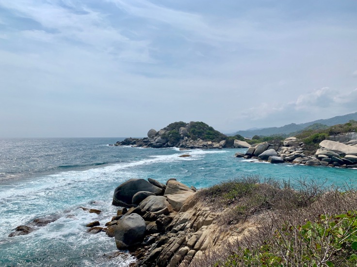
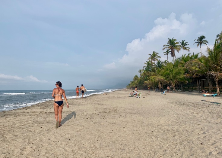
The jungle ends on a desert and beautiful beach of white sand and crystal water.
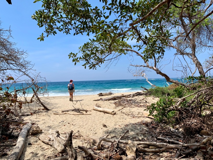
Be careful of the strong currents, but having a swim here after the walk is magical.
The most famous beach of the park is Cabo San Juan. It is a very nice beach, but nothing to envy to the beach we just talked about – and significantly more crowded.

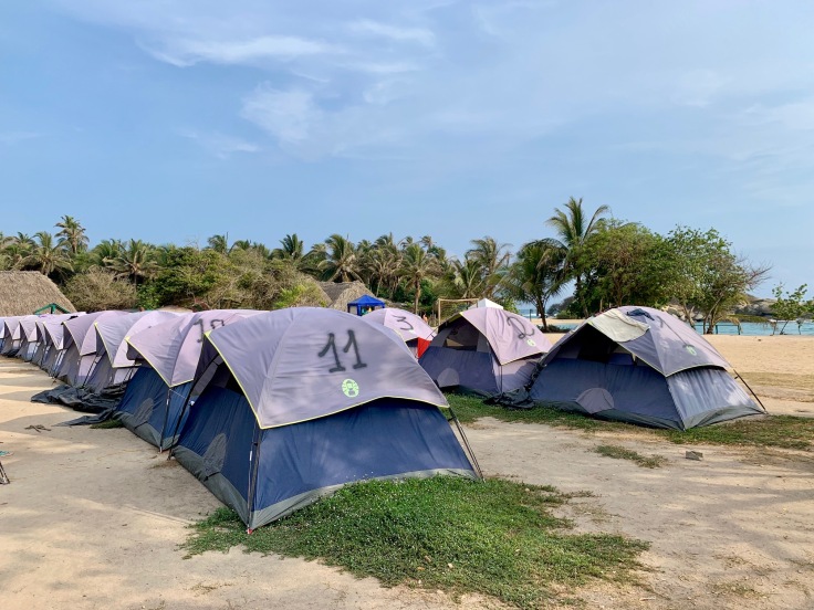
We stayed one night at the Cabo San Juan campsite. This camping is a fraud to be honest! Super expensive, shitty facilities and horrible staff (COP 40,000 per person for a tent or a hammock) but this is unfortunately the only alternative to spend the night there. Other camp sites exist in the park, but are as expensive and not in the seafront.
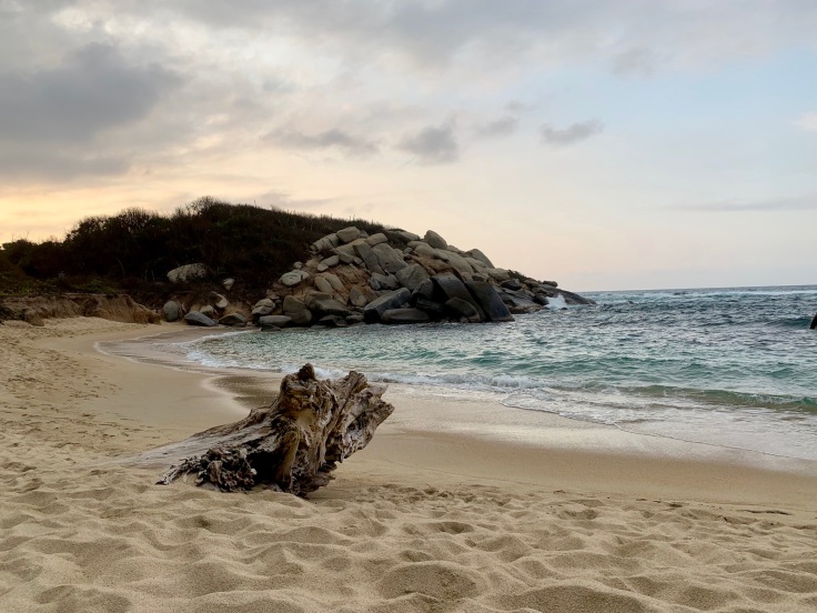
However, it is a real blast to spend a night in the park, chilling on the beach at sunset and having a drink in front of the waves below the stars, so we wouldn’t change anything, it is still worth it!
Day 2: From Cabo San Juan to El Zaino
It is worth the pain to wake up early and enjoy the zone as long as day tourists are not here yet (the park opens at 8am so the first day tourists are here around 10.30am).
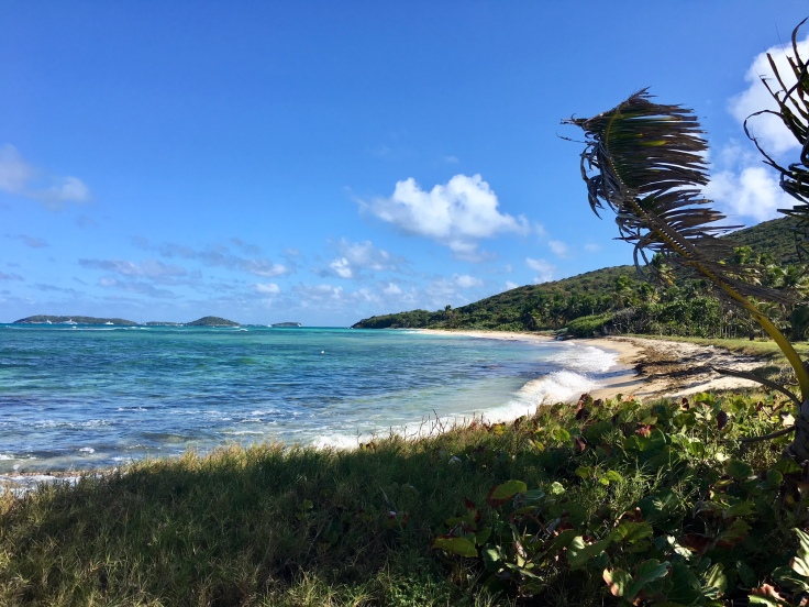
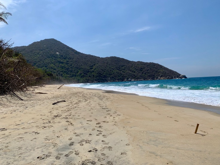
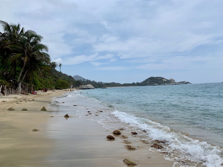
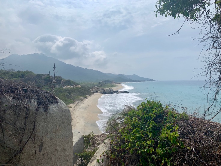
The walk between Cabo San Juan and El Zaino is really beautiful. The jungle, with much more palm trees, is really beautiful and different from the one between Calabazo and Cabo San Juan.
The walk from Calabazo to El Zaino lasts three hours, but you have to include a few stops in the schedule as the natural landscape is astonishing.
Either for swimming on another beach
Or watching out monkeys performing a show above your head
Or simply because the landscape is simply stunning
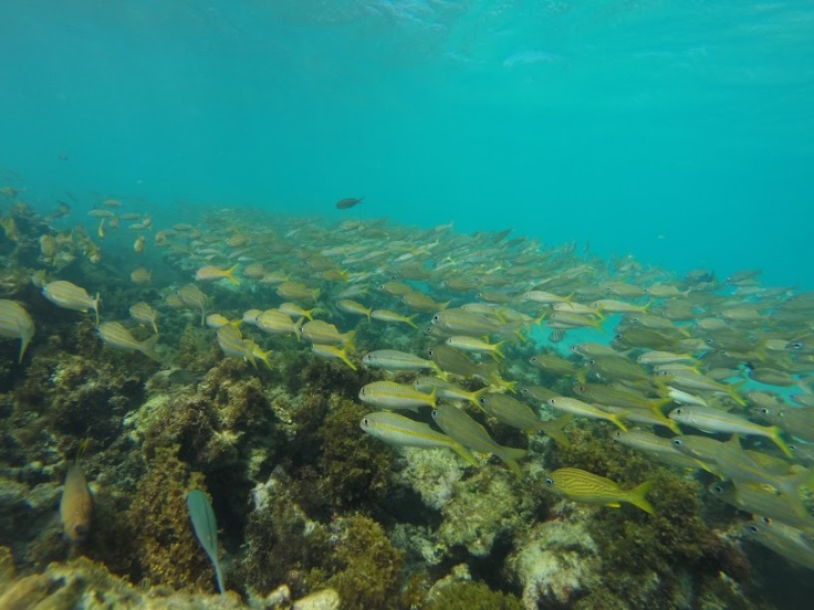
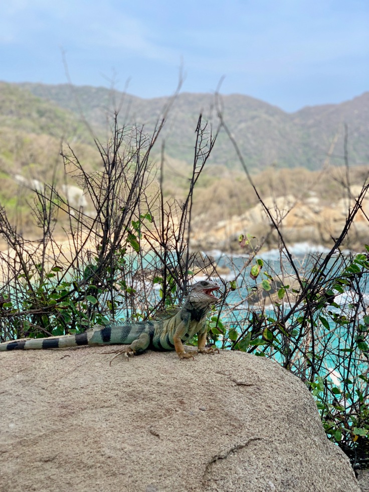
The Tayrona Park has a very rich wildlife. Always keep a look around in order to not miss anything.
The park border lies far from El Zaino main entrance, which is one hour walk from the park. As walking along the road doesn’t have much interest, we recommend to take the park shuttle to go from the park entrance to El Zaino (we walked and it was long, especially after two days hiking).
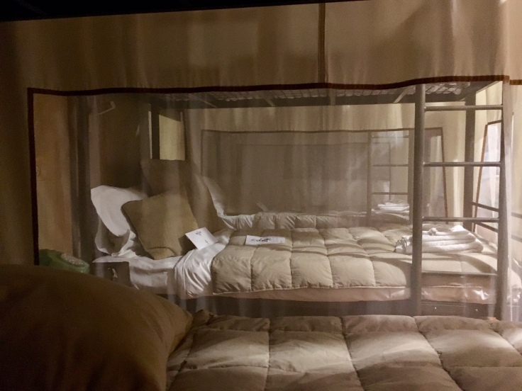
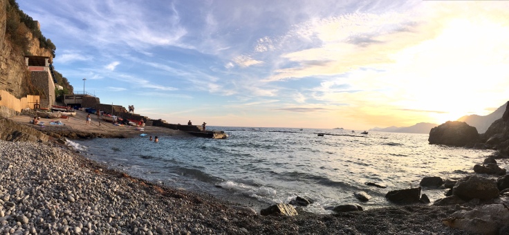
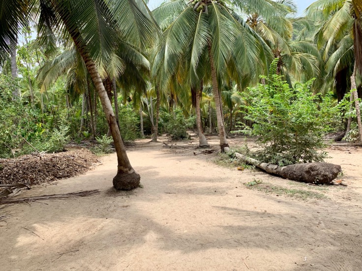
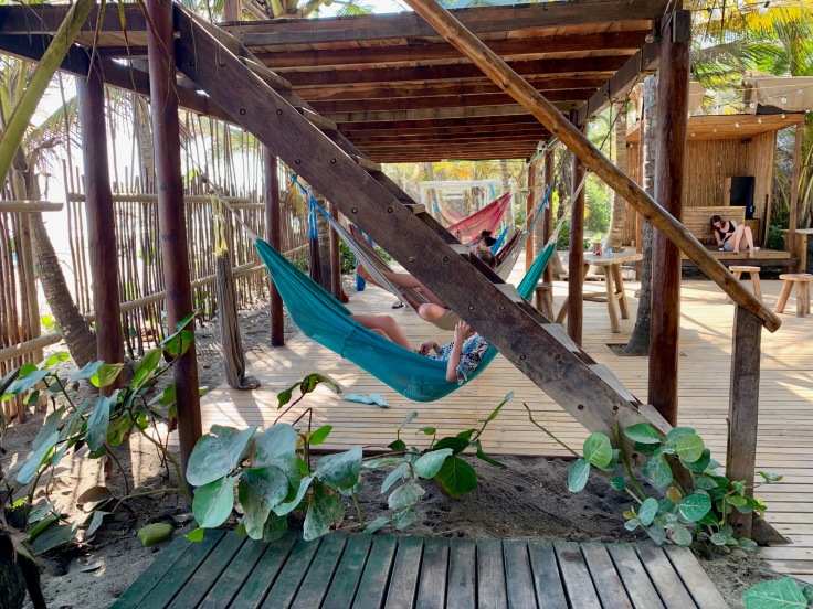
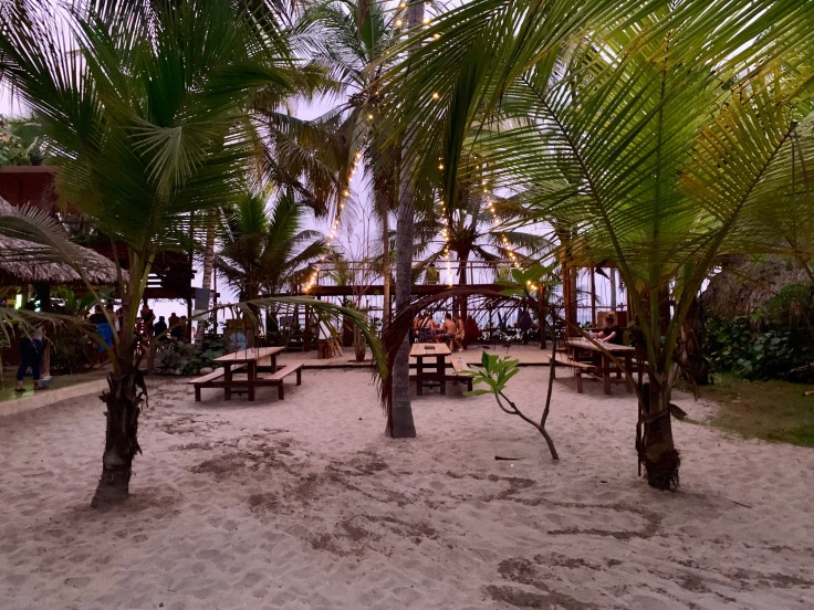
A PLACE TO SLEEP: Costeno Beach Hotel, this is by far the greatest place we stayed in Colombia
This is by far the greatest place we stayed in Colombia. Costenobeach is a beachcamp along the sea, a few kilometres from Tayrona Park. Motocycles take you from there to El Zaino (COP 10,000) or Calabazo (COP 20,000).
We spend only one afternoon and night in Costeno beach, but if you have time, definitely stay there longer.
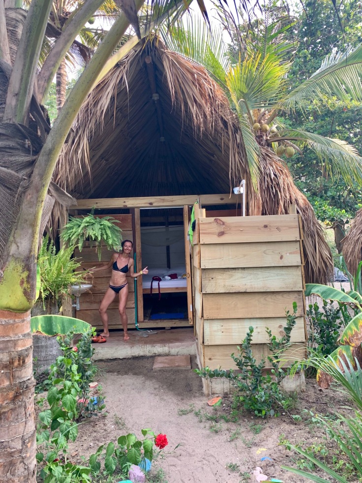
Houses are charming and the atmosphere is so relaxing that it will simply amaze you.
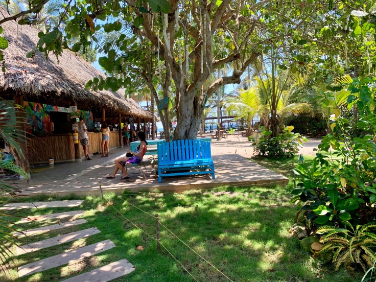
Everything there was great, from the food to the staff going for the activities and the cocktails.
Definitely something to add to your list!
Alternatively, we also heard very positive comments about Los Hermanos, very close by, managed by three French people, and Palomino, which is also great for partying and full of backpackers.
If you make it until then, we hope Colombia is on your next trips’ list now 🙂 Any question, use Instagram or the contact form!
Best,
Alie & Zach